Valdés elevation
Valdés (Andalusia, Provincia de Málaga), Spain elevation is 293 meters and Valdés elevation in feet is 961 ft above sea level [src 1]. Valdés is a populated place (feature code) with elevation that is 310 meters (1017 ft) smaller than average city elevation in Spain.
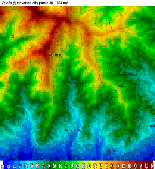
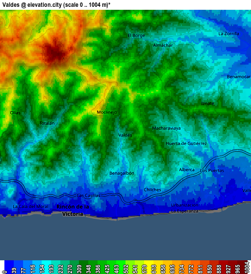
Below is the Elevation map of Valdés, which displays elevation range with different colors. Scale of the first map is from 36 to 703 m (118 to 2306 ft) with average elevation of 307.5 meters (=1009 ft) [note 1]
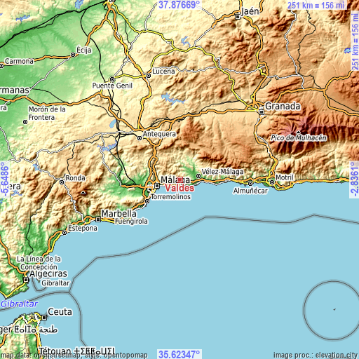
These maps also provides idea of topography and contour of this city, they are displayed at different zoom levels. More info about maps, scale and edge coordinates you can find below images.
| \ | Map #1 | Map #2 | Topo.Map |
| Scale [m] | 36..703 m | 0..1004 m | × |
| Scale [ft] | 118..2306 ft | 0..3294 ft | × |
| Average | 307.5 m = 1009 ft | 304.4 m = 999 ft | × |
| Width | 7.83 km = 4.9 mi | 15.66 km = 9.7 mi | 250.5 km = 155.7 mi |
| Height | 7.83 km = 4.9 mi | 15.66 km = 9.7 mi | 250.5 km = 155.7 mi |
| ↑Max Latitude | 36.793549° | 36.828733° | 37.87669° |
| Latitude at center | 36.75835° | 36.75835° | 36.75835° |
| ↓Min Latitude | 36.723134° | 36.687903° | 35.62347° |
| ← Min Longitude | -4.286295° | -4.330241° | -5.6486° |
| Longitude center | -4.24235° | -4.24235° | -4.24235° |
| →Max Longitude | -4.198405° | -4.154459° | -2.8361° |
Nearby cities:
Cities around Valdés sort by population:
• Vélez-Málaga elevation 62 m
12.7 km,  78°
78°
• Rincón de la Victoria 11 m
5.5 km,  213°
213°
• Torre del Mar 6 m
13.4 km,  97°
97°
• Benamocarra 134 m
8.1 km,  63°
63°
• Almáchar 222 m
6.1 km,  22°
22°
• Viñuela 166 m
14.7 km,  37°
37°
• Benamargosa 109 m
9.6 km,  26°
26°
• Comares 700 m
10.1 km,  357°
357°
• Moclinejo 463 m
1.8 km,  321°
321°
• Iznate 165 m
5.9 km, 62°
• Totalán 277 m
4.9 km,  278°
278°
• Cútar 296 m
8.2 km,  9°
9°
Multilingual:
 En español:
Valdés elevación 293 m.
 En France:
Valdés élévation 293 m.


Sources and notes:
- [note 1] Map square and city borders are not equal. Map elevation data is calculated only from area inside that square.
- [src 1] Elevation data from geonames database provided with same terms of usage.
- [src 2] The elevation map of Valdés is generated using elevation data from NASA's 3 arcsec (90m) resolution SRTM data.
- [src 3] Base (background) map © OpenStreetMap contributors tiles are generated by Geofabrik and OpenTopoMap.
Copyright & License:
This Valdés Elevation Map is licensed under CC BY-SA. You may reuse any part from this page, if you give a proper credit by linking to this URL:
 More info on terms of use page.