Villafranca de los Caballeros elevation
Villafranca de los Caballeros (Castille-La Mancha, Province of Toledo), Spain elevation is 645 meters and Villafranca de los Caballeros elevation in feet is 2116 ft above sea level [src 1]. Villafranca de los Caballeros is a seat of a third-order administrative division (feature code) with elevation that is 42 meters (138 ft) bigger than average city elevation in Spain.
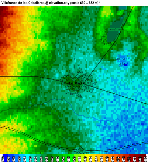
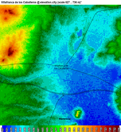
Below is the Elevation map of Villafranca de los Caballeros, which displays elevation range with different colors. Scale of the first map is from 630 to 682 m (2067 to 2238 ft) with average elevation of 647.4 meters (=2124 ft) [note 1]
These maps also provides idea of topography and contour of this city, they are displayed at different zoom levels. More info about maps, scale and edge coordinates you can find below images.
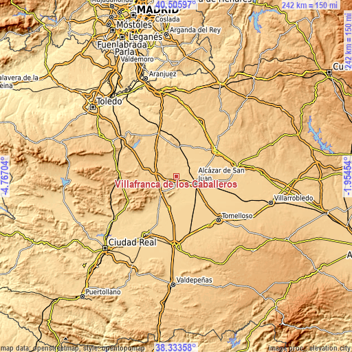
| \ | Map #1 | Map #2 | Topo.Map |
| Scale [m] | 630..682 m | 627..736 m | × |
| Scale [ft] | 2067..2238 ft | 2057..2415 ft | × |
| Average | 647.4 m = 2124 ft | 656.1 m = 2153 ft | × |
| Width | 7.55 km = 4.7 mi | 15.1 km = 9.4 mi | 241.5 km = 150.1 mi |
| Height | 7.55 km = 4.7 mi | 15.1 km = 9.4 mi | 241.5 km = 150.1 mi |
| ↑Max Latitude | 39.462176° | 39.496095° | 40.50597° |
| Latitude at center | 39.42824° | 39.42824° | 39.42824° |
| ↓Min Latitude | 39.394287° | 39.360318° | 38.33358° |
| ← Min Longitude | -3.404735° | -3.448681° | -4.76704° |
| Longitude center | -3.36079° | -3.36079° | -3.36079° |
| →Max Longitude | -3.316845° | -3.272899° | -1.95454° |
Nearby cities:
Cities around Villafranca de los Caballeros sort by population:
• Alcázar de San Juan elevation 649 m
13.8 km,  107°
107°
• Campo de Criptana 711 m
20.4 km,  97°
97°
• Madridejos 693 m
15.4 km,  286°
286°
• Consuegra 708 m
21.6 km,  280°
280°
• Villacañas 677 m
21.8 km,  5°
5°
• Herencia 650 m
6.9 km,  177°
177°
• Villa de Don Fadrique 672 m
24.1 km,  30°
30°
• Villarta de San Juan 631 m
21.8 km,  194°
194°
• Camuñas 681 m
8.1 km,  269°
269°
• Quero 654 m
13.4 km,  46°
46°
• Arenas de San Juan 629 m
26.3 km,  207°
207°
• Puerto Lápice 678 m
15.6 km,  221°
221°
Multilingual:
 En español:
Villafranca de los Caballeros elevación 645 m.
 En France:
Villafranca de los Caballeros élévation 645 m.
 Auf Deutsch:
Villafranca de los Caballeros höhe über dem Meeresspiegel ist 645 m.
 На русском:
Villafranca de los Caballeros высота над уровнем моря 645 м
Sources and notes:
- [note 1] Map square and city borders are not equal. Map elevation data is calculated only from area inside that square.
- [src 1] Elevation data from geonames database provided with same terms of usage.
- [src 2] The elevation map of Villafranca de los Caballeros is generated using elevation data from NASA's 3 arcsec (90m) resolution SRTM data.
- [src 3] Base (background) map © OpenStreetMap contributors tiles are generated by Geofabrik and OpenTopoMap.
Copyright & License:
This Villafranca de los Caballeros Elevation Map is licensed under CC BY-SA. You may reuse any part from this page, if you give a proper credit by linking to this URL:
 More info on terms of use page.