Aş Şaff elevation
Aş Şaff (Giza), Egypt elevation is 27 meters and Aş Şaff elevation in feet is 89 ft above sea level [src 1]. Aş Şaff is a populated place (feature code) with elevation that is 17 meters (56 ft) smaller than average city elevation in Egypt.
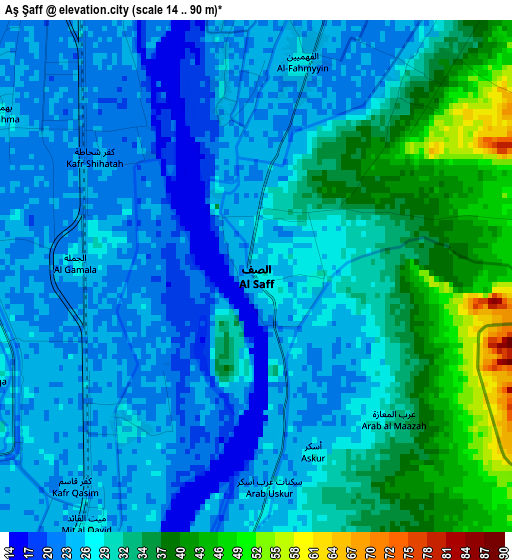
Below is the Elevation map of Aş Şaff, which displays elevation range with different colors. Scale of the first map is from 14 to 90 m (46 to 295 ft) with average elevation of 28.8 meters (=94 ft) [note 1]
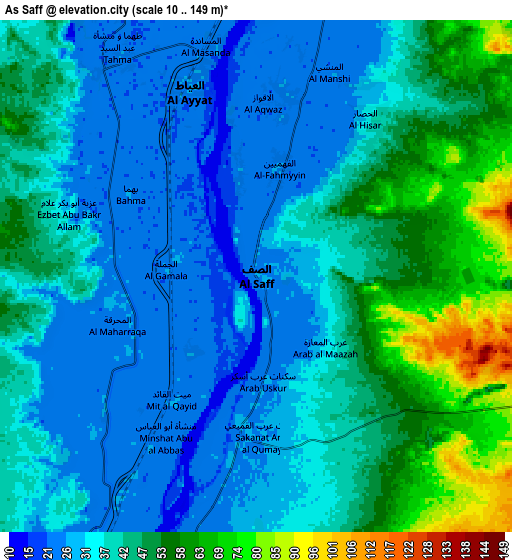
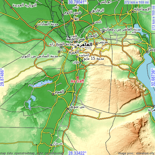
These maps also provides idea of topography and contour of this city, they are displayed at different zoom levels. More info about maps, scale and edge coordinates you can find below images.
| \ | Map #1 | Map #2 | Topo.Map |
| Scale [m] | 14..90 m | 10..149 m | × |
| Scale [ft] | 46..295 ft | 33..489 ft | × |
| Average | 28.8 m = 94 ft | 40.2 m = 132 ft | × |
| Width | 8.5 km = 5.3 mi | 17 km = 10.6 mi | 272 km = 169 mi |
| Height | 8.5 km = 5.3 mi | 17 km = 10.6 mi | 272 km = 169 mi |
| ↑Max Latitude | 29.602936° | 29.641138° | 30.78041° |
| Latitude at center | 29.56472° | 29.56472° | 29.56472° |
| ↓Min Latitude | 29.526489° | 29.488244° | 28.33422° |
| ← Min Longitude | 31.237165° | 31.193219° | 29.87486° |
| Longitude center | 31.28111° | 31.28111° | 31.28111° |
| →Max Longitude | 31.325055° | 31.369001° | 32.68736° |
Nearby cities:
Cities around Aş Şaff sort by population:
• Cairo elevation 23 m
55.4 km,  356°
356°
• Giza 30 m
49.8 km,  352°
352°
• Al Fayyūm 29 m
51.1 km,  236°
236°
• Ḩalwān 28 m
30.8 km,  3°
3°
• New Cairo 271 m
54.9 km,  19°
19°
• Banī Suwayf 33 m
57.3 km,  198°
198°
• Al Ḩawāmidīyah 23 m
37.4 km, 355°
• Būsh 31 m
48.7 km, 197°
• Ţāmiyah -6 m
32.5 km,  252°
252°
• Madīnat Sittah Uktūbar 126 m
35.8 km,  321°
321°
• Al Wāsiţah 33 m
26.3 km, 196°
• Al ‘Ayyāţ 25 m
6.5 km,  339°
339°
Multilingual:
 En español:
Aş Şaff elevación 27 m.
 En France:
Aş Şaff élévation 27 m.


Sources and notes:
- [note 1] Map square and city borders are not equal. Map elevation data is calculated only from area inside that square.
- [src 1] Elevation data from geonames database provided with same terms of usage.
- [src 2] The elevation map of Aş Şaff is generated using elevation data from NASA's 3 arcsec (90m) resolution SRTM data.
- [src 3] Base (background) map © OpenStreetMap contributors tiles are generated by Geofabrik and OpenTopoMap.
Copyright & License:
This Aş Şaff Elevation Map is licensed under CC BY-SA. You may reuse any part from this page, if you give a proper credit by linking to this URL:
 More info on terms of use page.