El Oued elevation
El Oued, Algeria elevation is 84 meters and El Oued elevation in feet is 276 ft above sea level [src 1]. El Oued is a seat of a first-order administrative division (feature code) with elevation that is 354 meters (1161 ft) smaller than average city elevation in Algeria.
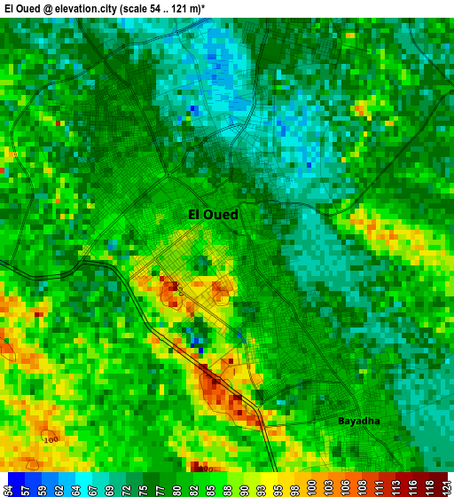
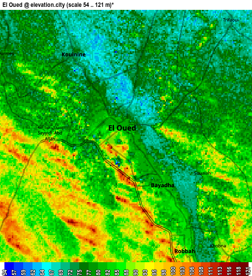
Below is the Elevation map of El Oued, which displays elevation range with different colors. Scale of the first map is from 54 to 121 m (177 to 397 ft) with average elevation of 80.1 meters (=263 ft) [note 1]
These maps also provides idea of topography and contour of this city, they are displayed at different zoom levels. More info about maps, scale and edge coordinates you can find below images.
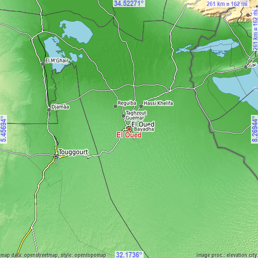
| \ | Map #1 | Map #2 | Topo.Map |
| Scale [m] | 54..121 m | 54..121 m | × |
| Scale [ft] | 177..397 ft | 177..397 ft | × |
| Average | 80.1 m = 263 ft | 81.8 m = 268 ft | × |
| Width | 8.16 km = 5.1 mi | 16.33 km = 10.1 mi | 261.2 km = 162.3 mi |
| Height | 8.16 km = 5.1 mi | 16.33 km = 10.1 mi | 261.2 km = 162.3 mi |
| ↑Max Latitude | 33.392778° | 33.429461° | 34.52271° |
| Latitude at center | 33.35608° | 33.35608° | 33.35608° |
| ↓Min Latitude | 33.319366° | 33.282637° | 32.1736° |
| ← Min Longitude | 6.819245° | 6.775299° | 5.45694° |
| Longitude center | 6.86319° | 6.86319° | 6.86319° |
| →Max Longitude | 6.907135° | 6.951081° | 8.26944° |
Nearby cities:
Cities around El Oued sort by population:
• Reguiba elevation 58 m
27.5 km,  327°
327°
• Djamaa 40 m
83.1 km,  283°
283°
• Touggourt 72 m
79.9 km,  249°
249°
• Tebesbest 70 m
77.3 km, 249°
• El Hadjira 130 m
150.6 km,  236°
236°
• Debila 52 m
19.6 km,  24°
24°
• Sidi Okba 53 m
178.2 km, 330°
• Megarine 68 m
74.4 km,  255°
255°
• Robbah 90 m
9.5 km,  152°
152°
• Sidi Amrane 45 m
80.9 km, 281°
• Zeribet el Oued 47 m
151 km,  347°
347°
• Oumache 54 m
184.3 km,  323°
323°
Multilingual:
 En español:
El Oued elevación 84 m.
 En France:
Oued Souf élévation 84 m.


Sources and notes:
- [note 1] Map square and city borders are not equal. Map elevation data is calculated only from area inside that square.
- [src 1] Elevation data from geonames database provided with same terms of usage.
- [src 2] The elevation map of El Oued is generated using elevation data from NASA's 3 arcsec (90m) resolution SRTM data.
- [src 3] Base (background) map © OpenStreetMap contributors tiles are generated by Geofabrik and OpenTopoMap.
Copyright & License:
This El Oued Elevation Map is licensed under CC BY-SA. You may reuse any part from this page, if you give a proper credit by linking to this URL:
 More info on terms of use page.