Sidi Okba elevation
Sidi Okba (Biskra), Algeria elevation is 53 meters and Sidi Okba elevation in feet is 174 ft above sea level [src 1]. Sidi Okba is a populated place (feature code) with elevation that is 385 meters (1263 ft) smaller than average city elevation in Algeria.
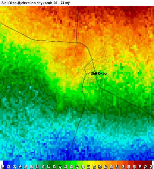
Below is the Elevation map of Sidi Okba, which displays elevation range with different colors. Scale of the first map is from 20 to 74 m (66 to 243 ft) with average elevation of 44.4 meters (=146 ft) [note 1]
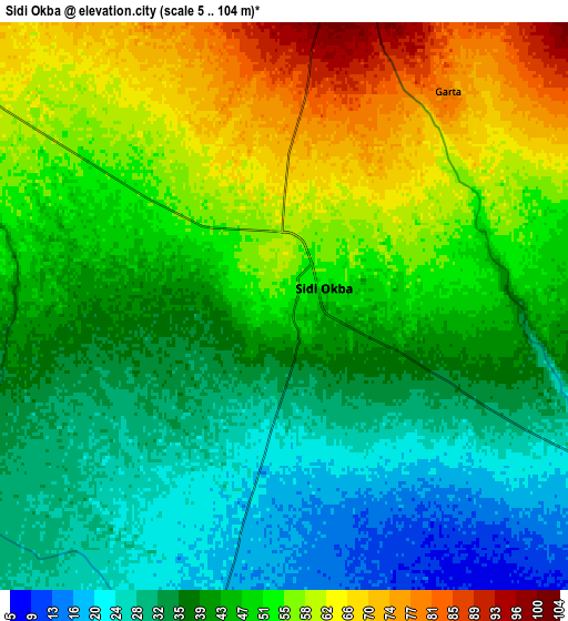
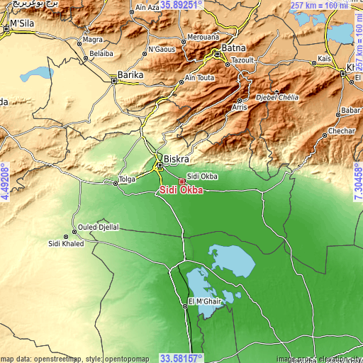
These maps also provides idea of topography and contour of this city, they are displayed at different zoom levels. More info about maps, scale and edge coordinates you can find below images.
| \ | Map #1 | Map #2 | Topo.Map |
| Scale [m] | 20..74 m | 5..104 m | × |
| Scale [ft] | 66..243 ft | 16..341 ft | × |
| Average | 44.4 m = 146 ft | 45.3 m = 149 ft | × |
| Width | 8.03 km = 5 mi | 16.06 km = 10 mi | 257 km = 159.7 mi |
| Height | 8.03 km = 5 mi | 16.06 km = 10 mi | 257 km = 159.7 mi |
| ↑Max Latitude | 34.781222° | 34.817308° | 35.89251° |
| Latitude at center | 34.74512° | 34.74512° | 34.74512° |
| ↓Min Latitude | 34.709002° | 34.672869° | 33.58157° |
| ← Min Longitude | 5.854385° | 5.810439° | 4.49208° |
| Longitude center | 5.89833° | 5.89833° | 5.89833° |
| →Max Longitude | 5.942275° | 5.986221° | 7.30458° |
Nearby cities:
Cities around Sidi Okba sort by population:
• Biskra elevation 115 m
19.5 km,  306°
306°
• Batna 1037 m
93.6 km,  15°
15°
• Barika 476 m
86.5 km,  325°
325°
• Aïn Touta 925 m
70.2 km,  0°
0°
• Tolga 161 m
47.6 km,  266°
266°
• Sidi Khaled 204 m
92.4 km,  244°
244°
• Merouana 992 m
98.5 km, 0°
• Tazoult-Lambese 1205 m
88.3 km, 21°
• Arris 1205 m
70.2 km,  35°
35°
• Zeribet el Oued 47 m
56.4 km,  97°
97°
• Oumache 54 m
20.7 km,  253°
253°
• Boumagueur 678 m
90.2 km,  339°
339°
Multilingual:
 En español:
Sidi Okba elevación 53 m.
 En France:
Sidi Okba élévation 53 m.
 Auf Deutsch:
Sidi Okba höhe über dem Meeresspiegel ist 53 m.

Sources and notes:
- [note 1] Map square and city borders are not equal. Map elevation data is calculated only from area inside that square.
- [src 1] Elevation data from geonames database provided with same terms of usage.
- [src 2] The elevation map of Sidi Okba is generated using elevation data from NASA's 3 arcsec (90m) resolution SRTM data.
- [src 3] Base (background) map © OpenStreetMap contributors tiles are generated by Geofabrik and OpenTopoMap.
Copyright & License:
This Sidi Okba Elevation Map is licensed under CC BY-SA. You may reuse any part from this page, if you give a proper credit by linking to this URL:
 More info on terms of use page.