Makouda elevation
Makouda (Boumerdes), Algeria elevation is 310 meters and Makouda elevation in feet is 1017 ft above sea level [src 1]. Makouda is a populated place (feature code) with elevation that is 128 meters (420 ft) smaller than average city elevation in Algeria.
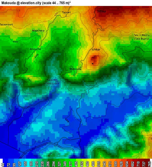
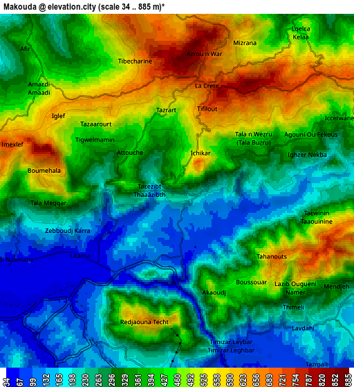
Below is the Elevation map of Makouda, which displays elevation range with different colors. Scale of the first map is from 44 to 765 m (144 to 2510 ft) with average elevation of 285.4 meters (=936 ft) [note 1]
These maps also provides idea of topography and contour of this city, they are displayed at different zoom levels. More info about maps, scale and edge coordinates you can find below images.
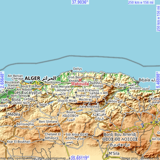
| \ | Map #1 | Map #2 | Topo.Map |
| Scale [m] | 44..765 m | 34..885 m | × |
| Scale [ft] | 144..2510 ft | 112..2904 ft | × |
| Average | 285.4 m = 936 ft | 353.9 m = 1161 ft | × |
| Width | 7.83 km = 4.9 mi | 15.65 km = 9.7 mi | 250.4 km = 155.6 mi |
| Height | 7.83 km = 4.9 mi | 15.65 km = 9.7 mi | 250.4 km = 155.6 mi |
| ↑Max Latitude | 36.820857° | 36.856028° | 37.9036° |
| Latitude at center | 36.78567° | 36.78567° | 36.78567° |
| ↓Min Latitude | 36.750467° | 36.715248° | 35.65119° |
| ← Min Longitude | 4.018785° | 3.974839° | 2.65648° |
| Longitude center | 4.06273° | 4.06273° | 4.06273° |
| →Max Longitude | 4.106675° | 4.150621° | 5.46898° |
Nearby cities:
Cities around Makouda sort by population:
• Tizi Ouzou elevation 206 m
8.3 km,  190°
190°
• Timizart 312 m
18.2 km,  84°
84°
• Draa Ben Khedda 43 m
10.6 km,  237°
237°
• Beni Douala 804 m
18.6 km,  174°
174°
• L’Arbaa Naït Irathen 710 m
21 km,  144°
144°
• Mekla 325 m
21.3 km,  122°
122°
• Dellys 63 m
19.8 km,  317°
317°
• Tirmitine 532 m
16.3 km,  206°
206°
• Tadmaït 52 m
15.2 km,  252°
252°
• Boudjima 295 m
8.1 km, 76°
• Tizi Rached 405 m
17.1 km, 137°
• Naciria 169 m
21 km,  257°
257°
Multilingual:
 En español:
Makouda elevación 310 m.
 En France:
Makouda élévation 310 m.


Sources and notes:
- [note 1] Map square and city borders are not equal. Map elevation data is calculated only from area inside that square.
- [src 1] Elevation data from geonames database provided with same terms of usage.
- [src 2] The elevation map of Makouda is generated using elevation data from NASA's 3 arcsec (90m) resolution SRTM data.
- [src 3] Base (background) map © OpenStreetMap contributors tiles are generated by Geofabrik and OpenTopoMap.
Copyright & License:
This Makouda Elevation Map is licensed under CC BY-SA. You may reuse any part from this page, if you give a proper credit by linking to this URL:
 More info on terms of use page.