M’Sila elevation
M’Sila (M'Sila), Algeria elevation is 477 meters and M’Sila elevation in feet is 1565 ft above sea level [src 1]. M’Sila is a seat of a first-order administrative division (feature code) with elevation that is 39 meters (128 ft) bigger than average city elevation in Algeria.
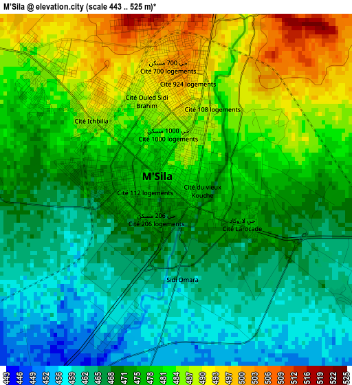
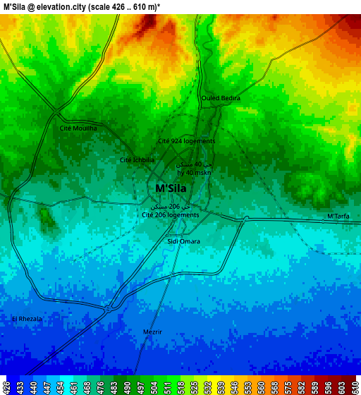
Below is the Elevation map of M’Sila, which displays elevation range with different colors. Scale of the first map is from 443 to 525 m (1453 to 1722 ft) with average elevation of 475.1 meters (=1559 ft) [note 1]
These maps also provides idea of topography and contour of this city, they are displayed at different zoom levels. More info about maps, scale and edge coordinates you can find below images.
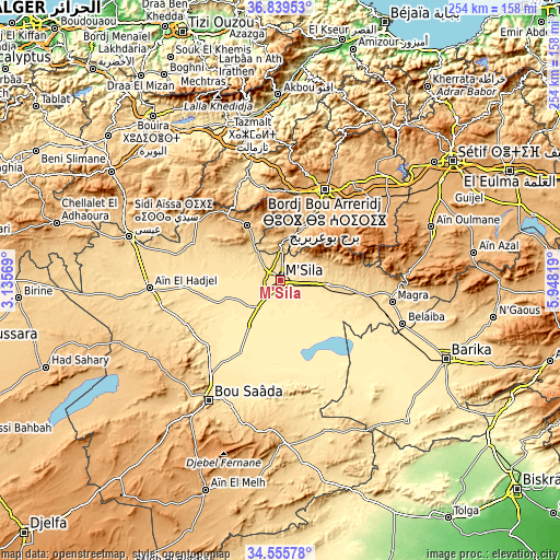
| \ | Map #1 | Map #2 | Topo.Map |
| Scale [m] | 443..525 m | 426..610 m | × |
| Scale [ft] | 1453..1722 ft | 1398..2001 ft | × |
| Average | 475.1 m = 1559 ft | 482 m = 1581 ft | × |
| Width | 7.94 km = 4.9 mi | 15.87 km = 9.9 mi | 253.9 km = 157.8 mi |
| Height | 7.94 km = 4.9 mi | 15.87 km = 9.9 mi | 253.9 km = 157.8 mi |
| ↑Max Latitude | 35.741507° | 35.777167° | 36.83953° |
| Latitude at center | 35.70583° | 35.70583° | 35.70583° |
| ↓Min Latitude | 35.670137° | 35.634429° | 34.55578° |
| ← Min Longitude | 4.497995° | 4.454049° | 3.13569° |
| Longitude center | 4.54194° | 4.54194° | 4.54194° |
| →Max Longitude | 4.585885° | 4.629831° | 5.94819° |
Nearby cities:
Cities around M’Sila sort by population:
• Bordj Bou Arreridj elevation 906 m
45.4 km,  25°
25°
• El Achir 998 m
40.5 km,  10°
10°
• Barika 476 m
82.4 km,  115°
115°
• Sidi Aïssa 662 m
72.2 km,  286°
286°
• Râs el Oued 1102 m
51.4 km,  59°
59°
• ‘Aïn el Hadjel 544 m
59.8 km,  266°
266°
• Bordj Ghdir 1088 m
38.8 km, 55°
• Melouza 936 m
44.2 km,  313°
313°
• Salah Bey 976 m
69.5 km,  76°
76°
• Mansourah 667 m
43.2 km,  349°
349°
• Chorfa 342 m
75.8 km, 345°
• Bordj Zemoura 1043 m
69.3 km,  24°
24°
Multilingual:
 En español:
M’Sila elevación 477 m.
 En France:
M’Sila élévation 477 m.


Sources and notes:
- [note 1] Map square and city borders are not equal. Map elevation data is calculated only from area inside that square.
- [src 1] Elevation data from geonames database provided with same terms of usage.
- [src 2] The elevation map of M’Sila is generated using elevation data from NASA's 3 arcsec (90m) resolution SRTM data.
- [src 3] Base (background) map © OpenStreetMap contributors tiles are generated by Geofabrik and OpenTopoMap.
Copyright & License:
This M’Sila Elevation Map is licensed under CC BY-SA. You may reuse any part from this page, if you give a proper credit by linking to this URL:
 More info on terms of use page.