Sfizef elevation
Sfizef (Sidi Bel Abbès), Algeria elevation is 551 meters and Sfizef elevation in feet is 1808 ft above sea level [src 1]. Sfizef is a populated place (feature code) with elevation that is 113 meters (371 ft) bigger than average city elevation in Algeria.
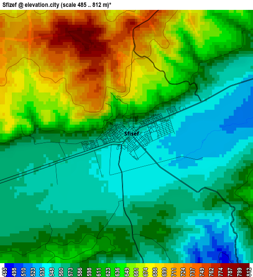
Below is the Elevation map of Sfizef, which displays elevation range with different colors. Scale of the first map is from 485 to 812 m (1591 to 2664 ft) with average elevation of 610.2 meters (=2002 ft) [note 1]
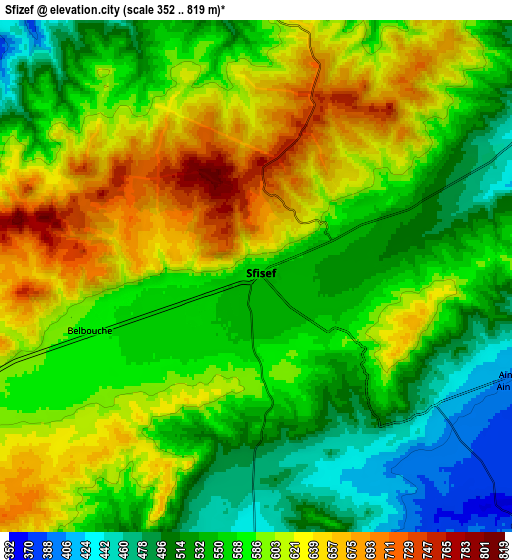
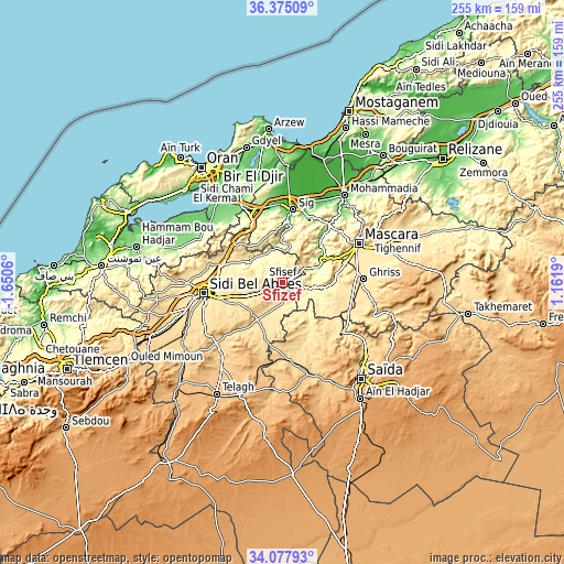
These maps also provides idea of topography and contour of this city, they are displayed at different zoom levels. More info about maps, scale and edge coordinates you can find below images.
| \ | Map #1 | Map #2 | Topo.Map |
| Scale [m] | 485..812 m | 352..819 m | × |
| Scale [ft] | 1591..2664 ft | 1155..2687 ft | × |
| Average | 610.2 m = 2002 ft | 576.6 m = 1892 ft | × |
| Width | 7.98 km = 5 mi | 15.96 km = 9.9 mi | 255.4 km = 158.7 mi |
| Height | 7.98 km = 5 mi | 15.96 km = 9.9 mi | 255.4 km = 158.7 mi |
| ↑Max Latitude | 35.270526° | 35.306397° | 36.37509° |
| Latitude at center | 35.23464° | 35.23464° | 35.23464° |
| ↓Min Latitude | 35.198738° | 35.16282° | 34.07793° |
| ← Min Longitude | -0.288295° | -0.332241° | -1.6506° |
| Longitude center | -0.24435° | -0.24435° | -0.24435° |
| →Max Longitude | -0.200405° | -0.156459° | 1.1619° |
Nearby cities:
Cities around Sfizef sort by population:
• Oran elevation 118 m
62.6 km,  325°
325°
• Sidi Bel Abbès 476 m
35.5 km,  261°
261°
• Mascara 590 m
39.3 km,  62°
62°
• Saïda 840 m
57.6 km,  141°
141°
• Es Senia 88 m
57.4 km,  323°
323°
• Bir el Djir 162 m
60.4 km, 333°
• Sig 62 m
33 km,  8°
8°
• Aïn el Bya 63 m
63.5 km,  355°
355°
• Sidi ech Chahmi 92 m
53.5 km, 331°
• Bou Hanifia el Hamamat 232 m
19.7 km, 63°
• ’Aïn el Berd 483 m
28.3 km,  300°
300°
• ’Aïn el Hadjar 1024 m
63.7 km,  146°
146°
Multilingual:
 En español:
Sfizef elevación 551 m.
 En France:
Sfizef élévation 551 m.


Sources and notes:
- [note 1] Map square and city borders are not equal. Map elevation data is calculated only from area inside that square.
- [src 1] Elevation data from geonames database provided with same terms of usage.
- [src 2] The elevation map of Sfizef is generated using elevation data from NASA's 3 arcsec (90m) resolution SRTM data.
- [src 3] Base (background) map © OpenStreetMap contributors tiles are generated by Geofabrik and OpenTopoMap.
Copyright & License:
This Sfizef Elevation Map is licensed under CC BY-SA. You may reuse any part from this page, if you give a proper credit by linking to this URL:
 More info on terms of use page.