Tiaret elevation
Tiaret, Algeria elevation is 1031 meters and Tiaret elevation in feet is 3383 ft above sea level [src 1]. Tiaret is a seat of a first-order administrative division (feature code) with elevation that is 593 meters (1946 ft) bigger than average city elevation in Algeria.
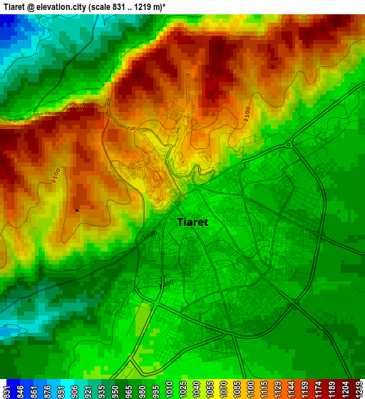
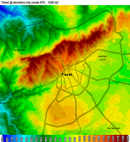
Below is the Elevation map of Tiaret, which displays elevation range with different colors. Scale of the first map is from 831 to 1219 m (2726 to 3999 ft) with average elevation of 1032.3 meters (=3387 ft) [note 1]
These maps also provides idea of topography and contour of this city, they are displayed at different zoom levels. More info about maps, scale and edge coordinates you can find below images.
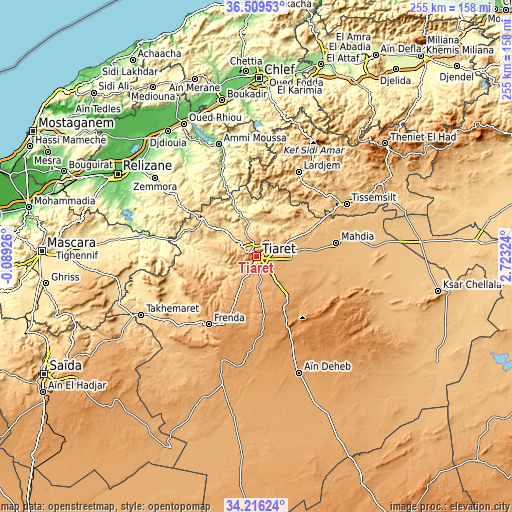
| \ | Map #1 | Map #2 | Topo.Map |
| Scale [m] | 831..1219 m | 676..1220 m | × |
| Scale [ft] | 2726..3999 ft | 2218..4003 ft | × |
| Average | 1032.3 m = 3387 ft | 967.8 m = 3175 ft | × |
| Width | 7.97 km = 5 mi | 15.94 km = 9.9 mi | 255 km = 158.4 mi |
| Height | 7.97 km = 5 mi | 15.94 km = 9.9 mi | 255 km = 158.4 mi |
| ↑Max Latitude | 35.406856° | 35.442666° | 36.50953° |
| Latitude at center | 35.37103° | 35.37103° | 35.37103° |
| ↓Min Latitude | 35.335188° | 35.29933° | 34.21624° |
| ← Min Longitude | 1.273045° | 1.229099° | -0.08926° |
| Longitude center | 1.31699° | 1.31699° | 1.31699° |
| →Max Longitude | 1.360935° | 1.404881° | 2.72324° |
Nearby cities:
Cities around Tiaret sort by population:
• Sougueur elevation 1133 m
26.3 km,  141°
141°
• Frenda 1058 m
41.8 km,  215°
215°
• Tissemsilt 866 m
51.8 km,  59°
59°
• Oued Rhiou 97 m
74.8 km,  331°
331°
• Mehdia daira de meghila 909 m
40.4 km,  80°
80°
• ’Aïn Deheb 1081 m
62.4 km,  160°
160°
• Lardjem 552 m
46.9 km,  26°
26°
• Ammi Moussa 157 m
58.3 km,  341°
341°
• Oued el Abtal 259 m
57.8 km,  279°
279°
• Zemoura 288 m
64.1 km,  307°
307°
• Djebilet Rosfa 905 m
71.4 km, 217°
• Smala 323 m
63.8 km, 307°
Multilingual:
 En español:
Tiaret elevación 1031 m.
 En France:
Tiaret élévation 1031 m.


Sources and notes:
- [note 1] Map square and city borders are not equal. Map elevation data is calculated only from area inside that square.
- [src 1] Elevation data from geonames database provided with same terms of usage.
- [src 2] The elevation map of Tiaret is generated using elevation data from NASA's 3 arcsec (90m) resolution SRTM data.
- [src 3] Base (background) map © OpenStreetMap contributors tiles are generated by Geofabrik and OpenTopoMap.
Copyright & License:
This Tiaret Elevation Map is licensed under CC BY-SA. You may reuse any part from this page, if you give a proper credit by linking to this URL:
 More info on terms of use page.