Concepción de La Vega elevation
Concepción de La Vega (La Vega), Dominican Republic elevation is 101 meters and Concepción de La Vega elevation in feet is 331 ft above sea level [src 1]. Concepción de La Vega is a seat of a first-order administrative division (feature code) with elevation that is 62 meters (203 ft) smaller than average city elevation in Dominican Republic.
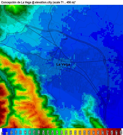
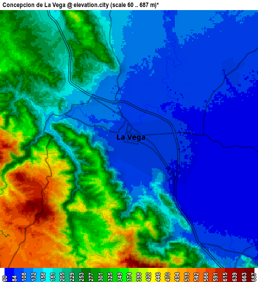
Below is the Elevation map of Concepción de La Vega, which displays elevation range with different colors. Scale of the first map is from 71 to 456 m (233 to 1496 ft) with average elevation of 145.7 meters (=478 ft) [note 1]
These maps also provides idea of topography and contour of this city, they are displayed at different zoom levels. More info about maps, scale and edge coordinates you can find below images.
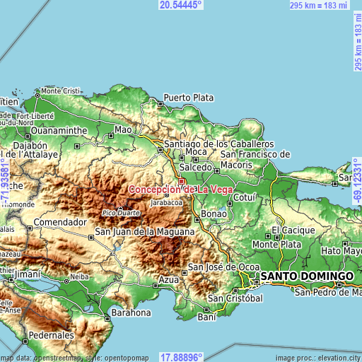
| \ | Map #1 | Map #2 | Topo.Map |
| Scale [m] | 71..456 m | 60..687 m | × |
| Scale [ft] | 233..1496 ft | 197..2254 ft | × |
| Average | 145.7 m = 478 ft | 217.2 m = 713 ft | × |
| Width | 9.23 km = 5.7 mi | 18.46 km = 11.5 mi | 295.3 km = 183.5 mi |
| Height | 9.23 km = 5.7 mi | 18.46 km = 11.5 mi | 295.3 km = 183.5 mi |
| ↑Max Latitude | 19.26356° | 19.30504° | 20.54445° |
| Latitude at center | 19.22207° | 19.22207° | 19.22207° |
| ↓Min Latitude | 19.180569° | 19.139058° | 17.88896° |
| ← Min Longitude | -70.573505° | -70.617451° | -71.93581° |
| Longitude center | -70.52956° | -70.52956° | -70.52956° |
| →Max Longitude | -70.485615° | -70.441669° | -69.12331° |
Nearby cities:
Cities around Concepción de La Vega sort by population:
• Moca elevation 191 m
19.1 km,  1°
1°
• Salcedo 196 m
20.9 km,  34°
34°
• Jarabacoa 552 m
16.2 km,  223°
223°
• Licey al Medio 199 m
24.6 km,  342°
342°
• Jima Abajo 69 m
18.9 km,  121°
121°
• Rincón 88 m
17.3 km,  131°
131°
• Río Verde Arriba 169 m
11.1 km, 339°
• Villa Tapia 107 m
14.3 km,  52°
52°
• Cayetano Germosén 150 m
14.4 km,  19°
19°
• Baitoa 250 m
21.6 km,  302°
302°
• Juan López Abajo 254 m
23.7 km,  7°
7°
• Sabana del Puerto 118 m
21 km,  145°
145°
Multilingual:
 En español:
Concepción de La Vega elevación 101 m.
 En France:
Concepción de La Vega élévation 101 m.
 Auf Deutsch:
Concepción de La Vega höhe über dem Meeresspiegel ist 101 m.
 На русском:
Консепсион-де-ла-Вега высота над уровнем моря 101 м
Sources and notes:
- [note 1] Map square and city borders are not equal. Map elevation data is calculated only from area inside that square.
- [src 1] Elevation data from geonames database provided with same terms of usage.
- [src 2] The elevation map of Concepción de La Vega is generated using elevation data from NASA's 3 arcsec (90m) resolution SRTM data.
- [src 3] Base (background) map © OpenStreetMap contributors tiles are generated by Geofabrik and OpenTopoMap.
Copyright & License:
This Concepción de La Vega Elevation Map is licensed under CC BY-SA. You may reuse any part from this page, if you give a proper credit by linking to this URL:
 More info on terms of use page.