Pepillo Salcedo elevation
Pepillo Salcedo (Monte Cristi), Dominican Republic elevation is 7 meters and Pepillo Salcedo elevation in feet is 23 ft above sea level [src 1]. Pepillo Salcedo is a populated place (feature code) with elevation that is 156 meters (512 ft) smaller than average city elevation in Dominican Republic.
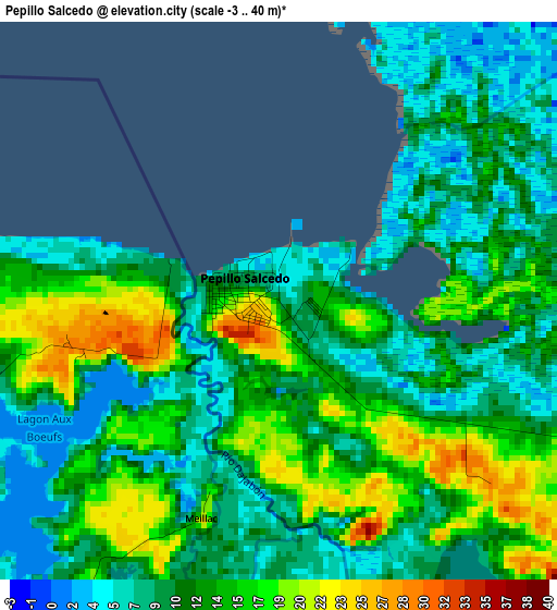
Below is the Elevation map of Pepillo Salcedo, which displays elevation range with different colors. Scale of the first map is from -3 to 40 m (-10 to 131 ft) with average elevation of 11.9 meters (=39 ft) [note 1]
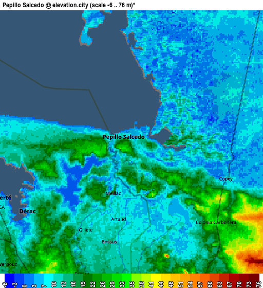
These maps also provides idea of topography and contour of this city, they are displayed at different zoom levels. More info about maps, scale and edge coordinates you can find below images.
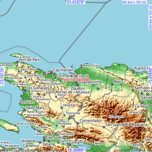
| \ | Map #1 | Map #2 | Topo.Map |
| Scale [m] | -3..40 m | -6..76 m | × |
| Scale [ft] | -10..131 ft | -20..249 ft | × |
| Average | 11.9 m = 39 ft | 12.4 m = 41 ft | × |
| Width | 9.2 km = 5.7 mi | 18.4 km = 11.4 mi | 294.4 km = 182.9 mi |
| Height | 9.2 km = 5.7 mi | 18.4 km = 11.4 mi | 294.4 km = 182.9 mi |
| ↑Max Latitude | 19.739778° | 19.781136° | 21.01679° |
| Latitude at center | 19.69841° | 19.69841° | 19.69841° |
| ↓Min Latitude | 19.657031° | 19.615641° | 18.36908° |
| ← Min Longitude | -71.789075° | -71.833021° | -73.15138° |
| Longitude center | -71.74513° | -71.74513° | -71.74513° |
| →Max Longitude | -71.701185° | -71.657239° | -70.33888° |
Nearby cities:
Cities around Pepillo Salcedo sort by population:
• San Fernando de Monte Cristi elevation 16 m
19.6 km,  31°
31°
• Dajabón 38 m
17.1 km,  166°
166°
• Sabaneta 127 m
48.9 km,  120°
120°
• Villa Vásquez 32 m
31.6 km,  81°
81°
• Las Matas de Santa Cruz 34 m
25.4 km,  96°
96°
• Loma de Cabrera 303 m
33.2 km,  152°
152°
• Castañuelas 23 m
25.8 km,  86°
86°
• Partido 200 m
31.6 km,  138°
138°
• Restauración 583 m
43 km, 172°
• Cana Chapetón 63 m
52.1 km, 101°
• El Pino 216 m
40.7 km, 135°
• Villa Elisa 68 m
49.8 km, 91°
Multilingual:
 En español:
Pepillo Salcedo elevación 7 m.
 En France:
Pepillo Salcedo élévation 7 m.
 Auf Deutsch:
Pepillo Salcedo höhe über dem Meeresspiegel ist 7 m.

Sources and notes:
- [note 1] Map square and city borders are not equal. Map elevation data is calculated only from area inside that square.
- [src 1] Elevation data from geonames database provided with same terms of usage.
- [src 2] The elevation map of Pepillo Salcedo is generated using elevation data from NASA's 3 arcsec (90m) resolution SRTM data.
- [src 3] Base (background) map © OpenStreetMap contributors tiles are generated by Geofabrik and OpenTopoMap.
Copyright & License:
This Pepillo Salcedo Elevation Map is licensed under CC BY-SA. You may reuse any part from this page, if you give a proper credit by linking to this URL:
 More info on terms of use page.