San José de Las Matas elevation
San José de Las Matas (Santiago), Dominican Republic elevation is 524 meters and San José de Las Matas elevation in feet is 1719 ft above sea level [src 1]. San José de Las Matas is a populated place (feature code) with elevation that is 361 meters (1184 ft) bigger than average city elevation in Dominican Republic.
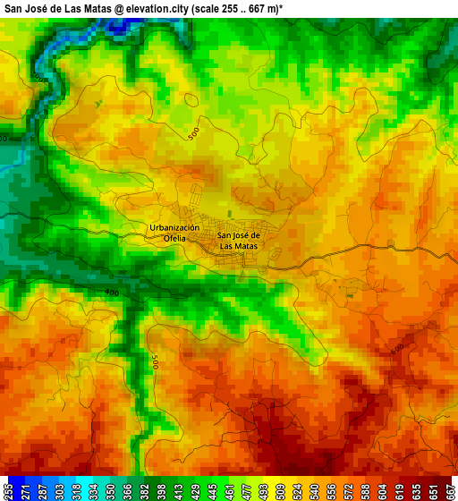
Below is the Elevation map of San José de Las Matas, which displays elevation range with different colors. Scale of the first map is from 255 to 667 m (837 to 2188 ft) with average elevation of 509.1 meters (=1670 ft) [note 1]
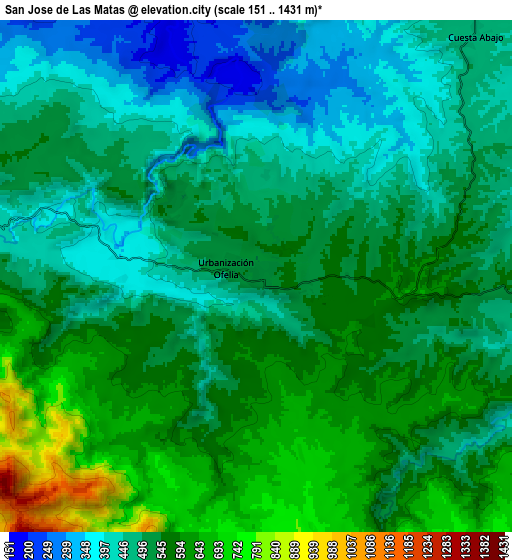
These maps also provides idea of topography and contour of this city, they are displayed at different zoom levels. More info about maps, scale and edge coordinates you can find below images.
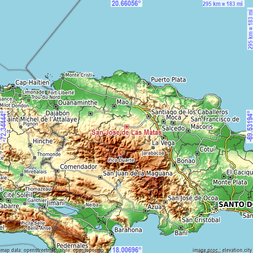
| \ | Map #1 | Map #2 | Topo.Map |
| Scale [m] | 255..667 m | 151..1431 m | × |
| Scale [ft] | 837..2188 ft | 495..4695 ft | × |
| Average | 509.1 m = 1670 ft | 525.2 m = 1723 ft | × |
| Width | 9.22 km = 5.7 mi | 18.44 km = 11.5 mi | 295.1 km = 183.4 mi |
| Height | 9.22 km = 5.7 mi | 18.44 km = 11.5 mi | 295.1 km = 183.4 mi |
| ↑Max Latitude | 19.38061° | 19.42206° | 20.66056° |
| Latitude at center | 19.33915° | 19.33915° | 19.33915° |
| ↓Min Latitude | 19.297679° | 19.256198° | 18.00696° |
| ← Min Longitude | -70.982135° | -71.026081° | -72.34444° |
| Longitude center | -70.93819° | -70.93819° | -70.93819° |
| →Max Longitude | -70.894245° | -70.850299° | -69.53194° |
Nearby cities:
Cities around San José de Las Matas sort by population:
• Santiago de los Caballeros elevation 199 m
28.2 km,  63°
63°
• Mao 85 m
27.8 km,  328°
328°
• Esperanza 113 m
27.7 km,  349°
349°
• Villa Bisonó 131 m
25.8 km,  14°
14°
• Villa González 164 m
27.3 km,  35°
35°
• Monción 372 m
23.9 km,  289°
289°
• Sabana Iglesia 291 m
18.8 km,  96°
96°
• La Canela 182 m
19.7 km, 40°
• Baitoa 250 m
24.7 km,  93°
93°
• Amina 80 m
24 km, 345°
• Guatapanal 150 m
18.8 km, 6°
• Juncalito Abajo 969 m
18.2 km,  136°
136°
Multilingual:
 En español:
San José de Las Matas elevación 524 m.
 En France:
San José de Las Matas élévation 524 m.
 Auf Deutsch:
San José de Las Matas höhe über dem Meeresspiegel ist 524 m.
 На русском:
San José de Las Matas высота над уровнем моря 524 м
Sources and notes:
- [note 1] Map square and city borders are not equal. Map elevation data is calculated only from area inside that square.
- [src 1] Elevation data from geonames database provided with same terms of usage.
- [src 2] The elevation map of San José de Las Matas is generated using elevation data from NASA's 3 arcsec (90m) resolution SRTM data.
- [src 3] Base (background) map © OpenStreetMap contributors tiles are generated by Geofabrik and OpenTopoMap.
Copyright & License:
This San José de Las Matas Elevation Map is licensed under CC BY-SA. You may reuse any part from this page, if you give a proper credit by linking to this URL:
 More info on terms of use page.