Køge elevation
Køge (Zealand, Køge Kommune), Denmark elevation is 4 meters and Køge elevation in feet is 13 ft above sea level [src 1]. Køge is a seat of a second-order administrative division (feature code) with elevation that is 23 meters (75 ft) smaller than average city elevation in Denmark.
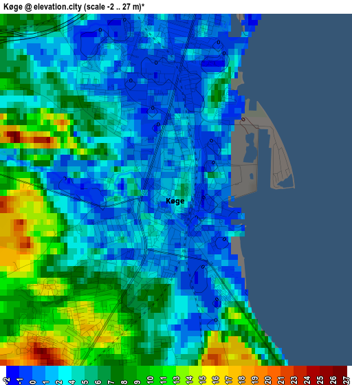
Below is the Elevation map of Køge, which displays elevation range with different colors. Scale of the first map is from -2 to 27 m (-7 to 89 ft) with average elevation of 5.4 meters (=18 ft) [note 1]
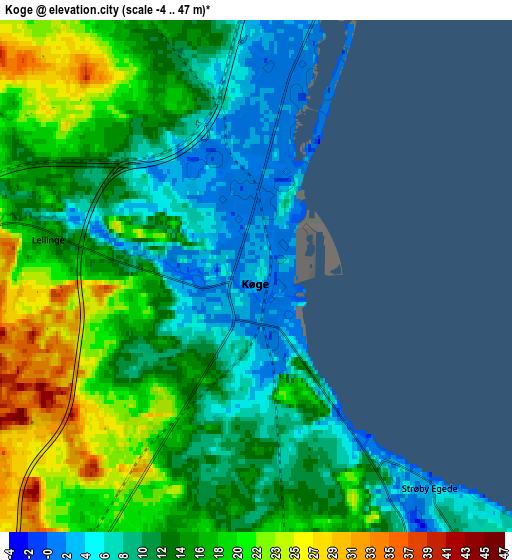
These maps also provides idea of topography and contour of this city, they are displayed at different zoom levels. More info about maps, scale and edge coordinates you can find below images.
| \ | Map #1 | Map #2 | Topo.Map |
| Scale [m] | -2..27 m | -4..47 m | × |
| Scale [ft] | -7..89 ft | -13..154 ft | × |
| Average | 5.4 m = 18 ft | 13.8 m = 45 ft | × |
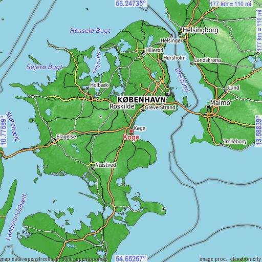
| Width | 5.54 km = 3.4 mi | 11.08 km = 6.9 mi | 177.3 km = 110.2 mi |
| Height | 5.54 km = 3.4 mi | 11.08 km = 6.9 mi | 177.3 km = 110.2 mi |
| ↑Max Latitude | 55.48293° | 55.507823° | 56.24735° |
| Latitude at center | 55.45802° | 55.45802° | 55.45802° |
| ↓Min Latitude | 55.433095° | 55.408154° | 54.65257° |
| ← Min Longitude | 12.138195° | 12.094249° | 10.77589° |
| Longitude center | 12.18214° | 12.18214° | 12.18214° |
| →Max Longitude | 12.226085° | 12.270031° | 13.58839° |
Nearby cities:
Cities around Køge sort by population:
• Greve elevation 3 m
15.8 km,  28°
28°
• Solrød Strand 2 m
8.7 km,  16°
16°
• Tune 50 m
15 km,  357°
357°
• Viby 41 m
14.2 km,  315°
315°
• Havdrup 23 m
10.3 km,  339°
339°
• Borup 44 m
13.6 km,  287°
287°
• Strøby Egede 5 m
6.3 km,  141°
141°
• Ejby 30 m
7 km,  296°
296°
• Bjæverskov 30 m
9.2 km,  269°
269°
• Hårlev 13 m
12.5 km,  164°
164°
• Osted 42 m
18.3 km,  309°
309°
• Solrød 17 m
8.7 km,  0°
0°
Multilingual:
 En español:
Køge elevación 4 m.
 En France:
Køge élévation 4 m.


Sources and notes:
- [note 1] Map square and city borders are not equal. Map elevation data is calculated only from area inside that square.
- [src 1] Elevation data from geonames database provided with same terms of usage.
- [src 2] The elevation map of Køge is generated using elevation data from NASA's 3 arcsec (90m) resolution SRTM data.
- [src 3] Base (background) map © OpenStreetMap contributors tiles are generated by Geofabrik and OpenTopoMap.
Copyright & License:
This Køge Elevation Map is licensed under CC BY-SA. You may reuse any part from this page, if you give a proper credit by linking to this URL:
 More info on terms of use page.