Tune elevation
Tune (Zealand, Greve Kommune), Denmark elevation is 50 meters and Tune elevation in feet is 164 ft above sea level [src 1]. Tune is a populated place (feature code) with elevation that is 23 meters (75 ft) bigger than average city elevation in Denmark.
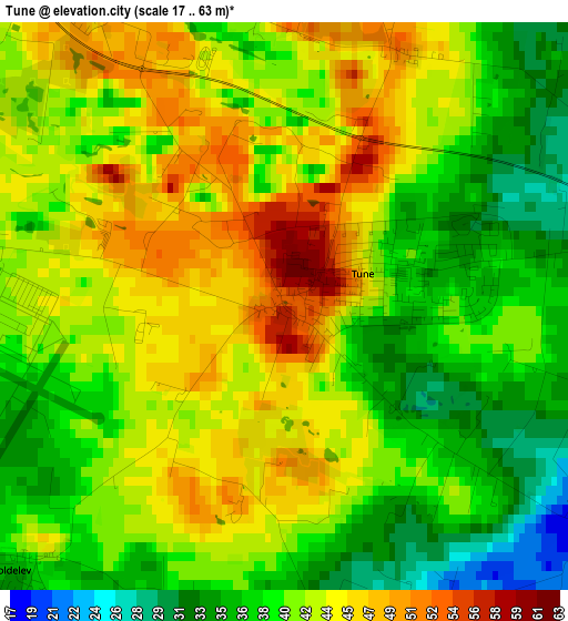
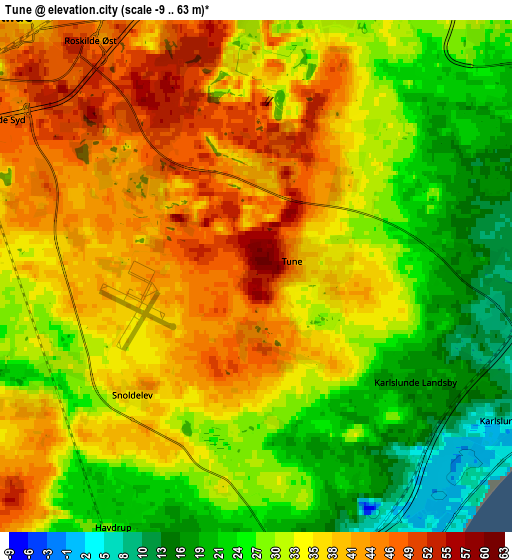
Below is the Elevation map of Tune, which displays elevation range with different colors. Scale of the first map is from 17 to 63 m (56 to 207 ft) with average elevation of 41.1 meters (=135 ft) [note 1]
These maps also provides idea of topography and contour of this city, they are displayed at different zoom levels. More info about maps, scale and edge coordinates you can find below images.
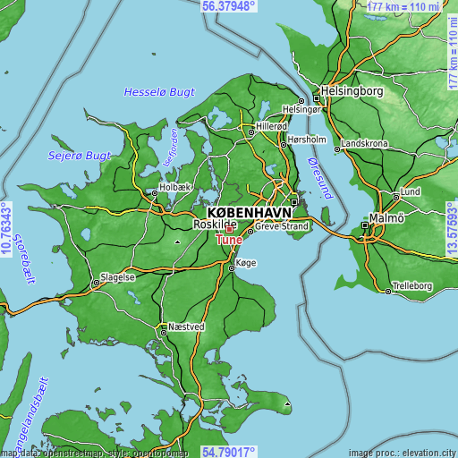
| \ | Map #1 | Map #2 | Topo.Map |
| Scale [m] | 17..63 m | -9..63 m | × |
| Scale [ft] | 56..207 ft | -30..207 ft | × |
| Average | 41.1 m = 135 ft | 33 m = 108 ft | × |
| Width | 5.52 km = 3.4 mi | 11.04 km = 6.9 mi | 176.7 km = 109.8 mi |
| Height | 5.52 km = 3.4 mi | 11.04 km = 6.9 mi | 176.7 km = 109.8 mi |
| ↑Max Latitude | 55.617694° | 55.642503° | 56.37948° |
| Latitude at center | 55.59287° | 55.59287° | 55.59287° |
| ↓Min Latitude | 55.56803° | 55.543174° | 54.79017° |
| ← Min Longitude | 12.125735° | 12.081789° | 10.76343° |
| Longitude center | 12.16968° | 12.16968° | 12.16968° |
| →Max Longitude | 12.213625° | 12.257571° | 13.57593° |
Nearby cities:
Cities around Tune sort by population:
• Greve elevation 3 m
8.3 km,  97°
97°
• Roskilde 41 m
7.8 km,  313°
313°
• Taastrup 15 m
10.4 km,  52°
52°
• Ishøj 4 m
11.7 km,  77°
77°
• Solrød Strand 2 m
7.4 km,  153°
153°
• Fløng 27 m
7.8 km,  8°
8°
• Viby 41 m
10.4 km,  241°
241°
• Svogerslev 39 m
10.8 km,  295°
295°
• Havdrup 23 m
6.1 km,  208°
208°
• Vindinge 54 m
3.9 km,  329°
329°
• Lejre 17 m
12.3 km,  276°
276°
• Solrød 17 m
6.3 km,  172°
172°
Multilingual:
 En español:
Tune elevación 50 m.
 En France:
Tune élévation 50 m.


Sources and notes:
- [note 1] Map square and city borders are not equal. Map elevation data is calculated only from area inside that square.
- [src 1] Elevation data from geonames database provided with same terms of usage.
- [src 2] The elevation map of Tune is generated using elevation data from NASA's 3 arcsec (90m) resolution SRTM data.
- [src 3] Base (background) map © OpenStreetMap contributors tiles are generated by Geofabrik and OpenTopoMap.
Copyright & License:
This Tune Elevation Map is licensed under CC BY-SA. You may reuse any part from this page, if you give a proper credit by linking to this URL:
 More info on terms of use page.