Vamdrup elevation
Vamdrup (South Denmark, Kolding Kommune), Denmark elevation is 37 meters and Vamdrup elevation in feet is 121 ft above sea level [src 1]. Vamdrup is a populated place (feature code) with elevation that is 10 meters (33 ft) bigger than average city elevation in Denmark.
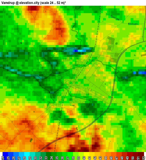
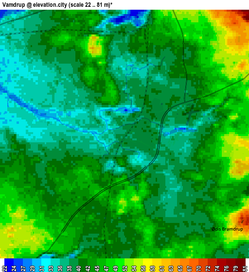
Below is the Elevation map of Vamdrup, which displays elevation range with different colors. Scale of the first map is from 24 to 52 m (79 to 171 ft) with average elevation of 38.8 meters (=127 ft) [note 1]
These maps also provides idea of topography and contour of this city, they are displayed at different zoom levels. More info about maps, scale and edge coordinates you can find below images.
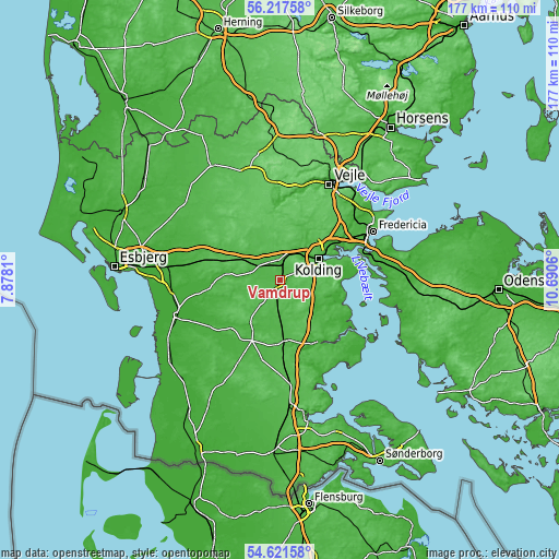
| \ | Map #1 | Map #2 | Topo.Map |
| Scale [m] | 24..52 m | 22..81 m | × |
| Scale [ft] | 79..171 ft | 72..266 ft | × |
| Average | 38.8 m = 127 ft | 42.3 m = 139 ft | × |
| Width | 5.55 km = 3.4 mi | 11.09 km = 6.9 mi | 177.5 km = 110.3 mi |
| Height | 5.55 km = 3.4 mi | 11.09 km = 6.9 mi | 177.4 km = 110.2 mi |
| ↑Max Latitude | 55.452569° | 55.477482° | 56.21758° |
| Latitude at center | 55.42764° | 55.42764° | 55.42764° |
| ↓Min Latitude | 55.402696° | 55.377735° | 54.62158° |
| ← Min Longitude | 9.240405° | 9.196459° | 7.8781° |
| Longitude center | 9.28435° | 9.28435° | 9.28435° |
| →Max Longitude | 9.328295° | 9.372241° | 10.6906° |
Nearby cities:
Cities around Vamdrup sort by population:
• Kolding elevation 8 m
13.7 km,  59°
59°
• Haderslev 13 m
23.6 km,  147°
147°
• Vejen 41 m
11 km,  302°
302°
• Vojens 42 m
20.2 km,  176°
176°
• Brørup 60 m
17.9 km,  289°
289°
• Taulov 30 m
24.7 km, 57°
• Rødding 35 m
15.6 km,  243°
243°
• Christiansfeld 28 m
14.9 km,  121°
121°
• Lunderskov 38 m
6.3 km,  8°
8°
• Gram 36 m
21.4 km,  224°
224°
• Egtved 60 m
21 km,  3°
3°
• Sønder Bjert 24 m
18.1 km,  81°
81°
Multilingual:
 En español:
Vamdrup elevación 37 m.
 En France:
Vamdrup élévation 37 m.


Sources and notes:
- [note 1] Map square and city borders are not equal. Map elevation data is calculated only from area inside that square.
- [src 1] Elevation data from geonames database provided with same terms of usage.
- [src 2] The elevation map of Vamdrup is generated using elevation data from NASA's 3 arcsec (90m) resolution SRTM data.
- [src 3] Base (background) map © OpenStreetMap contributors tiles are generated by Geofabrik and OpenTopoMap.
Copyright & License:
This Vamdrup Elevation Map is licensed under CC BY-SA. You may reuse any part from this page, if you give a proper credit by linking to this URL:
 More info on terms of use page.