Viborg elevation
Viborg (Central Jutland, Viborg Kommune), Denmark elevation is 50 meters and Viborg elevation in feet is 164 ft above sea level [src 1]. Viborg is a seat of a first-order administrative division (feature code) with elevation that is 23 meters (75 ft) bigger than average city elevation in Denmark.
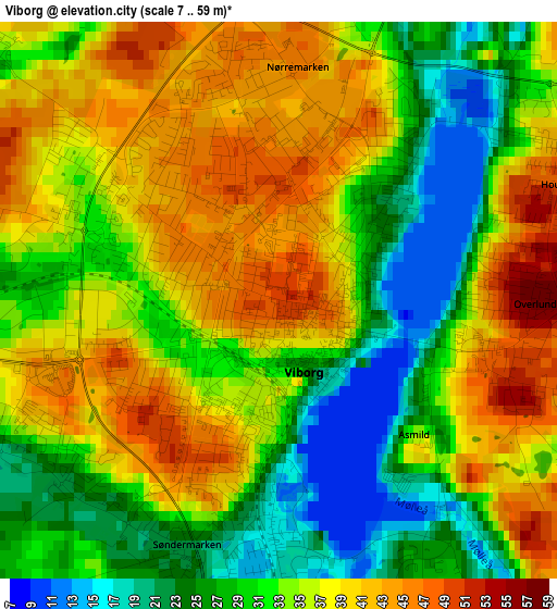
Below is the Elevation map of Viborg, which displays elevation range with different colors. Scale of the first map is from 7 to 59 m (23 to 194 ft) with average elevation of 33.7 meters (=111 ft) [note 1]
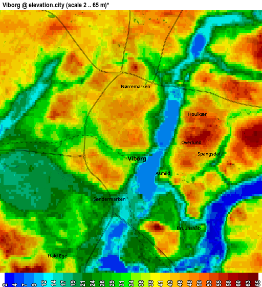
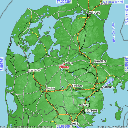
These maps also provides idea of topography and contour of this city, they are displayed at different zoom levels. More info about maps, scale and edge coordinates you can find below images.
| \ | Map #1 | Map #2 | Topo.Map |
| Scale [m] | 7..59 m | 2..65 m | × |
| Scale [ft] | 23..194 ft | 7..213 ft | × |
| Average | 33.7 m = 111 ft | 33.2 m = 109 ft | × |
| Width | 5.4 km = 3.4 mi | 10.8 km = 6.7 mi | 172.8 km = 107.4 mi |
| Height | 5.4 km = 3.4 mi | 10.8 km = 6.7 mi | 172.8 km = 107.4 mi |
| ↑Max Latitude | 56.477467° | 56.501729° | 57.22239° |
| Latitude at center | 56.45319° | 56.45319° | 56.45319° |
| ↓Min Latitude | 56.428897° | 56.404589° | 55.66809° |
| ← Min Longitude | 9.358065° | 9.314119° | 7.99576° |
| Longitude center | 9.40201° | 9.40201° | 9.40201° |
| →Max Longitude | 9.445955° | 9.489901° | 10.80826° |
Nearby cities:
Cities around Viborg sort by population:
• Silkeborg elevation 19 m
32.7 km,  164°
164°
• Skive 24 m
26.3 km,  298°
298°
• Hobro 12 m
31.8 km,  48°
48°
• Bjerringbro 14 m
18 km,  117°
117°
• Kjellerup 63 m
18.7 km,  173°
173°
• Farsø 32 m
35.7 km,  353°
353°
• Ålestrup 26 m
27.4 km,  11°
11°
• Langå 16 m
31.1 km,  102°
102°
• Stoholm 23 m
16.1 km,  282°
282°
• Karup 39 m
21.7 km,  221°
221°
• Bording Kirkeby 87 m
33.1 km,  197°
197°
• Ulstrup 12 m
25.1 km,  106°
106°
Multilingual:
 En español:
Viborg elevación 50 m.
 En France:
Viborg élévation 50 m.


Sources and notes:
- [note 1] Map square and city borders are not equal. Map elevation data is calculated only from area inside that square.
- [src 1] Elevation data from geonames database provided with same terms of usage.
- [src 2] The elevation map of Viborg is generated using elevation data from NASA's 3 arcsec (90m) resolution SRTM data.
- [src 3] Base (background) map © OpenStreetMap contributors tiles are generated by Geofabrik and OpenTopoMap.
Copyright & License:
This Viborg Elevation Map is licensed under CC BY-SA. You may reuse any part from this page, if you give a proper credit by linking to this URL:
 More info on terms of use page.