Hansaviertel elevation
Hansaviertel (Berlin), Germany elevation is 38 meters and Hansaviertel elevation in feet is 125 ft above sea level [src 1]. Hansaviertel is a section of populated place (feature code) with elevation that is 220 meters (722 ft) smaller than average city elevation in Germany.
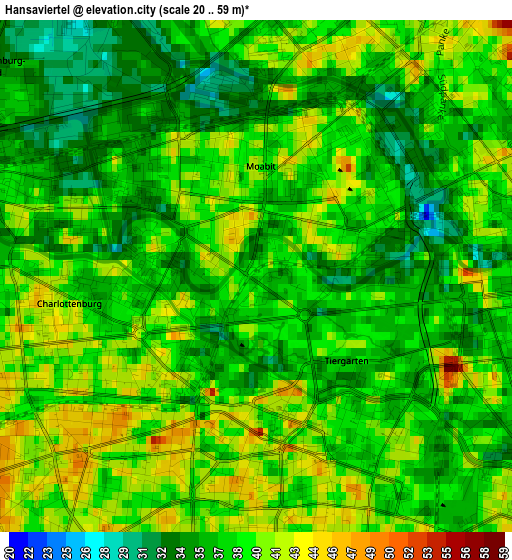
Below is the Elevation map of Hansaviertel, which displays elevation range with different colors. Scale of the first map is from 20 to 59 m (66 to 194 ft) with average elevation of 37.8 meters (=124 ft) [note 1]
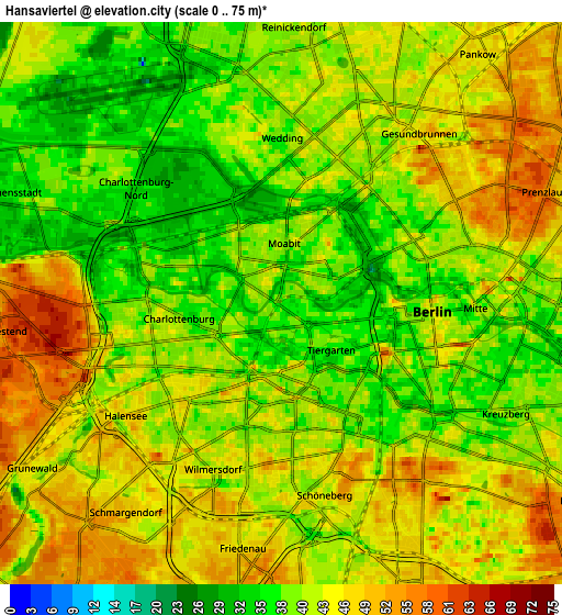
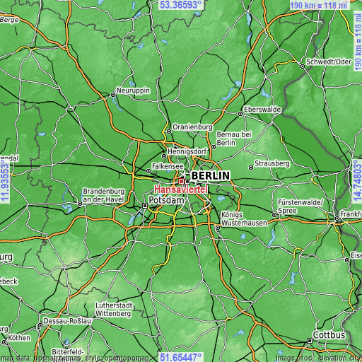
These maps also provides idea of topography and contour of this city, they are displayed at different zoom levels. More info about maps, scale and edge coordinates you can find below images.
| \ | Map #1 | Map #2 | Topo.Map |
| Scale [m] | 20..59 m | 0..75 m | × |
| Scale [ft] | 66..194 ft | 0..246 ft | × |
| Average | 37.8 m = 124 ft | 42.5 m = 139 ft | × |
| Width | 5.95 km = 3.7 mi | 11.89 km = 7.4 mi | 190.3 km = 118.2 mi |
| Height | 5.95 km = 3.7 mi | 11.89 km = 7.4 mi | 190.3 km = 118.2 mi |
| ↑Max Latitude | 52.545263° | 52.571979° | 53.36593° |
| Latitude at center | 52.51853° | 52.51853° | 52.51853° |
| ↓Min Latitude | 52.491781° | 52.465016° | 51.65447° |
| ← Min Longitude | 13.297835° | 13.253889° | 11.93553° |
| Longitude center | 13.34178° | 13.34178° | 13.34178° |
| →Max Longitude | 13.385725° | 13.429671° | 14.74803° |
Nearby cities:
Cities around Hansaviertel sort by population:
• Berlin elevation 43 m
4.7 km,  82°
82°
• Kreuzberg 40 m
4.7 km,  116°
116°
• Charlottenburg 46 m
4 km,  267°
267°
• Wilmersdorf 39 m
4.3 km,  203°
203°
• Gesundbrunnen 53 m
4.9 km,  43°
43°
• Mitte 48 m
4.3 km,  87°
87°
• Wedding 41 m
3.3 km,  16°
16°
• Moabit 40 m
0.9 km,  347°
347°
• Westend 60 m
4.4 km, 267°
• Charlottenburg-Nord 28 m
3.5 km,  292°
292°
• Halensee 49 m
4.4 km,  224°
224°
• Tiergarten 36 m
1.7 km,  97°
97°
Multilingual:
 En español:
Hansaviertel elevación 38 m.
 En France:
Berlin-Hansaviertel élévation 38 m.
 Auf Deutsch:
Berlin-Hansaviertel höhe über dem Meeresspiegel ist 38 m.

Sources and notes:
- [note 1] Map square and city borders are not equal. Map elevation data is calculated only from area inside that square.
- [src 1] Elevation data from geonames database provided with same terms of usage.
- [src 2] The elevation map of Hansaviertel is generated using elevation data from NASA's 3 arcsec (90m) resolution SRTM data.
- [src 3] Base (background) map © OpenStreetMap contributors tiles are generated by Geofabrik and OpenTopoMap.
Copyright & License:
This Hansaviertel Elevation Map is licensed under CC BY-SA. You may reuse any part from this page, if you give a proper credit by linking to this URL:
 More info on terms of use page.