Adendorf elevation
Adendorf (Lower Saxony), Germany elevation is 28 meters and Adendorf elevation in feet is 92 ft above sea level [src 1]. Adendorf is a seat of a fourth-order administrative division (feature code) with elevation that is 230 meters (755 ft) smaller than average city elevation in Germany.
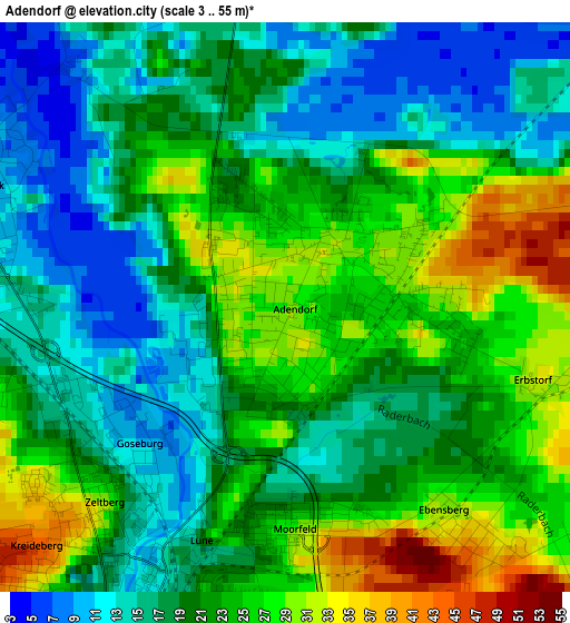
Below is the Elevation map of Adendorf, which displays elevation range with different colors. Scale of the first map is from 3 to 55 m (10 to 180 ft) with average elevation of 20.8 meters (=68 ft) [note 1]
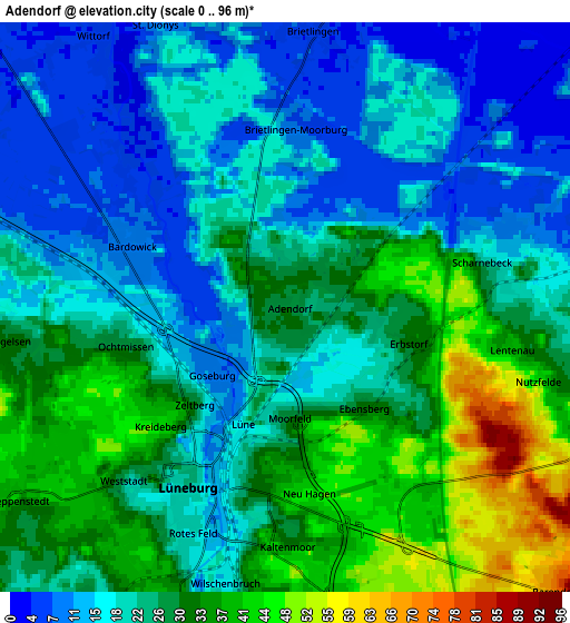
These maps also provides idea of topography and contour of this city, they are displayed at different zoom levels. More info about maps, scale and edge coordinates you can find below images.
| \ | Map #1 | Map #2 | Topo.Map |
| Scale [m] | 3..55 m | 0..96 m | × |
| Scale [ft] | 10..180 ft | 0..315 ft | × |
| Average | 20.8 m = 68 ft | 24.5 m = 80 ft | × |
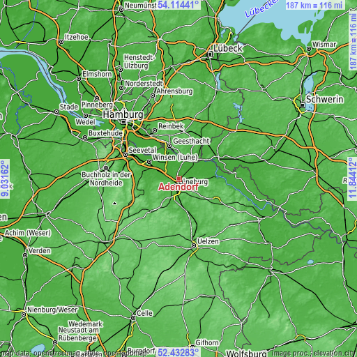
| Width | 5.84 km = 3.6 mi | 11.69 km = 7.3 mi | 187 km = 116.2 mi |
| Height | 5.84 km = 3.6 mi | 11.69 km = 7.3 mi | 187 km = 116.2 mi |
| ↑Max Latitude | 53.308156° | 53.334406° | 54.11441° |
| Latitude at center | 53.28189° | 53.28189° | 53.28189° |
| ↓Min Latitude | 53.255608° | 53.22931° | 52.43283° |
| ← Min Longitude | 10.393925° | 10.349979° | 9.03162° |
| Longitude center | 10.43787° | 10.43787° | 10.43787° |
| →Max Longitude | 10.481815° | 10.525761° | 11.84412° |
Nearby cities:
Cities around Adendorf sort by population:
• Lüneburg elevation 12 m
3.8 km,  204°
204°
• Reppenstedt 42 m
6.8 km,  238°
238°
• Bardowick 10 m
3.6 km,  291°
291°
• Scharnebeck 16 m
4.4 km,  74°
74°
• Brietlingen 5 m
5.8 km,  8°
8°
• Vögelsen 33 m
5.7 km,  261°
261°
• Barendorf 75 m
8.1 km,  136°
136°
• Rullstorf 22 m
6.1 km,  85°
85°
• Barum 2 m
8 km,  341°
341°
• Wendisch Evern 48 m
7.5 km,  165°
165°
• Wittorf 4 m
6.8 km,  327°
327°
• Echem 3 m
8.5 km,  47°
47°
Multilingual:
 En español:
Adendorf elevación 28 m.
 En France:
Adendorf élévation 28 m.


Sources and notes:
- [note 1] Map square and city borders are not equal. Map elevation data is calculated only from area inside that square.
- [src 1] Elevation data from geonames database provided with same terms of usage.
- [src 2] The elevation map of Adendorf is generated using elevation data from NASA's 3 arcsec (90m) resolution SRTM data.
- [src 3] Base (background) map © OpenStreetMap contributors tiles are generated by Geofabrik and OpenTopoMap.
Copyright & License:
This Adendorf Elevation Map is licensed under CC BY-SA. You may reuse any part from this page, if you give a proper credit by linking to this URL:
 More info on terms of use page.