Affing elevation
Affing (Bavaria, Swabia), Germany elevation is 476 meters and Affing elevation in feet is 1562 ft above sea level [src 1]. Affing is a seat of a fourth-order administrative division (feature code) with elevation that is 218 meters (715 ft) bigger than average city elevation in Germany.
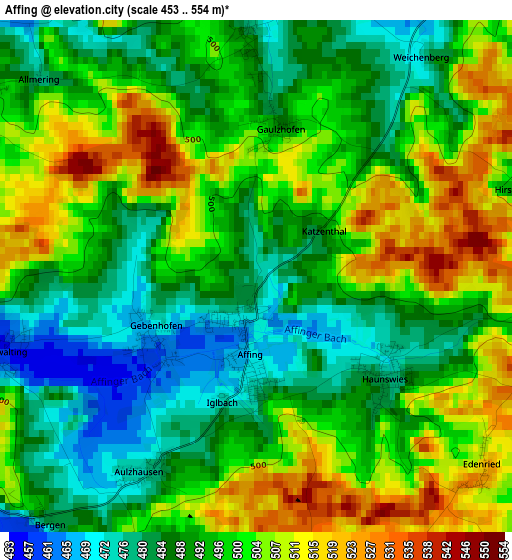
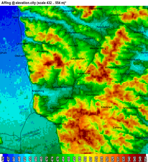
Below is the Elevation map of Affing, which displays elevation range with different colors. Scale of the first map is from 453 to 554 m (1486 to 1818 ft) with average elevation of 495.7 meters (=1626 ft) [note 1]
These maps also provides idea of topography and contour of this city, they are displayed at different zoom levels. More info about maps, scale and edge coordinates you can find below images.
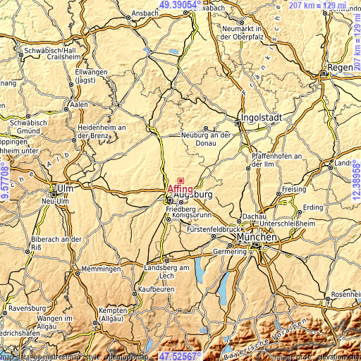
| \ | Map #1 | Map #2 | Topo.Map |
| Scale [m] | 453..554 m | 432..554 m | × |
| Scale [ft] | 1486..1818 ft | 1417..1818 ft | × |
| Average | 495.7 m = 1626 ft | 484.2 m = 1589 ft | × |
| Width | 6.48 km = 4 mi | 12.96 km = 8.1 mi | 207.4 km = 128.9 mi |
| Height | 6.48 km = 4 mi | 12.96 km = 8.1 mi | 207.3 km = 128.8 mi |
| ↑Max Latitude | 48.4958° | 48.524913° | 49.39054° |
| Latitude at center | 48.46667° | 48.46667° | 48.46667° |
| ↓Min Latitude | 48.437523° | 48.40836° | 47.52567° |
| ← Min Longitude | 10.939385° | 10.895439° | 9.57708° |
| Longitude center | 10.98333° | 10.98333° | 10.98333° |
| →Max Longitude | 11.027275° | 11.071221° | 12.38958° |
Nearby cities:
Cities around Affing sort by population:
• Friedberg elevation 517 m
12.2 km,  179°
179°
• Aichach 453 m
11.2 km,  95°
95°
• Gersthofen 473 m
9.4 km,  240°
240°
• Langweid 449 m
10 km,  285°
285°
• Dasing 480 m
10.2 km,  152°
152°
• Aindling 457 m
5.7 km,  336°
336°
• Inchenhofen 461 m
11 km,  62°
62°
• Rehling 502 m
4.1 km,  296°
296°
• Hollenbach 454 m
6.4 km,  73°
73°
• Obergriesbach 481 m
7.9 km,  127°
127°
• Petersdorf 485 m
6.7 km,  33°
33°
• Todtenweis 448 m
6.9 km,  324°
324°
Multilingual:
 En español:
Affing elevación 476 m.
 En France:
Affing élévation 476 m.


Sources and notes:
- [note 1] Map square and city borders are not equal. Map elevation data is calculated only from area inside that square.
- [src 1] Elevation data from geonames database provided with same terms of usage.
- [src 2] The elevation map of Affing is generated using elevation data from NASA's 3 arcsec (90m) resolution SRTM data.
- [src 3] Base (background) map © OpenStreetMap contributors tiles are generated by Geofabrik and OpenTopoMap.
Copyright & License:
This Affing Elevation Map is licensed under CC BY-SA. You may reuse any part from this page, if you give a proper credit by linking to this URL:
 More info on terms of use page.