Alheim elevation
Alheim (Hesse, Regierungsbezirk Kassel), Germany elevation is 179 meters and Alheim elevation in feet is 587 ft above sea level [src 1]. Alheim is a seat of a fourth-order administrative division (feature code) with elevation that is 79 meters (259 ft) smaller than average city elevation in Germany.
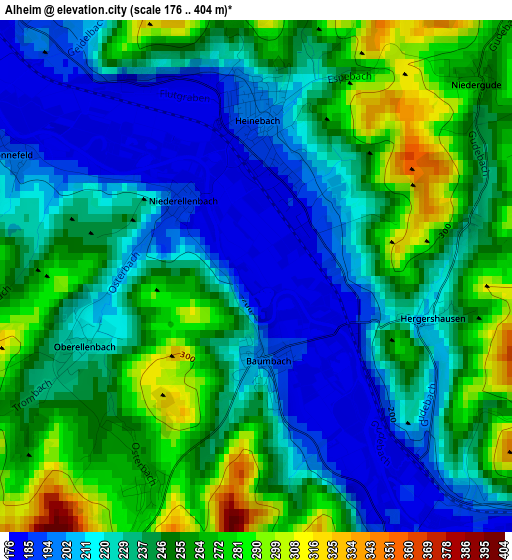
Below is the Elevation map of Alheim, which displays elevation range with different colors. Scale of the first map is from 176 to 404 m (577 to 1325 ft) with average elevation of 238.5 meters (=782 ft) [note 1]
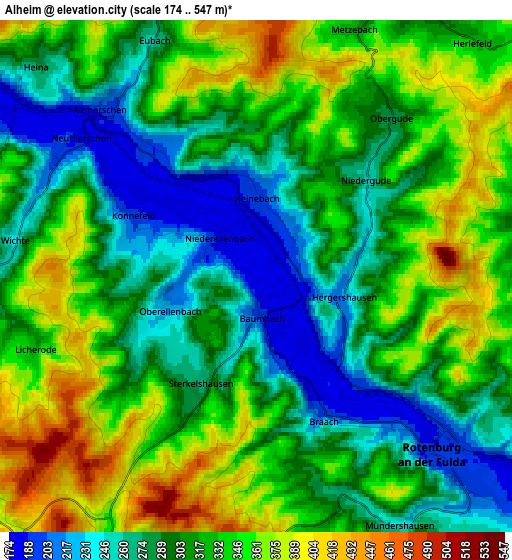
These maps also provides idea of topography and contour of this city, they are displayed at different zoom levels. More info about maps, scale and edge coordinates you can find below images.
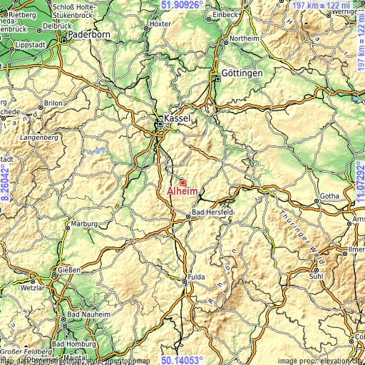
| \ | Map #1 | Map #2 | Topo.Map |
| Scale [m] | 176..404 m | 174..547 m | × |
| Scale [ft] | 577..1325 ft | 571..1795 ft | × |
| Average | 238.5 m = 782 ft | 314.2 m = 1031 ft | × |
| Width | 6.15 km = 3.8 mi | 12.29 km = 7.6 mi | 196.7 km = 122.2 mi |
| Height | 6.15 km = 3.8 mi | 12.29 km = 7.6 mi | 196.6 km = 122.2 mi |
| ↑Max Latitude | 51.060958° | 51.088569° | 51.90926° |
| Latitude at center | 51.03333° | 51.03333° | 51.03333° |
| ↓Min Latitude | 51.005686° | 50.978025° | 50.14053° |
| ← Min Longitude | 9.622725° | 9.578779° | 8.26042° |
| Longitude center | 9.66667° | 9.66667° | 9.66667° |
| →Max Longitude | 9.710615° | 9.754561° | 11.07292° |
Nearby cities:
Cities around Alheim sort by population:
• Bad Hersfeld elevation 209 m
18.2 km,  170°
170°
• Homberg 233 m
18.5 km,  268°
268°
• Bebra 200 m
11.1 km,  125°
125°
• Rotenburg an der Fulda 188 m
6 km, 134°
• Melsungen 179 m
13.4 km,  323°
323°
• Spangenberg 237 m
9.2 km,  358°
358°
• Malsfeld 186 m
11 km,  305°
305°
• Nentershausen 287 m
18.7 km,  95°
95°
• Körle 158 m
18.2 km, 324°
• Ronshausen 219 m
15.8 km, 125°
• Breitenbach 200 m
11.8 km,  136°
136°
• Cornberg 289 m
13.6 km,  86°
86°
Multilingual:
 En español:
Alheim elevación 179 m.
 En France:
Alheim élévation 179 m.


Sources and notes:
- [note 1] Map square and city borders are not equal. Map elevation data is calculated only from area inside that square.
- [src 1] Elevation data from geonames database provided with same terms of usage.
- [src 2] The elevation map of Alheim is generated using elevation data from NASA's 3 arcsec (90m) resolution SRTM data.
- [src 3] Base (background) map © OpenStreetMap contributors tiles are generated by Geofabrik and OpenTopoMap.
Copyright & License:
This Alheim Elevation Map is licensed under CC BY-SA. You may reuse any part from this page, if you give a proper credit by linking to this URL:
 More info on terms of use page.