Altdorf elevation
Altdorf (Baden-Württemberg, Regierungsbezirk Stuttgart), Germany elevation is 479 meters and Altdorf elevation in feet is 1572 ft above sea level [src 1]. Altdorf is a seat of a fourth-order administrative division (feature code) with elevation that is 221 meters (725 ft) bigger than average city elevation in Germany.
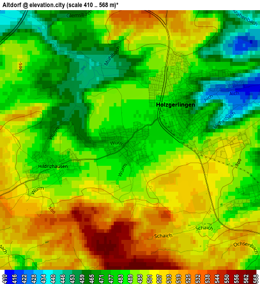
Below is the Elevation map of Altdorf, which displays elevation range with different colors. Scale of the first map is from 410 to 568 m (1345 to 1864 ft) with average elevation of 492.1 meters (=1615 ft) [note 1]
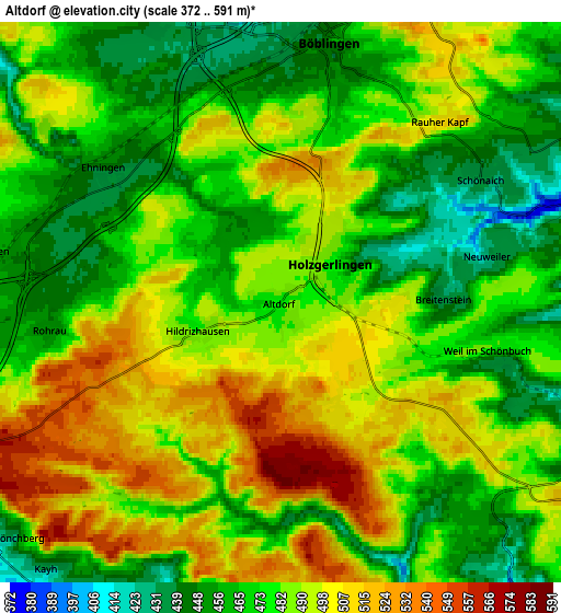
These maps also provides idea of topography and contour of this city, they are displayed at different zoom levels. More info about maps, scale and edge coordinates you can find below images.
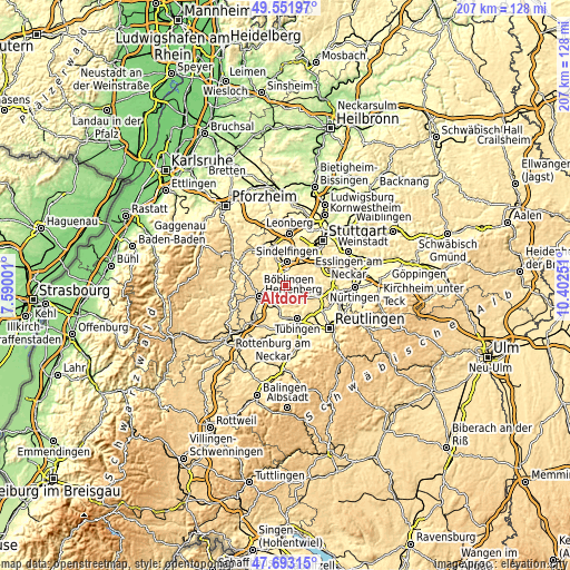
| \ | Map #1 | Map #2 | Topo.Map |
| Scale [m] | 410..568 m | 372..591 m | × |
| Scale [ft] | 1345..1864 ft | 1220..1939 ft | × |
| Average | 492.1 m = 1615 ft | 481.8 m = 1581 ft | × |
| Width | 6.46 km = 4 mi | 12.92 km = 8 mi | 206.7 km = 128.4 mi |
| Height | 6.46 km = 4 mi | 12.92 km = 8 mi | 206.7 km = 128.4 mi |
| ↑Max Latitude | 48.660155° | 48.689174° | 49.55197° |
| Latitude at center | 48.63112° | 48.63112° | 48.63112° |
| ↓Min Latitude | 48.602068° | 48.572999° | 47.69315° |
| ← Min Longitude | 8.952315° | 8.908369° | 7.59001° |
| Longitude center | 8.99626° | 8.99626° | 8.99626° |
| →Max Longitude | 9.040205° | 9.084151° | 10.40251° |
Nearby cities:
Cities around Altdorf sort by population:
• Sindelfingen elevation 468 m
7.8 km,  11°
11°
• Böblingen 442 m
5.8 km, 11°
• Gärtringen 471 m
7.1 km,  279°
279°
• Holzgerlingen 478 m
1.5 km,  49°
49°
• Schönaich 436 m
5.6 km,  56°
56°
• Weil im Schönbuch 481 m
5 km,  100°
100°
• Aidlingen 428 m
9.1 km,  305°
305°
• Ehningen 447 m
5.1 km, 307°
• Steinenbronn 439 m
9.7 km,  65°
65°
• Dettenhausen 395 m
8.1 km,  108°
108°
• Nufringen 458 m
7.9 km,  263°
263°
• Hildrizhausen 483 m
2.3 km,  250°
250°
Multilingual:
 En español:
Altdorf elevación 479 m.
 En France:
Altdorf élévation 479 m.


Sources and notes:
- [note 1] Map square and city borders are not equal. Map elevation data is calculated only from area inside that square.
- [src 1] Elevation data from geonames database provided with same terms of usage.
- [src 2] The elevation map of Altdorf is generated using elevation data from NASA's 3 arcsec (90m) resolution SRTM data.
- [src 3] Base (background) map © OpenStreetMap contributors tiles are generated by Geofabrik and OpenTopoMap.
Copyright & License:
This Altdorf Elevation Map is licensed under CC BY-SA. You may reuse any part from this page, if you give a proper credit by linking to this URL:
 More info on terms of use page.