Altensteig elevation
Altensteig (Baden-Württemberg, Karlsruhe Region), Germany elevation is 505 meters and Altensteig elevation in feet is 1657 ft above sea level [src 1]. Altensteig is a populated place (feature code) with elevation that is 247 meters (810 ft) bigger than average city elevation in Germany.
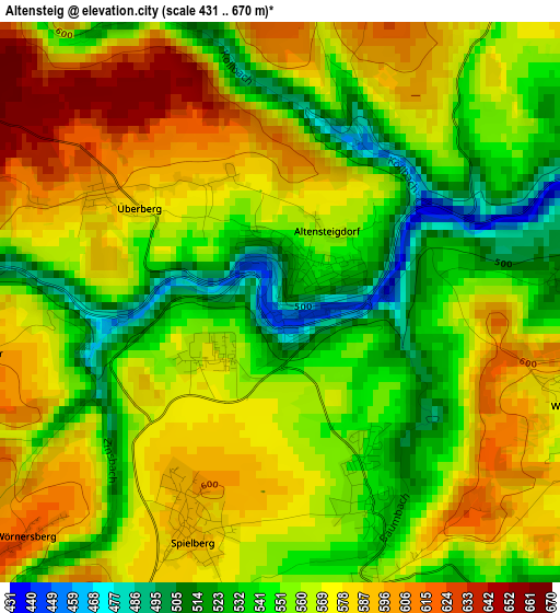
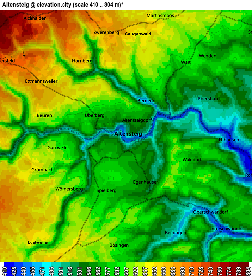
Below is the Elevation map of Altensteig, which displays elevation range with different colors. Scale of the first map is from 431 to 670 m (1414 to 2198 ft) with average elevation of 562.3 meters (=1845 ft) [note 1]
These maps also provides idea of topography and contour of this city, they are displayed at different zoom levels. More info about maps, scale and edge coordinates you can find below images.
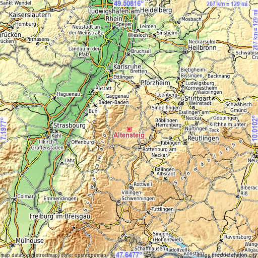
| \ | Map #1 | Map #2 | Topo.Map |
| Scale [m] | 431..670 m | 410..804 m | × |
| Scale [ft] | 1414..2198 ft | 1345..2638 ft | × |
| Average | 562.3 m = 1845 ft | 594.7 m = 1951 ft | × |
| Width | 6.46 km = 4 mi | 12.93 km = 8 mi | 206.9 km = 128.6 mi |
| Height | 6.46 km = 4 mi | 12.93 km = 8 mi | 206.8 km = 128.5 mi |
| ↑Max Latitude | 48.615551° | 48.644595° | 49.50816° |
| Latitude at center | 48.58649° | 48.58649° | 48.58649° |
| ↓Min Latitude | 48.557412° | 48.528318° | 47.6477° |
| ← Min Longitude | 8.560005° | 8.516059° | 7.1977° |
| Longitude center | 8.60395° | 8.60395° | 8.60395° |
| →Max Longitude | 8.647895° | 8.691841° | 10.0102° |
Nearby cities:
Cities around Altensteig sort by population:
• Nagold elevation 399 m
9.7 km,  114°
114°
• Wildberg 401 m
11.2 km,  68°
68°
• Pfalzgrafenweiler 634 m
7.2 km,  202°
202°
• Haiterbach 562 m
7.9 km,  157°
157°
• Neubulach 584 m
10.7 km,  39°
39°
• Ebhausen 462 m
5.8 km,  93°
93°
• Oberjettingen 575 m
12.8 km,  95°
95°
• Neuweiler 670 m
8.9 km,  358°
358°
• Simmersfeld 701 m
7.2 km,  297°
297°
• Egenhausen 549 m
2.4 km, 156°
• Rohrdorf 439 m
7.4 km, 107°
• Enzklösterle 597 m
13.2 km,  312°
312°
Multilingual:
 En español:
Altensteig elevación 505 m.
 En France:
Altensteig élévation 505 m.
 Auf Deutsch:
Altensteig höhe über dem Meeresspiegel ist 505 m.

Sources and notes:
- [note 1] Map square and city borders are not equal. Map elevation data is calculated only from area inside that square.
- [src 1] Elevation data from geonames database provided with same terms of usage.
- [src 2] The elevation map of Altensteig is generated using elevation data from NASA's 3 arcsec (90m) resolution SRTM data.
- [src 3] Base (background) map © OpenStreetMap contributors tiles are generated by Geofabrik and OpenTopoMap.
Copyright & License:
This Altensteig Elevation Map is licensed under CC BY-SA. You may reuse any part from this page, if you give a proper credit by linking to this URL:
 More info on terms of use page.