Arnstorf elevation
Arnstorf (Bavaria, Lower Bavaria), Germany elevation is 390 meters and Arnstorf elevation in feet is 1280 ft above sea level [src 1]. Arnstorf is a populated place (feature code) with elevation that is 132 meters (433 ft) bigger than average city elevation in Germany.
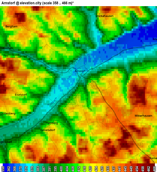
Below is the Elevation map of Arnstorf, which displays elevation range with different colors. Scale of the first map is from 358 to 466 m (1175 to 1529 ft) with average elevation of 413.3 meters (=1356 ft) [note 1]
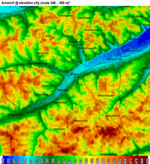
These maps also provides idea of topography and contour of this city, they are displayed at different zoom levels. More info about maps, scale and edge coordinates you can find below images.
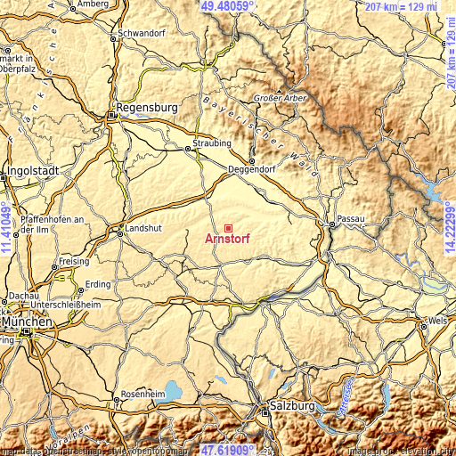
| \ | Map #1 | Map #2 | Topo.Map |
| Scale [m] | 358..466 m | 346..490 m | × |
| Scale [ft] | 1175..1529 ft | 1135..1608 ft | × |
| Average | 413.3 m = 1356 ft | 423 m = 1388 ft | × |
| Width | 6.47 km = 4 mi | 12.94 km = 8 mi | 207 km = 128.6 mi |
| Height | 6.47 km = 4 mi | 12.94 km = 8 mi | 207 km = 128.6 mi |
| ↑Max Latitude | 48.587477° | 48.616538° | 49.48059° |
| Latitude at center | 48.5584° | 48.5584° | 48.5584° |
| ↓Min Latitude | 48.529306° | 48.500196° | 47.61909° |
| ← Min Longitude | 12.772795° | 12.728849° | 11.41049° |
| Longitude center | 12.81674° | 12.81674° | 12.81674° |
| →Max Longitude | 12.860685° | 12.904631° | 14.22299° |
Nearby cities:
Cities around Arnstorf sort by population:
• Reisbach elevation 406 m
13.9 km,  275°
275°
• Ruhstorf 444 m
10.1 km,  258°
258°
• Eichendorf 358 m
8.7 km,  19°
19°
• Falkenberg 478 m
12.5 km,  210°
210°
• Simbach 445 m
5.8 km, 278°
• Dietersburg 416 m
10.8 km,  132°
132°
• Rossbach 400 m
10.2 km,  74°
74°
• Johanniskirchen 365 m
10.2 km,  105°
105°
• Haibach 396 m
12.8 km,  101°
101°
• Schönau 440 m
8.7 km,  163°
163°
• Wallerfing 359 m
14.7 km, 18°
• Malgersdorf 397 m
5.6 km,  240°
240°
Multilingual:
 En español:
Arnstorf elevación 390 m.
 En France:
Arnstorf élévation 390 m.
 Auf Deutsch:
Arnstorf höhe über dem Meeresspiegel ist 390 m.

Sources and notes:
- [note 1] Map square and city borders are not equal. Map elevation data is calculated only from area inside that square.
- [src 1] Elevation data from geonames database provided with same terms of usage.
- [src 2] The elevation map of Arnstorf is generated using elevation data from NASA's 3 arcsec (90m) resolution SRTM data.
- [src 3] Base (background) map © OpenStreetMap contributors tiles are generated by Geofabrik and OpenTopoMap.
Copyright & License:
This Arnstorf Elevation Map is licensed under CC BY-SA. You may reuse any part from this page, if you give a proper credit by linking to this URL:
 More info on terms of use page.