Bad Kösen elevation
Bad Kösen (Saxony-Anhalt), Germany elevation is 118 meters and Bad Kösen elevation in feet is 387 ft above sea level [src 1]. Bad Kösen is a populated place (feature code) with elevation that is 140 meters (459 ft) smaller than average city elevation in Germany.
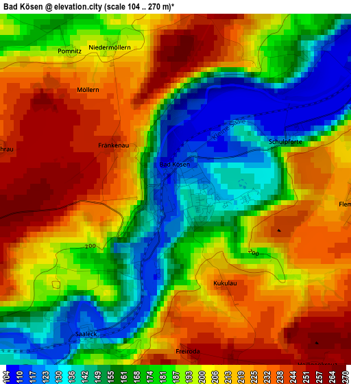
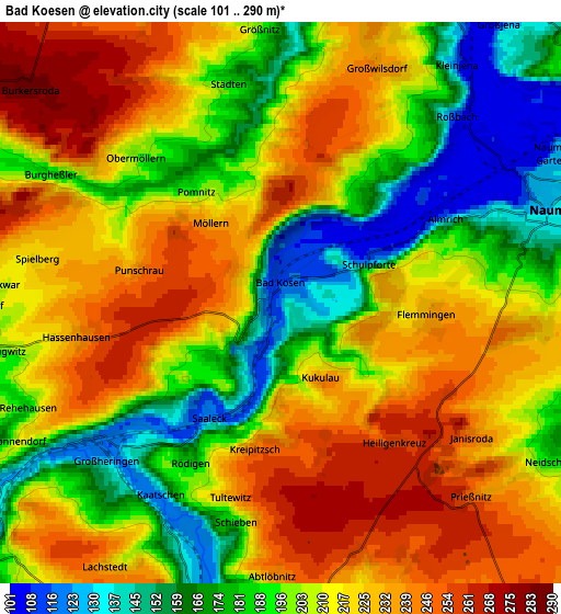
Below is the Elevation map of Bad Kösen, which displays elevation range with different colors. Scale of the first map is from 104 to 270 m (341 to 886 ft) with average elevation of 193.3 meters (=634 ft) [note 1]
These maps also provides idea of topography and contour of this city, they are displayed at different zoom levels. More info about maps, scale and edge coordinates you can find below images.
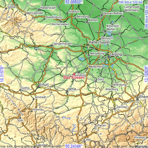
| \ | Map #1 | Map #2 | Topo.Map |
| Scale [m] | 104..270 m | 101..290 m | × |
| Scale [ft] | 341..886 ft | 331..951 ft | × |
| Average | 193.3 m = 634 ft | 207.7 m = 681 ft | × |
| Width | 6.13 km = 3.8 mi | 12.26 km = 7.6 mi | 196.2 km = 121.9 mi |
| Height | 6.13 km = 3.8 mi | 12.26 km = 7.6 mi | 196.2 km = 121.9 mi |
| ↑Max Latitude | 51.161877° | 51.189428° | 52.00832° |
| Latitude at center | 51.13431° | 51.13431° | 51.13431° |
| ↓Min Latitude | 51.106726° | 51.079126° | 50.24344° |
| ← Min Longitude | 11.678085° | 11.634139° | 10.31578° |
| Longitude center | 11.72203° | 11.72203° | 11.72203° |
| →Max Longitude | 11.765975° | 11.809921° | 13.12828° |
Nearby cities:
Cities around Bad Kösen sort by population:
• Naumburg elevation 134 m
6.4 km,  74°
74°
• Freyburg 117 m
9.4 km,  19°
19°
• Bad Sulza 134 m
8.4 km,  233°
233°
• Camburg 127 m
8.8 km,  185°
185°
• Schkölen 211 m
12.4 km,  146°
146°
• Laucha 111 m
10.4 km,  343°
343°
• Bad Bibra 154 m
12.6 km,  310°
310°
• Eckartsberga 243 m
11.3 km,  264°
264°
• Leißling 103 m
14.1 km, 67°
• Frauenprießnitz 318 m
13.1 km,  176°
176°
• Goseck 155 m
12.5 km,  54°
54°
• Schönburg 103 m
10.7 km, 70°
Multilingual:
 En español:
Bad Kösen elevación 118 m.
 En France:
Bad Kösen élévation 118 m.
 Auf Deutsch:
Bad Kösen höhe über dem Meeresspiegel ist 118 m.

Sources and notes:
- [note 1] Map square and city borders are not equal. Map elevation data is calculated only from area inside that square.
- [src 1] Elevation data from geonames database provided with same terms of usage.
- [src 2] The elevation map of Bad Kösen is generated using elevation data from NASA's 3 arcsec (90m) resolution SRTM data.
- [src 3] Base (background) map © OpenStreetMap contributors tiles are generated by Geofabrik and OpenTopoMap.
Copyright & License:
This Bad Kösen Elevation Map is licensed under CC BY-SA. You may reuse any part from this page, if you give a proper credit by linking to this URL:
 More info on terms of use page.