Bad Windsheim elevation
Bad Windsheim (Bavaria, Regierungsbezirk Mittelfranken), Germany elevation is 314 meters and Bad Windsheim elevation in feet is 1030 ft above sea level [src 1]. Bad Windsheim is a populated place (feature code) with elevation that is 56 meters (184 ft) bigger than average city elevation in Germany.
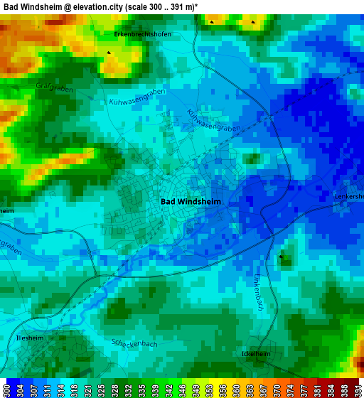
Below is the Elevation map of Bad Windsheim, which displays elevation range with different colors. Scale of the first map is from 300 to 391 m (984 to 1283 ft) with average elevation of 320.9 meters (=1053 ft) [note 1]
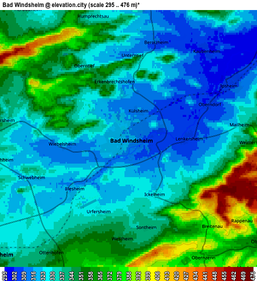
These maps also provides idea of topography and contour of this city, they are displayed at different zoom levels. More info about maps, scale and edge coordinates you can find below images.
| \ | Map #1 | Map #2 | Topo.Map |
| Scale [m] | 300..391 m | 295..476 m | × |
| Scale [ft] | 984..1283 ft | 968..1562 ft | × |
| Average | 320.9 m = 1053 ft | 340.2 m = 1116 ft | × |
| Width | 6.35 km = 3.9 mi | 12.69 km = 7.9 mi | 203.1 km = 126.2 mi |
| Height | 6.35 km = 3.9 mi | 12.69 km = 7.9 mi | 203.1 km = 126.2 mi |
| ↑Max Latitude | 49.53127° | 49.559784° | 50.40747° |
| Latitude at center | 49.50274° | 49.50274° | 49.50274° |
| ↓Min Latitude | 49.474193° | 49.44563° | 48.58097° |
| ← Min Longitude | 10.371445° | 10.327499° | 9.00914° |
| Longitude center | 10.41539° | 10.41539° | 10.41539° |
| →Max Longitude | 10.459335° | 10.503281° | 11.82164° |
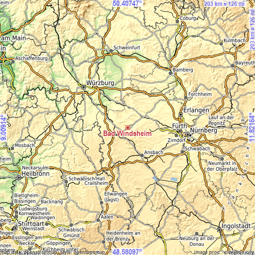
Nearby cities:
Cities around Bad Windsheim sort by population:
• Uffenheim elevation 327 m
14 km,  289°
289°
• Burgbernheim 341 m
8.8 km,  228°
228°
• Obernzenn 373 m
6.8 km,  146°
146°
• Flachslanden 465 m
13.6 km, 148°
• Sugenheim 311 m
11.2 km,  7°
7°
• Ipsheim 307 m
5.5 km,  60°
60°
• Dietersheim 301 m
10.8 km, 56°
• Oberdachstetten 483 m
9.7 km,  172°
172°
• Marktbergel 364 m
7.8 km,  208°
208°
• Trautskirchen 350 m
13.8 km,  111°
111°
• Markt Nordheim 330 m
10.7 km,  336°
336°
• Ergersheim 336 m
6.1 km,  284°
284°
Multilingual:
 En español:
Bad Windsheim elevación 314 m.
 En France:
Bad Windsheim élévation 314 m.
 Auf Deutsch:
Bad Windsheim höhe über dem Meeresspiegel ist 314 m.

Sources and notes:
- [note 1] Map square and city borders are not equal. Map elevation data is calculated only from area inside that square.
- [src 1] Elevation data from geonames database provided with same terms of usage.
- [src 2] The elevation map of Bad Windsheim is generated using elevation data from NASA's 3 arcsec (90m) resolution SRTM data.
- [src 3] Base (background) map © OpenStreetMap contributors tiles are generated by Geofabrik and OpenTopoMap.
Copyright & License:
This Bad Windsheim Elevation Map is licensed under CC BY-SA. You may reuse any part from this page, if you give a proper credit by linking to this URL:
 More info on terms of use page.