Bergtheim elevation
Bergtheim (Bavaria, Regierungsbezirk Unterfranken), Germany elevation is 281 meters and Bergtheim elevation in feet is 922 ft above sea level [src 1]. Bergtheim is a seat of a fourth-order administrative division (feature code) with elevation that is 23 meters (75 ft) bigger than average city elevation in Germany.
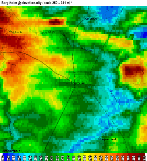
Below is the Elevation map of Bergtheim, which displays elevation range with different colors. Scale of the first map is from 250 to 311 m (820 to 1020 ft) with average elevation of 276.2 meters (=906 ft) [note 1]
These maps also provides idea of topography and contour of this city, they are displayed at different zoom levels. More info about maps, scale and edge coordinates you can find below images.
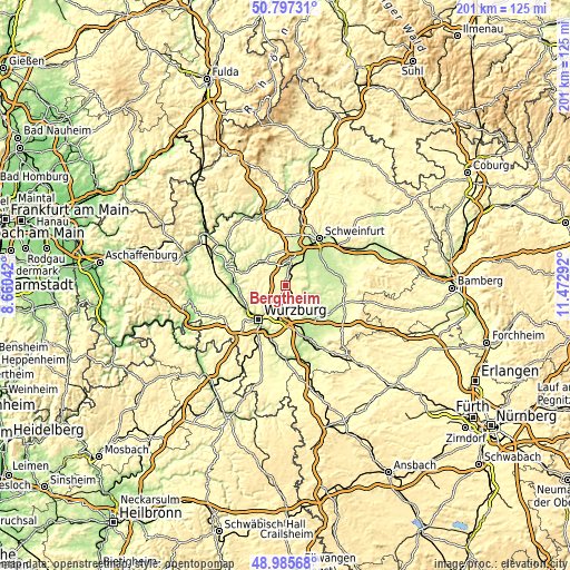
| \ | Map #1 | Topo.Map |
| Scale [m] | 250..311 m | × |
| Scale [ft] | 820..1020 ft | × |
| Average | 276.2 m = 906 ft | × |
| Width | 6.29 km = 3.9 mi | 201.4 km = 125.1 mi |
| Height | 6.29 km = 3.9 mi | 201.4 km = 125.1 mi |
| ↑Max Latitude | 49.928298° | 50.79731° |
| Latitude at center | 49.9° | 49.9° |
| ↓Min Latitude | 49.871685° | 48.98568° |
| ← Min Longitude | 10.022725° | 8.66042° |
| Longitude center | 10.06667° | 10.06667° |
| →Max Longitude | 10.110615° | 11.47292° |
Nearby cities:
Cities around Bergtheim sort by population:
• Werneck elevation 220 m
9.4 km,  14°
14°
• Arnstein 221 m
11.1 km,  321°
321°
• Rimpar 234 m
9.2 km,  238°
238°
• Estenfeld 246 m
9 km,  208°
208°
• Kürnach 266 m
6.1 km,  203°
203°
• Waigolshausen 241 m
8.1 km,  28°
28°
• Unterpleichfeld 268 m
3.8 km, 205°
• Schwanfeld 239 m
5.7 km,  64°
64°
• Prosselsheim 269 m
5.9 km,  133°
133°
• Wipfeld 245 m
7.4 km,  75°
75°
• Oberpleichfeld 275 m
2.9 km,  150°
150°
• Nordheim 199 m
9.7 km,  118°
118°
Multilingual:
 En español:
Bergtheim elevación 281 m.
 En France:
Bergtheim élévation 281 m.
 Auf Deutsch:
Bergtheim höhe über dem Meeresspiegel ist 281 m.

Sources and notes:
- [note 1] Map square and city borders are not equal. Map elevation data is calculated only from area inside that square.
- [src 1] Elevation data from geonames database provided with same terms of usage.
- [src 2] The elevation map of Bergtheim is generated using elevation data from NASA's 3 arcsec (90m) resolution SRTM data.
- [src 3] Base (background) map © OpenStreetMap contributors tiles are generated by Geofabrik and OpenTopoMap.
Copyright & License:
This Bergtheim Elevation Map is licensed under CC BY-SA. You may reuse any part from this page, if you give a proper credit by linking to this URL:
 More info on terms of use page.