Buch am Buchrain elevation
Buch am Buchrain (Bavaria, Upper Bavaria), Germany elevation is 532 meters and Buch am Buchrain elevation in feet is 1745 ft above sea level [src 1]. Buch am Buchrain is a populated place (feature code) with elevation that is 274 meters (899 ft) bigger than average city elevation in Germany.
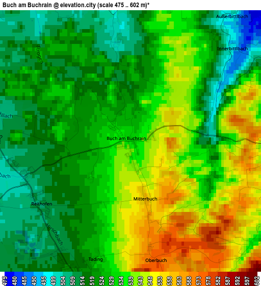
Below is the Elevation map of Buch am Buchrain, which displays elevation range with different colors. Scale of the first map is from 475 to 602 m (1558 to 1975 ft) with average elevation of 530.2 meters (=1740 ft) [note 1]
These maps also provides idea of topography and contour of this city, they are displayed at different zoom levels. More info about maps, scale and edge coordinates you can find below images.
| \ | Map #1 | Topo.Map |
| Scale [m] | 475..602 m | × |
| Scale [ft] | 1558..1975 ft | × |
| Average | 530.2 m = 1740 ft | × |
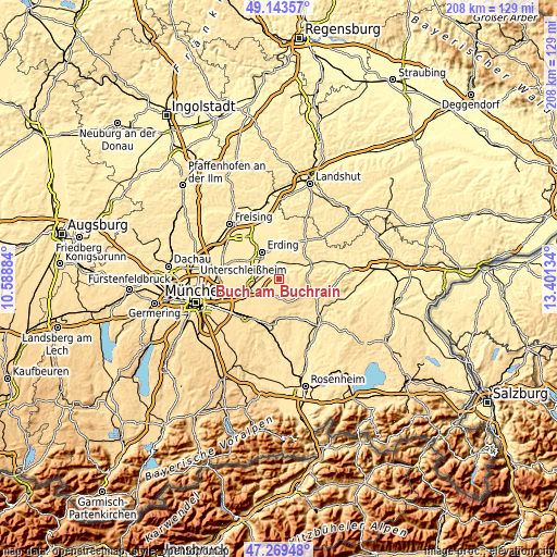
| Width | 6.51 km = 4 mi | 208.4 km = 129.5 mi |
| Height | 6.51 km = 4 mi | 208.4 km = 129.5 mi |
| ↑Max Latitude | 48.244374° | 49.14357° |
| Latitude at center | 48.2151° | 48.2151° |
| ↓Min Latitude | 48.185809° | 47.26948° |
| ← Min Longitude | 11.951145° | 10.58884° |
| Longitude center | 11.99509° | 11.99509° |
| →Max Longitude | 12.039035° | 13.40134° |
Nearby cities:
Cities around Buch am Buchrain sort by population:
• Markt Schwaben elevation 512 m
9.8 km,  253°
253°
• Isen 519 m
4.6 km,  94°
94°
• Wörth 493 m
7.7 km,  296°
296°
• Sankt Wolfgang 525 m
10.2 km, 89°
• Forstinning 515 m
8 km,  229°
229°
• Bockhorn 461 m
11.1 km,  356°
356°
• Hohenlinden 542 m
6.6 km,  180°
180°
• Lengdorf 468 m
6.2 km,  40°
40°
• Pastetten 505 m
4.2 km,  244°
244°
• Walpertskirchen 495 m
5 km,  343°
343°
• Maitenbeth 602 m
10.2 km,  134°
134°
• Ottenhofen 490 m
8.3 km,  271°
271°
Multilingual:
 En español:
Buch am Buchrain elevación 532 m.
 En France:
Buch am Buchrain élévation 532 m.
 Auf Deutsch:
Buch am Buchrain höhe über dem Meeresspiegel ist 532 m.

Sources and notes:
- [note 1] Map square and city borders are not equal. Map elevation data is calculated only from area inside that square.
- [src 1] Elevation data from geonames database provided with same terms of usage.
- [src 2] The elevation map of Buch am Buchrain is generated using elevation data from NASA's 3 arcsec (90m) resolution SRTM data.
- [src 3] Base (background) map © OpenStreetMap contributors tiles are generated by Geofabrik and OpenTopoMap.
Copyright & License:
This Buch am Buchrain Elevation Map is licensed under CC BY-SA. You may reuse any part from this page, if you give a proper credit by linking to this URL:
 More info on terms of use page.