Bünde elevation
Bünde (North Rhine-Westphalia, Regierungsbezirk Detmold), Germany elevation is 74 meters and Bünde elevation in feet is 243 ft above sea level [src 1]. Bünde is a populated place (feature code) with elevation that is 184 meters (604 ft) smaller than average city elevation in Germany.
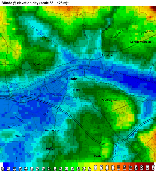
Below is the Elevation map of Bünde, which displays elevation range with different colors. Scale of the first map is from 55 to 128 m (180 to 420 ft) with average elevation of 75.9 meters (=249 ft) [note 1]
These maps also provides idea of topography and contour of this city, they are displayed at different zoom levels. More info about maps, scale and edge coordinates you can find below images.
| \ | Map #1 | Map #2 | Topo.Map |
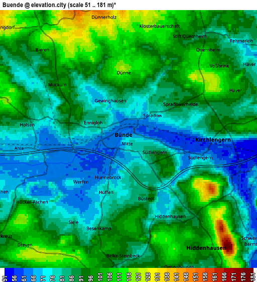
| Scale [m] | 55..128 m | 51..181 m | × |
| Scale [ft] | 180..420 ft | 167..594 ft | × |
| Average | 75.9 m = 249 ft | 89.5 m = 294 ft | × |
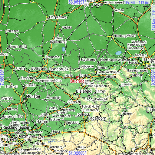
| Width | 5.99 km = 3.7 mi | 11.98 km = 7.4 mi | 191.7 km = 119.1 mi |
| Height | 5.99 km = 3.7 mi | 11.98 km = 7.4 mi | 191.7 km = 119.1 mi |
| ↑Max Latitude | 52.225297° | 52.252208° | 53.05197° |
| Latitude at center | 52.19837° | 52.19837° | 52.19837° |
| ↓Min Latitude | 52.171426° | 52.144467° | 51.32806° |
| ← Min Longitude | 8.542495° | 8.498549° | 7.18019° |
| Longitude center | 8.58644° | 8.58644° | 8.58644° |
| →Max Longitude | 8.630385° | 8.674331° | 9.99269° |
Nearby cities:
Cities around Bünde sort by population:
• Herford elevation 69 m
11 km,  147°
147°
• Löhne 68 m
7.3 km,  98°
98°
• Lübbecke 76 m
12.2 km,  8°
8°
• Hiddenhausen 83 m
4.1 km, 149°
• Enger 98 m
6.7 km,  196°
196°
• Kirchlengern 64 m
3.2 km,  86°
86°
• Spenge 90 m
9.5 km,  227°
227°
• Hüllhorst 135 m
10.9 km,  30°
30°
• Preußisch Oldendorf 61 m
13.5 km,  332°
332°
• Rödinghausen 135 m
9.1 km,  309°
309°
• Obernbeck 57 m
8 km, 87°
• Bad Holzhausen 59 m
10.6 km,  342°
342°
Multilingual:
 En español:
Bünde elevación 74 m.
 En France:
Bünde élévation 74 m.


Sources and notes:
- [note 1] Map square and city borders are not equal. Map elevation data is calculated only from area inside that square.
- [src 1] Elevation data from geonames database provided with same terms of usage.
- [src 2] The elevation map of Bünde is generated using elevation data from NASA's 3 arcsec (90m) resolution SRTM data.
- [src 3] Base (background) map © OpenStreetMap contributors tiles are generated by Geofabrik and OpenTopoMap.
Copyright & License:
This Bünde Elevation Map is licensed under CC BY-SA. You may reuse any part from this page, if you give a proper credit by linking to this URL:
 More info on terms of use page.