Büren elevation
Büren (North Rhine-Westphalia, Regierungsbezirk Detmold), Germany elevation is 243 meters and Büren elevation in feet is 797 ft above sea level [src 1]. Büren is a populated place (feature code) with elevation that is 15 meters (49 ft) smaller than average city elevation in Germany.
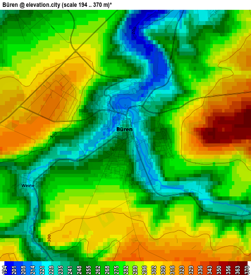
Below is the Elevation map of Büren, which displays elevation range with different colors. Scale of the first map is from 194 to 370 m (636 to 1214 ft) with average elevation of 275.7 meters (=905 ft) [note 1]
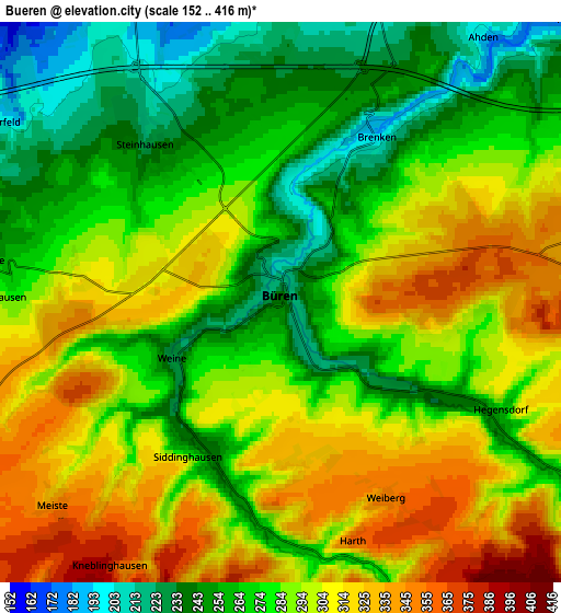
These maps also provides idea of topography and contour of this city, they are displayed at different zoom levels. More info about maps, scale and edge coordinates you can find below images.
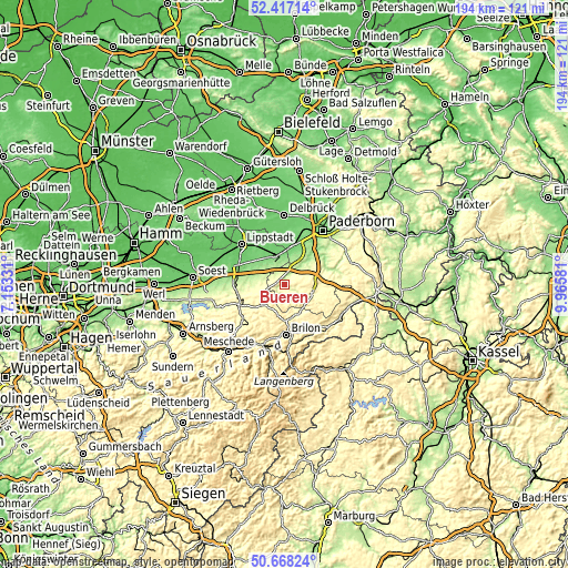
| \ | Map #1 | Map #2 | Topo.Map |
| Scale [m] | 194..370 m | 152..416 m | × |
| Scale [ft] | 636..1214 ft | 499..1365 ft | × |
| Average | 275.7 m = 905 ft | 286.2 m = 939 ft | × |
| Width | 6.08 km = 3.8 mi | 12.15 km = 7.5 mi | 194.5 km = 120.9 mi |
| Height | 6.08 km = 3.8 mi | 12.15 km = 7.5 mi | 194.4 km = 120.8 mi |
| ↑Max Latitude | 51.578408° | 51.605709° | 52.41714° |
| Latitude at center | 51.55109° | 51.55109° | 51.55109° |
| ↓Min Latitude | 51.523756° | 51.496405° | 50.66824° |
| ← Min Longitude | 8.515615° | 8.471669° | 7.15331° |
| Longitude center | 8.55956° | 8.55956° | 8.55956° |
| →Max Longitude | 8.603505° | 8.647451° | 9.96581° |
Nearby cities:
Cities around Büren sort by population:
• Lippstadt elevation 81 m
20.1 km,  312°
312°
• Warstein 346 m
18.8 km,  231°
231°
• Brilon 443 m
17.4 km,  177°
177°
• Salzkotten 99 m
13.7 km,  12°
12°
• Marsberg 254 m
22.4 km,  116°
116°
• Geseke 103 m
10.5 km,  341°
341°
• Erwitte 102 m
16.7 km,  294°
294°
• Olsberg 338 m
22.2 km,  192°
192°
• Wünnenberg 289 m
10.3 km,  109°
109°
• Rüthen 376 m
10.9 km, 231°
• Anröchte 186 m
15.7 km,  276°
276°
• Altenbüren 467 m
18.7 km, 191°
Multilingual:
 En español:
Büren elevación 243 m.
 En France:
Büren élévation 243 m.


Sources and notes:
- [note 1] Map square and city borders are not equal. Map elevation data is calculated only from area inside that square.
- [src 1] Elevation data from geonames database provided with same terms of usage.
- [src 2] The elevation map of Büren is generated using elevation data from NASA's 3 arcsec (90m) resolution SRTM data.
- [src 3] Base (background) map © OpenStreetMap contributors tiles are generated by Geofabrik and OpenTopoMap.
Copyright & License:
This Büren Elevation Map is licensed under CC BY-SA. You may reuse any part from this page, if you give a proper credit by linking to this URL:
 More info on terms of use page.