Burgebrach elevation
Burgebrach (Bavaria, Upper Franconia), Germany elevation is 270 meters and Burgebrach elevation in feet is 886 ft above sea level [src 1]. Burgebrach is a populated place (feature code) with elevation that is 12 meters (39 ft) bigger than average city elevation in Germany.
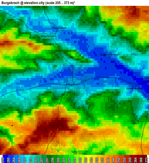
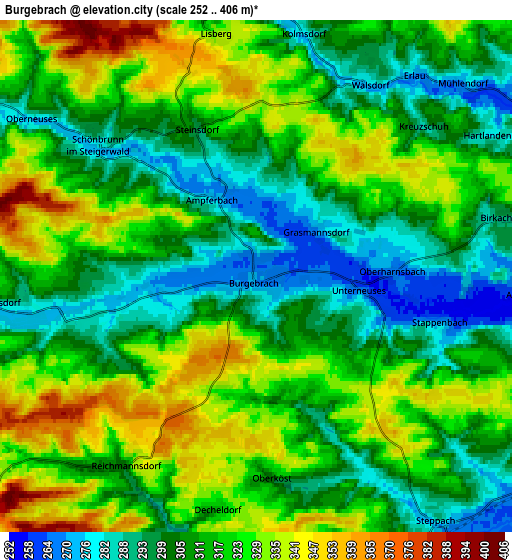
Below is the Elevation map of Burgebrach, which displays elevation range with different colors. Scale of the first map is from 255 to 373 m (837 to 1224 ft) with average elevation of 300.7 meters (=987 ft) [note 1]
These maps also provides idea of topography and contour of this city, they are displayed at different zoom levels. More info about maps, scale and edge coordinates you can find below images.
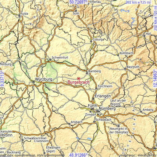
| \ | Map #1 | Map #2 | Topo.Map |
| Scale [m] | 255..373 m | 252..406 m | × |
| Scale [ft] | 837..1224 ft | 827..1332 ft | × |
| Average | 300.7 m = 987 ft | 314.2 m = 1031 ft | × |
| Width | 6.3 km = 3.9 mi | 12.61 km = 7.8 mi | 201.7 km = 125.3 mi |
| Height | 6.3 km = 3.9 mi | 12.61 km = 7.8 mi | 201.7 km = 125.3 mi |
| ↑Max Latitude | 49.85666° | 49.884983° | 50.72697° |
| Latitude at center | 49.82832° | 49.82832° | 49.82832° |
| ↓Min Latitude | 49.799963° | 49.77159° | 48.91266° |
| ← Min Longitude | 10.699435° | 10.655489° | 9.33713° |
| Longitude center | 10.74338° | 10.74338° | 10.74338° |
| →Max Longitude | 10.787325° | 10.831271° | 12.14963° |
Nearby cities:
Cities around Burgebrach sort by population:
• Stegaurach elevation 287 m
8.3 km,  60°
60°
• Schlüsselfeld 298 m
12 km,  228°
228°
• Bischberg 241 m
11.2 km,  34°
34°
• Frensdorf 257 m
8.9 km,  98°
98°
• Viereth-Trunstadt 240 m
10.7 km,  13°
13°
• Pommersfelden 268 m
8.6 km,  142°
142°
• Walsdorf 290 m
5.1 km, 33°
• Wachenroth 294 m
8.8 km,  194°
194°
• Pettstadt 248 m
13.3 km,  89°
89°
• Mühlhausen 277 m
8.5 km,  164°
164°
• Priesendorf 307 m
9.1 km,  345°
345°
• Burgwindheim 292 m
10.5 km,  269°
269°
Multilingual:
 En español:
Burgebrach elevación 270 m.
 En France:
Burgebrach élévation 270 m.
 Auf Deutsch:
Burgebrach höhe über dem Meeresspiegel ist 270 m.

Sources and notes:
- [note 1] Map square and city borders are not equal. Map elevation data is calculated only from area inside that square.
- [src 1] Elevation data from geonames database provided with same terms of usage.
- [src 2] The elevation map of Burgebrach is generated using elevation data from NASA's 3 arcsec (90m) resolution SRTM data.
- [src 3] Base (background) map © OpenStreetMap contributors tiles are generated by Geofabrik and OpenTopoMap.
Copyright & License:
This Burgebrach Elevation Map is licensed under CC BY-SA. You may reuse any part from this page, if you give a proper credit by linking to this URL:
 More info on terms of use page.