Burg Stargard elevation
Burg Stargard (Mecklenburg-Vorpommern), Germany elevation is 57 meters and Burg Stargard elevation in feet is 187 ft above sea level [src 1]. Burg Stargard is a populated place (feature code) with elevation that is 201 meters (659 ft) smaller than average city elevation in Germany.
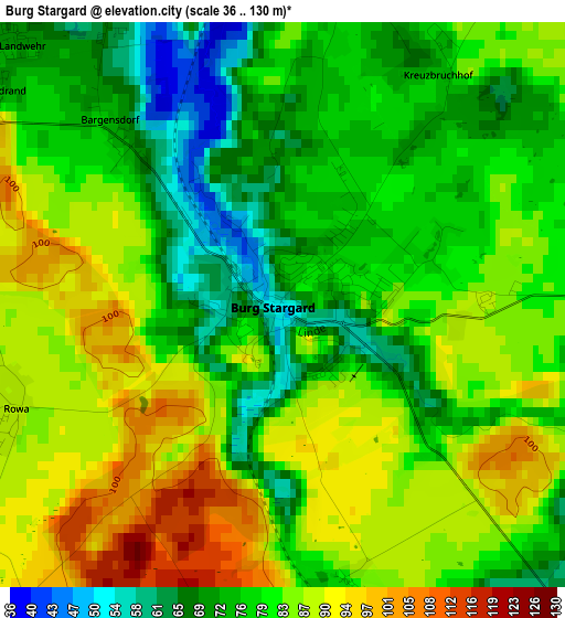
Below is the Elevation map of Burg Stargard, which displays elevation range with different colors. Scale of the first map is from 36 to 130 m (118 to 427 ft) with average elevation of 80.8 meters (=265 ft) [note 1]
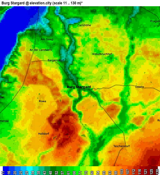
These maps also provides idea of topography and contour of this city, they are displayed at different zoom levels. More info about maps, scale and edge coordinates you can find below images.
| \ | Map #1 | Map #2 | Topo.Map |
| Scale [m] | 36..130 m | 11..130 m | × |
| Scale [ft] | 118..427 ft | 36..427 ft | × |
| Average | 80.8 m = 265 ft | 75.5 m = 248 ft | × |
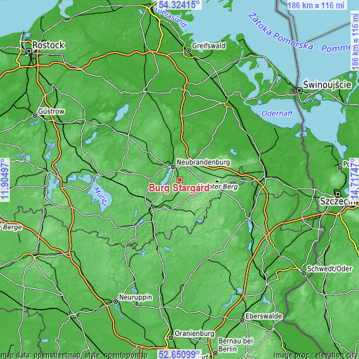
| Width | 5.81 km = 3.6 mi | 11.63 km = 7.2 mi | 186 km = 115.6 mi |
| Height | 5.81 km = 3.6 mi | 11.63 km = 7.2 mi | 186 km = 115.6 mi |
| ↑Max Latitude | 53.521954° | 53.548072° | 54.32415° |
| Latitude at center | 53.49582° | 53.49582° | 53.49582° |
| ↓Min Latitude | 53.46967° | 53.443503° | 52.65099° |
| ← Min Longitude | 13.267275° | 13.223329° | 11.90497° |
| Longitude center | 13.31122° | 13.31122° | 13.31122° |
| →Max Longitude | 13.355165° | 13.399111° | 14.71747° |
Nearby cities:
Cities around Burg Stargard sort by population:
• Neubrandenburg elevation 18 m
8 km,  342°
342°
• Loitz 118 m
7.8 km,  139°
139°
• Woldegk 110 m
18.4 km,  102°
102°
• Penzlin 51 m
15.1 km,  273°
273°
• Blankensee 83 m
10.6 km,  195°
195°
• Wulkenzin 58 m
10.8 km,  299°
299°
• Groß Nemerow 62 m
6.2 km,  246°
246°
• Wustrow 21 m
10.5 km,  258°
258°
• Neuenkirchen 73 m
11.9 km,  18°
18°
• Neverin 65 m
14 km,  6°
6°
• Trollenhagen 66 m
12.4 km,  353°
353°
• Carpin 74 m
16.1 km, 196°
Multilingual:
 En español:
Burg Stargard elevación 57 m.
 En France:
Burg Stargard élévation 57 m.
 Auf Deutsch:
Burg Stargard höhe über dem Meeresspiegel ist 57 m.

Sources and notes:
- [note 1] Map square and city borders are not equal. Map elevation data is calculated only from area inside that square.
- [src 1] Elevation data from geonames database provided with same terms of usage.
- [src 2] The elevation map of Burg Stargard is generated using elevation data from NASA's 3 arcsec (90m) resolution SRTM data.
- [src 3] Base (background) map © OpenStreetMap contributors tiles are generated by Geofabrik and OpenTopoMap.
Copyright & License:
This Burg Stargard Elevation Map is licensed under CC BY-SA. You may reuse any part from this page, if you give a proper credit by linking to this URL:
 More info on terms of use page.