Büttstedt elevation
Büttstedt (Thuringia), Germany elevation is 374 meters and Büttstedt elevation in feet is 1227 ft above sea level [src 1]. Büttstedt is a seat of a fourth-order administrative division (feature code) with elevation that is 116 meters (381 ft) bigger than average city elevation in Germany.
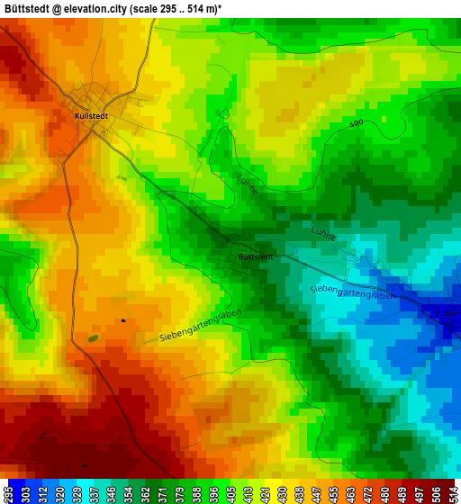
Below is the Elevation map of Büttstedt, which displays elevation range with different colors. Scale of the first map is from 295 to 514 m (968 to 1686 ft) with average elevation of 411.5 meters (=1350 ft) [note 1]
These maps also provides idea of topography and contour of this city, they are displayed at different zoom levels. More info about maps, scale and edge coordinates you can find below images.
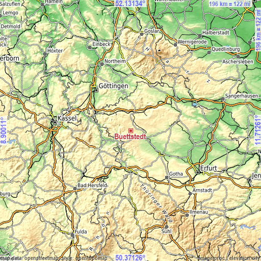
| \ | Map #1 | Topo.Map |
| Scale [m] | 295..514 m | × |
| Scale [ft] | 968..1686 ft | × |
| Average | 411.5 m = 1350 ft | × |
| Width | 6.12 km = 3.8 mi | 195.7 km = 121.6 mi |
| Height | 6.12 km = 3.8 mi | 195.7 km = 121.6 mi |
| ↑Max Latitude | 51.287212° | 52.13134° |
| Latitude at center | 51.25972° | 51.25972° |
| ↓Min Latitude | 51.232211° | 50.37126° |
| ← Min Longitude | 10.262415° | 8.90011° |
| Longitude center | 10.30636° | 10.30636° |
| →Max Longitude | 10.350305° | 11.71261° |
Nearby cities:
Cities around Büttstedt sort by population:
• Mühlhausen elevation 221 m
11.7 km,  118°
118°
• Dingelstädt 337 m
6.2 km,  7°
7°
• Wanfried 177 m
12.7 km,  227°
227°
• Anrode 367 m
2 km,  67°
67°
• Katharinenberg 406 m
9.3 km,  199°
199°
• Heyerode 348 m
10.6 km,  174°
174°
• Oberdorla 228 m
13.2 km,  142°
142°
• Küllstedt 442 m
2.5 km,  314°
314°
• Effelder 472 m
4.7 km,  241°
241°
• Geismar 212 m
10.3 km,  252°
252°
• Geisleden 328 m
12.5 km,  323°
323°
• Großbartloff 281 m
6.3 km,  260°
260°
Multilingual:
 En español:
Büttstedt elevación 374 m.
 En France:
Büttstedt élévation 374 m.
 Auf Deutsch:
Büttstedt höhe über dem Meeresspiegel ist 374 m.

Sources and notes:
- [note 1] Map square and city borders are not equal. Map elevation data is calculated only from area inside that square.
- [src 1] Elevation data from geonames database provided with same terms of usage.
- [src 2] The elevation map of Büttstedt is generated using elevation data from NASA's 3 arcsec (90m) resolution SRTM data.
- [src 3] Base (background) map © OpenStreetMap contributors tiles are generated by Geofabrik and OpenTopoMap.
Copyright & License:
This Büttstedt Elevation Map is licensed under CC BY-SA. You may reuse any part from this page, if you give a proper credit by linking to this URL:
 More info on terms of use page.