Carlow elevation
Carlow (Mecklenburg-Vorpommern), Germany elevation is 37 meters and Carlow elevation in feet is 121 ft above sea level [src 1]. Carlow is a populated place (feature code) with elevation that is 221 meters (725 ft) smaller than average city elevation in Germany.
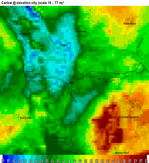
Below is the Elevation map of Carlow, which displays elevation range with different colors. Scale of the first map is from 16 to 77 m (52 to 253 ft) with average elevation of 43.2 meters (=142 ft) [note 1]
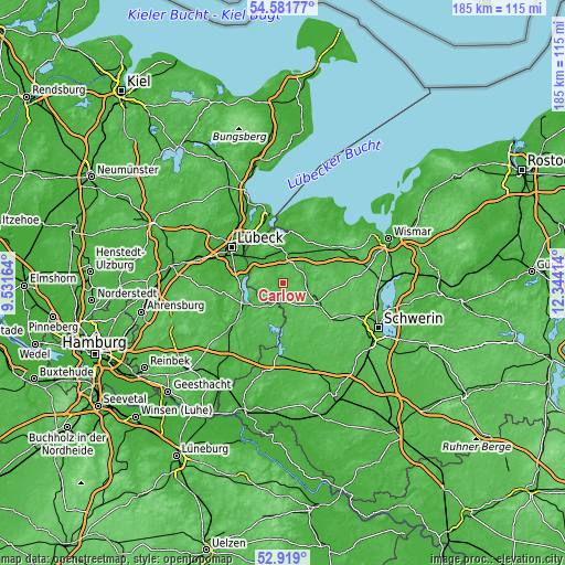
These maps also provides idea of topography and contour of this city, they are displayed at different zoom levels. More info about maps, scale and edge coordinates you can find below images.
| \ | Map #1 | Topo.Map |
| Scale [m] | 16..77 m | × |
| Scale [ft] | 52..253 ft | × |
| Average | 43.2 m = 142 ft | × |
| Width | 5.78 km = 3.6 mi | 184.9 km = 114.9 mi |
| Height | 5.78 km = 3.6 mi | 184.9 km = 114.9 mi |
| ↑Max Latitude | 53.784582° | 54.58177° |
| Latitude at center | 53.75861° | 53.75861° |
| ↓Min Latitude | 53.732622° | 52.919° |
| ← Min Longitude | 10.893945° | 9.53164° |
| Longitude center | 10.93789° | 10.93789° |
| →Max Longitude | 10.981835° | 12.34414° |
Nearby cities:
Cities around Carlow sort by population:
• Ratzeburg elevation 13 m
12.7 km,  238°
238°
• Grevesmühlen 41 m
20.3 km,  55°
55°
• Gadebusch 35 m
13.4 km,  118°
118°
• Groß Grönau 8 m
13.2 km,  290°
290°
• Dassow 14 m
17.1 km,  8°
8°
• Rehna 26 m
7.7 km,  72°
72°
• Selmsdorf 35 m
14.7 km,  339°
339°
• Berkenthin 9 m
19.1 km,  261°
261°
• Lützow 61 m
19.5 km,  126°
126°
• Krummesse 10 m
19.1 km,  278°
278°
• Schlagsdorf 43 m
7.9 km,  249°
249°
• Roggendorf 59 m
8.9 km,  145°
145°
Multilingual:
 En español:
Carlow elevación 37 m.
 En France:
Carlow élévation 37 m.


Sources and notes:
- [note 1] Map square and city borders are not equal. Map elevation data is calculated only from area inside that square.
- [src 1] Elevation data from geonames database provided with same terms of usage.
- [src 2] The elevation map of Carlow is generated using elevation data from NASA's 3 arcsec (90m) resolution SRTM data.
- [src 3] Base (background) map © OpenStreetMap contributors tiles are generated by Geofabrik and OpenTopoMap.
Copyright & License:
This Carlow Elevation Map is licensed under CC BY-SA. You may reuse any part from this page, if you give a proper credit by linking to this URL:
 More info on terms of use page.