Contwig elevation
Contwig (Rheinland-Pfalz), Germany elevation is 256 meters and Contwig elevation in feet is 840 ft above sea level [src 1]. Contwig is a seat of a fourth-order administrative division (feature code) with elevation that is 2 meters (7 ft) smaller than average city elevation in Germany.
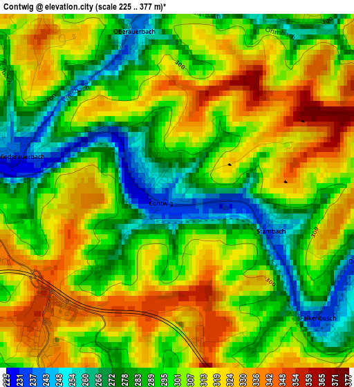
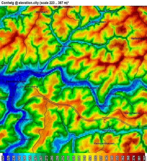
Below is the Elevation map of Contwig, which displays elevation range with different colors. Scale of the first map is from 225 to 377 m (738 to 1237 ft) with average elevation of 301.5 meters (=989 ft) [note 1]
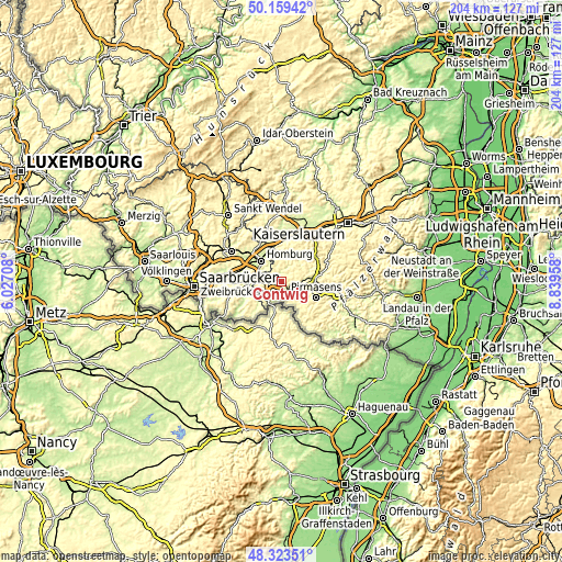
These maps also provides idea of topography and contour of this city, they are displayed at different zoom levels. More info about maps, scale and edge coordinates you can find below images.
| \ | Map #1 | Map #2 | Topo.Map |
| Scale [m] | 225..377 m | 223..387 m | × |
| Scale [ft] | 738..1237 ft | 732..1270 ft | × |
| Average | 301.5 m = 989 ft | 304.8 m = 1000 ft | × |
| Width | 6.38 km = 4 mi | 12.76 km = 7.9 mi | 204.1 km = 126.8 mi |
| Height | 6.38 km = 4 mi | 12.76 km = 7.9 mi | 204.1 km = 126.8 mi |
| ↑Max Latitude | 49.278677° | 49.307338° | 50.15942° |
| Latitude at center | 49.25° | 49.25° | 49.25° |
| ↓Min Latitude | 49.221306° | 49.192595° | 48.32351° |
| ← Min Longitude | 7.389385° | 7.345439° | 6.02708° |
| Longitude center | 7.43333° | 7.43333° | 7.43333° |
| →Max Longitude | 7.477275° | 7.521221° | 8.83958° |
Nearby cities:
Cities around Contwig sort by population:
• Homburg elevation 242 m
10.9 km,  321°
321°
• Zweibrücken 242 m
4.6 km,  265°
265°
• Blieskastel 242 m
12.9 km,  263°
263°
• Thaleischweiler-Fröschen 290 m
11 km,  80°
80°
• Bechhofen 315 m
11.4 km,  347°
347°
• Rieschweiler-Mühlbach 284 m
5.2 km,  110°
110°
• Rimschweiler 238 m
5.4 km,  230°
230°
• Hornbach 240 m
8.4 km,  214°
214°
• Dellfeld 236 m
3.4 km,  121°
121°
• Höheinöd 406 m
13.3 km,  70°
70°
• Maßweiler 347 m
7.5 km, 75°
• Höheischweiler 352 m
8.7 km,  102°
102°
Multilingual:
 En español:
Contwig elevación 256 m.
 En France:
Contwig élévation 256 m.


Sources and notes:
- [note 1] Map square and city borders are not equal. Map elevation data is calculated only from area inside that square.
- [src 1] Elevation data from geonames database provided with same terms of usage.
- [src 2] The elevation map of Contwig is generated using elevation data from NASA's 3 arcsec (90m) resolution SRTM data.
- [src 3] Base (background) map © OpenStreetMap contributors tiles are generated by Geofabrik and OpenTopoMap.
Copyright & License:
This Contwig Elevation Map is licensed under CC BY-SA. You may reuse any part from this page, if you give a proper credit by linking to this URL:
 More info on terms of use page.