Dabel elevation
Dabel (Mecklenburg-Vorpommern), Germany elevation is 42 meters and Dabel elevation in feet is 138 ft above sea level [src 1]. Dabel is a populated place (feature code) with elevation that is 216 meters (709 ft) smaller than average city elevation in Germany.
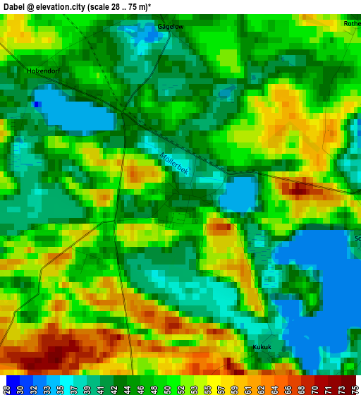
Below is the Elevation map of Dabel, which displays elevation range with different colors. Scale of the first map is from 28 to 75 m (92 to 246 ft) with average elevation of 47.8 meters (=157 ft) [note 1]
These maps also provides idea of topography and contour of this city, they are displayed at different zoom levels. More info about maps, scale and edge coordinates you can find below images.
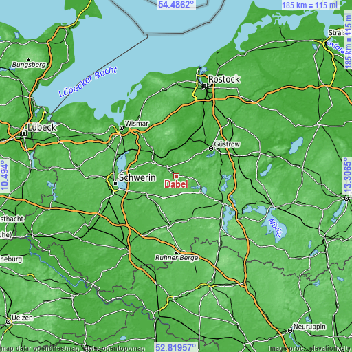
| \ | Map #1 | Topo.Map |
| Scale [m] | 28..75 m | × |
| Scale [ft] | 92..246 ft | × |
| Average | 47.8 m = 157 ft | × |
| Width | 5.79 km = 3.6 mi | 185.3 km = 115.1 mi |
| Height | 5.79 km = 3.6 mi | 185.3 km = 115.1 mi |
| ↑Max Latitude | 53.687152° | 54.4862° |
| Latitude at center | 53.66112° | 53.66112° |
| ↓Min Latitude | 53.635072° | 52.81957° |
| ← Min Longitude | 11.856305° | 10.494° |
| Longitude center | 11.90025° | 11.90025° |
| →Max Longitude | 11.944195° | 13.3065° |
Nearby cities:
Cities around Dabel sort by population:
• Bützow elevation 7 m
21.5 km,  14°
14°
• Crivitz 44 m
19.1 km,  239°
239°
• Sternberg 23 m
7.5 km,  319°
319°
• Goldberg 51 m
14.8 km,  122°
122°
• Warin 25 m
20.1 km, 320°
• Brüel 18 m
14.9 km,  304°
304°
• Gägelow 45 m
2.7 km,  354°
354°
• Demen 42 m
9.5 km,  248°
248°
• Tarnow 15 m
15.3 km,  30°
30°
• Dobbertin 51 m
12.3 km,  110°
110°
• Domsühl 58 m
21.1 km,  203°
203°
• Warnow 25 m
13.9 km, 354°
Multilingual:
 En español:
Dabel elevación 42 m.
 En France:
Dabel élévation 42 m.


Sources and notes:
- [note 1] Map square and city borders are not equal. Map elevation data is calculated only from area inside that square.
- [src 1] Elevation data from geonames database provided with same terms of usage.
- [src 2] The elevation map of Dabel is generated using elevation data from NASA's 3 arcsec (90m) resolution SRTM data.
- [src 3] Base (background) map © OpenStreetMap contributors tiles are generated by Geofabrik and OpenTopoMap.
Copyright & License:
This Dabel Elevation Map is licensed under CC BY-SA. You may reuse any part from this page, if you give a proper credit by linking to this URL:
 More info on terms of use page.