Deggingen elevation
Deggingen (Baden-Württemberg, Regierungsbezirk Stuttgart), Germany elevation is 490 meters and Deggingen elevation in feet is 1608 ft above sea level [src 1]. Deggingen is a seat of a fourth-order administrative division (feature code) with elevation that is 232 meters (761 ft) bigger than average city elevation in Germany.
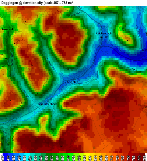
Below is the Elevation map of Deggingen, which displays elevation range with different colors. Scale of the first map is from 457 to 788 m (1499 to 2585 ft) with average elevation of 638.8 meters (=2096 ft) [note 1]
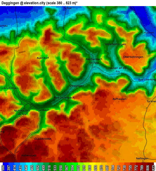
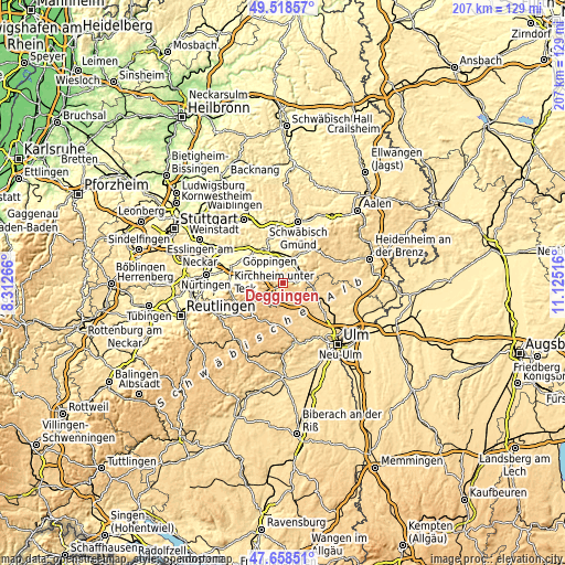
These maps also provides idea of topography and contour of this city, they are displayed at different zoom levels. More info about maps, scale and edge coordinates you can find below images.
| \ | Map #1 | Map #2 | Topo.Map |
| Scale [m] | 457..788 m | 380..823 m | × |
| Scale [ft] | 1499..2585 ft | 1247..2700 ft | × |
| Average | 638.8 m = 2096 ft | 639.5 m = 2098 ft | × |
| Width | 6.46 km = 4 mi | 12.93 km = 8 mi | 206.8 km = 128.5 mi |
| Height | 6.46 km = 4 mi | 12.93 km = 8 mi | 206.8 km = 128.5 mi |
| ↑Max Latitude | 48.626155° | 48.655193° | 49.51857° |
| Latitude at center | 48.5971° | 48.5971° | 48.5971° |
| ↓Min Latitude | 48.568028° | 48.53894° | 47.65851° |
| ← Min Longitude | 9.674965° | 9.631019° | 8.31266° |
| Longitude center | 9.71891° | 9.71891° | 9.71891° |
| →Max Longitude | 9.762855° | 9.806801° | 11.12516° |
Nearby cities:
Cities around Deggingen sort by population:
• Kuchen elevation 406 m
7.3 km,  54°
54°
• Gingen an der Fils 379 m
8.3 km,  33°
33°
• Bad Überkingen 442 m
5.7 km,  86°
86°
• Bad Ditzenbach 504 m
1.5 km,  228°
228°
• Eschenbach 410 m
7.1 km,  329°
329°
• Gruibingen 566 m
5.5 km,  267°
267°
• Wiesensteig 590 m
7.9 km,  239°
239°
• Dürnau 429 m
7.8 km,  308°
308°
• Nellingen 691 m
8.1 km,  139°
139°
• Schlat 418 m
6.3 km,  351°
351°
• Gammelshausen 441 m
6.9 km, 313°
• Mühlhausen 542 m
5.1 km, 243°
Multilingual:
 En español:
Deggingen elevación 490 m.
 En France:
Deggingen élévation 490 m.
 Auf Deutsch:
Deggingen höhe über dem Meeresspiegel ist 490 m.

Sources and notes:
- [note 1] Map square and city borders are not equal. Map elevation data is calculated only from area inside that square.
- [src 1] Elevation data from geonames database provided with same terms of usage.
- [src 2] The elevation map of Deggingen is generated using elevation data from NASA's 3 arcsec (90m) resolution SRTM data.
- [src 3] Base (background) map © OpenStreetMap contributors tiles are generated by Geofabrik and OpenTopoMap.
Copyright & License:
This Deggingen Elevation Map is licensed under CC BY-SA. You may reuse any part from this page, if you give a proper credit by linking to this URL:
 More info on terms of use page.