Dorfen elevation
Dorfen (Bavaria, Upper Bavaria), Germany elevation is 443 meters and Dorfen elevation in feet is 1453 ft above sea level [src 1]. Dorfen is a populated place (feature code) with elevation that is 185 meters (607 ft) bigger than average city elevation in Germany.
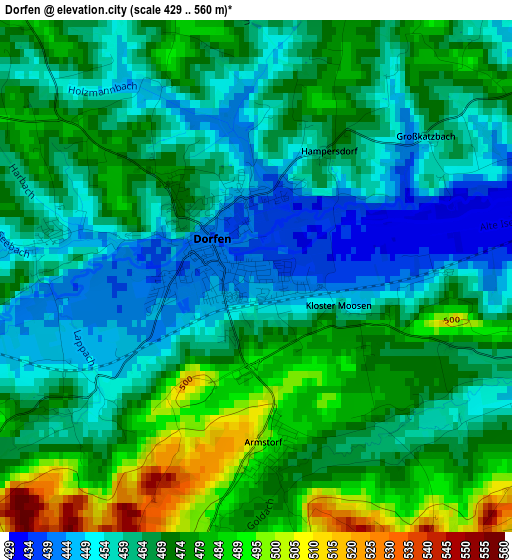
Below is the Elevation map of Dorfen, which displays elevation range with different colors. Scale of the first map is from 429 to 560 m (1407 to 1837 ft) with average elevation of 467.7 meters (=1534 ft) [note 1]
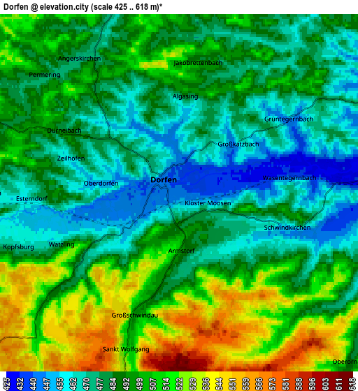
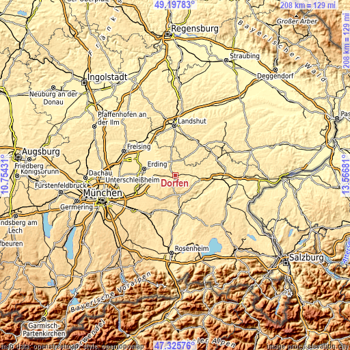
These maps also provides idea of topography and contour of this city, they are displayed at different zoom levels. More info about maps, scale and edge coordinates you can find below images.
| \ | Map #1 | Map #2 | Topo.Map |
| Scale [m] | 429..560 m | 425..618 m | × |
| Scale [ft] | 1407..1837 ft | 1394..2028 ft | × |
| Average | 467.7 m = 1534 ft | 492.4 m = 1615 ft | × |
| Width | 6.5 km = 4 mi | 13.01 km = 8.1 mi | 208.2 km = 129.4 mi |
| Height | 6.5 km = 4 mi | 13.01 km = 8.1 mi | 208.1 km = 129.3 mi |
| ↑Max Latitude | 48.299612° | 48.328838° | 49.19783° |
| Latitude at center | 48.27037° | 48.27037° | 48.27037° |
| ↓Min Latitude | 48.241111° | 48.211835° | 47.32576° |
| ← Min Longitude | 12.116615° | 12.072669° | 10.75431° |
| Longitude center | 12.16056° | 12.16056° | 12.16056° |
| →Max Longitude | 12.204505° | 12.248451° | 13.56681° |
Nearby cities:
Cities around Dorfen sort by population:
• Taufkirchen elevation 490 m
9.1 km,  346°
346°
• Isen 519 m
10.1 km,  229°
229°
• Sankt Wolfgang 525 m
6.3 km,  198°
198°
• Schwindegg 432 m
7.3 km,  88°
88°
• Buchbach 452 m
9.6 km,  60°
60°
• Lengdorf 468 m
8.3 km,  260°
260°
• Obertaufkirchen 469 m
8.8 km,  97°
97°
• Aham 465 m
8.7 km,  0°
0°
• Ramsau 509 m
12 km,  154°
154°
• Reichertsheim 526 m
12 km,  130°
130°
• Inning am Holz 492 m
10.6 km,  323°
323°
• Kirchdorf 548 m
10.9 km,  165°
165°
Multilingual:
 En español:
Dorfen elevación 443 m.
 En France:
Dorfen élévation 443 m.


Sources and notes:
- [note 1] Map square and city borders are not equal. Map elevation data is calculated only from area inside that square.
- [src 1] Elevation data from geonames database provided with same terms of usage.
- [src 2] The elevation map of Dorfen is generated using elevation data from NASA's 3 arcsec (90m) resolution SRTM data.
- [src 3] Base (background) map © OpenStreetMap contributors tiles are generated by Geofabrik and OpenTopoMap.
Copyright & License:
This Dorfen Elevation Map is licensed under CC BY-SA. You may reuse any part from this page, if you give a proper credit by linking to this URL:
 More info on terms of use page.