Dreieich elevation
Dreieich (Hesse, Regierungsbezirk Darmstadt), Germany elevation is 134 meters and Dreieich elevation in feet is 440 ft above sea level [src 1]. Dreieich is a populated place (feature code) with elevation that is 124 meters (407 ft) smaller than average city elevation in Germany.
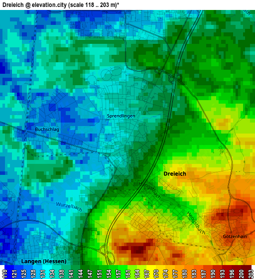
Below is the Elevation map of Dreieich, which displays elevation range with different colors. Scale of the first map is from 118 to 203 m (387 to 666 ft) with average elevation of 146.1 meters (=479 ft) [note 1]
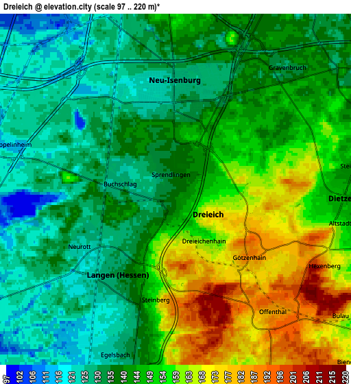
These maps also provides idea of topography and contour of this city, they are displayed at different zoom levels. More info about maps, scale and edge coordinates you can find below images.
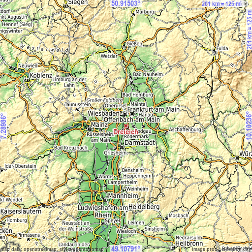
| \ | Map #1 | Map #2 | Topo.Map |
| Scale [m] | 118..203 m | 97..220 m | × |
| Scale [ft] | 387..666 ft | 318..722 ft | × |
| Average | 146.1 m = 479 ft | 144.1 m = 473 ft | × |
| Width | 6.28 km = 3.9 mi | 12.56 km = 7.8 mi | 200.9 km = 124.8 mi |
| Height | 6.28 km = 3.9 mi | 12.56 km = 7.8 mi | 200.9 km = 124.8 mi |
| ↑Max Latitude | 50.048197° | 50.076408° | 50.91503° |
| Latitude at center | 50.01997° | 50.01997° | 50.01997° |
| ↓Min Latitude | 49.991726° | 49.963465° | 49.10791° |
| ← Min Longitude | 8.652165° | 8.608219° | 7.28986° |
| Longitude center | 8.69611° | 8.69611° | 8.69611° |
| →Max Longitude | 8.740055° | 8.784001° | 10.10236° |
Nearby cities:
Cities around Dreieich sort by population:
• Frankfurt am Main elevation 113 m
10.7 km,  355°
355°
• Offenbach 113 m
10.3 km,  29°
29°
• Gallus 101 m
10.1 km,  331°
331°
• Langen 134 m
3.9 km,  210°
210°
• Neu Isenburg 127 m
3.2 km, 357°
• Dietzenbach 152 m
5.9 km,  101°
101°
• Mörfelden-Walldorf 109 m
8.5 km,  250°
250°
• Niederrad 99 m
8.5 km, 325°
• Heusenstamm 130 m
8.5 km,  62°
62°
• Egelsbach 124 m
6.2 km,  201°
201°
• Erzhausen 119 m
8 km, 205°
• Messel 177 m
9.6 km,  160°
160°
Multilingual:
 En español:
Dreieich elevación 134 m.
 En France:
Dreieich élévation 134 m.
 Auf Deutsch:
Dreieich höhe über dem Meeresspiegel ist 134 m.

Sources and notes:
- [note 1] Map square and city borders are not equal. Map elevation data is calculated only from area inside that square.
- [src 1] Elevation data from geonames database provided with same terms of usage.
- [src 2] The elevation map of Dreieich is generated using elevation data from NASA's 3 arcsec (90m) resolution SRTM data.
- [src 3] Base (background) map © OpenStreetMap contributors tiles are generated by Geofabrik and OpenTopoMap.
Copyright & License:
This Dreieich Elevation Map is licensed under CC BY-SA. You may reuse any part from this page, if you give a proper credit by linking to this URL:
 More info on terms of use page.