Emmendingen elevation
Emmendingen (Baden-Württemberg, Freiburg Region), Germany elevation is 207 meters and Emmendingen elevation in feet is 679 ft above sea level [src 1]. Emmendingen is a seat of a third-order administrative division (feature code) with elevation that is 51 meters (167 ft) smaller than average city elevation in Germany.
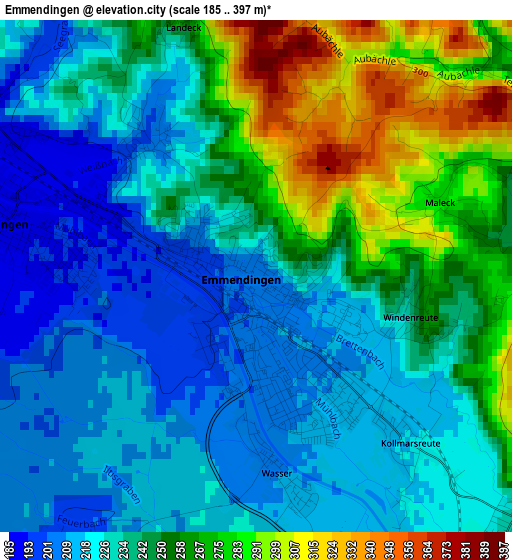
Below is the Elevation map of Emmendingen, which displays elevation range with different colors. Scale of the first map is from 185 to 397 m (607 to 1302 ft) with average elevation of 240.9 meters (=790 ft) [note 1]
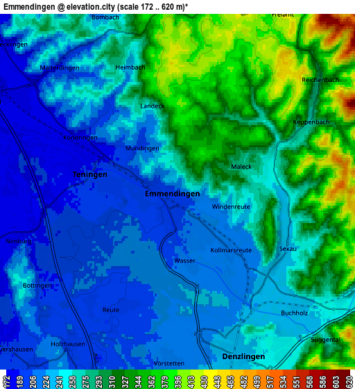
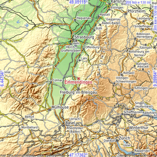
These maps also provides idea of topography and contour of this city, they are displayed at different zoom levels. More info about maps, scale and edge coordinates you can find below images.
| \ | Map #1 | Map #2 | Topo.Map |
| Scale [m] | 185..397 m | 172..620 m | × |
| Scale [ft] | 607..1302 ft | 564..2034 ft | × |
| Average | 240.9 m = 790 ft | 267 m = 876 ft | × |
| Width | 6.52 km = 4.1 mi | 13.05 km = 8.1 mi | 208.8 km = 129.7 mi |
| Height | 6.52 km = 4.1 mi | 13.05 km = 8.1 mi | 208.7 km = 129.7 mi |
| ↑Max Latitude | 48.150288° | 48.179599° | 49.05115° |
| Latitude at center | 48.12096° | 48.12096° | 48.12096° |
| ↓Min Latitude | 48.091615° | 48.062254° | 47.17362° |
| ← Min Longitude | 7.809645° | 7.765699° | 6.44734° |
| Longitude center | 7.85359° | 7.85359° | 7.85359° |
| →Max Longitude | 7.897535° | 7.941481° | 9.25984° |
Nearby cities:
Cities around Emmendingen sort by population:
• Waldkirch elevation 266 m
8.6 km,  108°
108°
• Denzlingen 232 m
6.4 km,  159°
159°
• Teningen 190 m
3.2 km,  287°
287°
• Gundelfingen 235 m
8.8 km,  174°
174°
• Kenzingen 172 m
10.4 km,  323°
323°
• Gutach im Breisgau 399 m
9.6 km,  92°
92°
• Bahlingen 188 m
8.4 km,  269°
269°
• Riegel 183 m
8.4 km, 293°
• Sexau 234 m
4.5 km,  117°
117°
• Eichstetten 192 m
8.8 km,  250°
250°
• Malterdingen 186 m
6.4 km,  308°
308°
• Vörstetten 211 m
6 km,  182°
182°
Multilingual:
 En español:
Emmendingen elevación 207 m.
 En France:
Emmendingen élévation 207 m.
 Auf Deutsch:
Emmendingen höhe über dem Meeresspiegel ist 207 m.

Sources and notes:
- [note 1] Map square and city borders are not equal. Map elevation data is calculated only from area inside that square.
- [src 1] Elevation data from geonames database provided with same terms of usage.
- [src 2] The elevation map of Emmendingen is generated using elevation data from NASA's 3 arcsec (90m) resolution SRTM data.
- [src 3] Base (background) map © OpenStreetMap contributors tiles are generated by Geofabrik and OpenTopoMap.
Copyright & License:
This Emmendingen Elevation Map is licensed under CC BY-SA. You may reuse any part from this page, if you give a proper credit by linking to this URL:
 More info on terms of use page.