Empfingen elevation
Empfingen (Baden-Württemberg, Karlsruhe Region), Germany elevation is 493 meters and Empfingen elevation in feet is 1617 ft above sea level [src 1]. Empfingen is a seat of a fourth-order administrative division (feature code) with elevation that is 235 meters (771 ft) bigger than average city elevation in Germany.
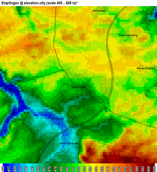
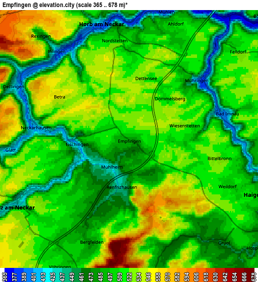
Below is the Elevation map of Empfingen, which displays elevation range with different colors. Scale of the first map is from 409 to 608 m (1342 to 1995 ft) with average elevation of 509 meters (=1670 ft) [note 1]
These maps also provides idea of topography and contour of this city, they are displayed at different zoom levels. More info about maps, scale and edge coordinates you can find below images.
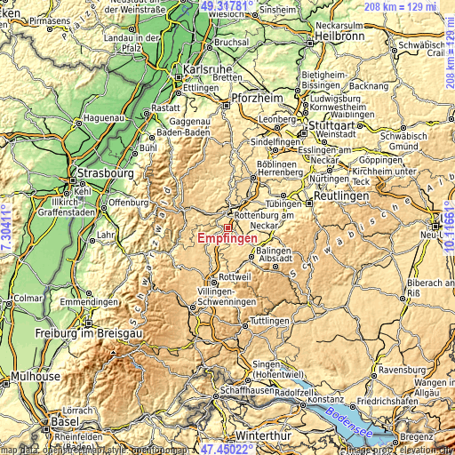
| \ | Map #1 | Map #2 | Topo.Map |
| Scale [m] | 409..608 m | 365..678 m | × |
| Scale [ft] | 1342..1995 ft | 1198..2224 ft | × |
| Average | 509 m = 1670 ft | 507.2 m = 1664 ft | × |
| Width | 6.49 km = 4 mi | 12.98 km = 8.1 mi | 207.7 km = 129.1 mi |
| Height | 6.49 km = 4 mi | 12.98 km = 8.1 mi | 207.6 km = 129 mi |
| ↑Max Latitude | 48.421752° | 48.450908° | 49.31781° |
| Latitude at center | 48.39258° | 48.39258° | 48.39258° |
| ↓Min Latitude | 48.363391° | 48.334185° | 47.45022° |
| ← Min Longitude | 8.666415° | 8.622469° | 7.30411° |
| Longitude center | 8.71036° | 8.71036° | 8.71036° |
| →Max Longitude | 8.754305° | 8.798251° | 10.11661° |
Nearby cities:
Cities around Empfingen sort by population:
• Horb am Neckar elevation 394 m
5.9 km,  346°
346°
• Sulz am Neckar 431 m
6.6 km,  239°
239°
• Haigerloch 443 m
7.5 km,  113°
113°
• Rosenfeld 630 m
11.8 km,  175°
175°
• Geislingen 564 m
13.9 km,  147°
147°
• Haiterbach 562 m
15.1 km,  341°
341°
• Rangendingen 418 m
13.3 km,  95°
95°
• Vöhringen 507 m
7.3 km,  207°
207°
• Mühlheim am Bach 428 m
1.8 km, 211°
• Hirrlingen 429 m
13.3 km,  80°
80°
• Schopfloch 666 m
13.6 km,  300°
300°
• Grosselfingen 520 m
14.7 km,  117°
117°
Multilingual:
 En español:
Empfingen elevación 493 m.
 En France:
Empfingen élévation 493 m.
 Auf Deutsch:
Empfingen höhe über dem Meeresspiegel ist 493 m.

Sources and notes:
- [note 1] Map square and city borders are not equal. Map elevation data is calculated only from area inside that square.
- [src 1] Elevation data from geonames database provided with same terms of usage.
- [src 2] The elevation map of Empfingen is generated using elevation data from NASA's 3 arcsec (90m) resolution SRTM data.
- [src 3] Base (background) map © OpenStreetMap contributors tiles are generated by Geofabrik and OpenTopoMap.
Copyright & License:
This Empfingen Elevation Map is licensed under CC BY-SA. You may reuse any part from this page, if you give a proper credit by linking to this URL:
 More info on terms of use page.