Eriskirch elevation
Eriskirch (Baden-Württemberg, Tübingen Region), Germany elevation is 411 meters and Eriskirch elevation in feet is 1348 ft above sea level [src 1]. Eriskirch is a seat of a fourth-order administrative division (feature code) with elevation that is 153 meters (502 ft) bigger than average city elevation in Germany.
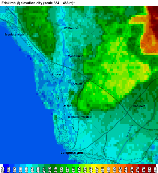
Below is the Elevation map of Eriskirch, which displays elevation range with different colors. Scale of the first map is from 384 to 486 m (1260 to 1594 ft) with average elevation of 409.9 meters (=1345 ft) [note 1]
These maps also provides idea of topography and contour of this city, they are displayed at different zoom levels. More info about maps, scale and edge coordinates you can find below images.
| \ | Map #1 | Map #2 | Topo.Map |
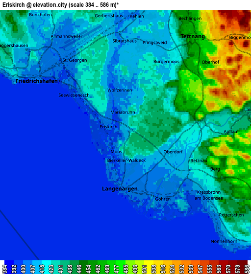
| Scale [m] | 384..486 m | 384..586 m | × |
| Scale [ft] | 1260..1594 ft | 1260..1923 ft | × |
| Average | 409.9 m = 1345 ft | 419.3 m = 1376 ft | × |
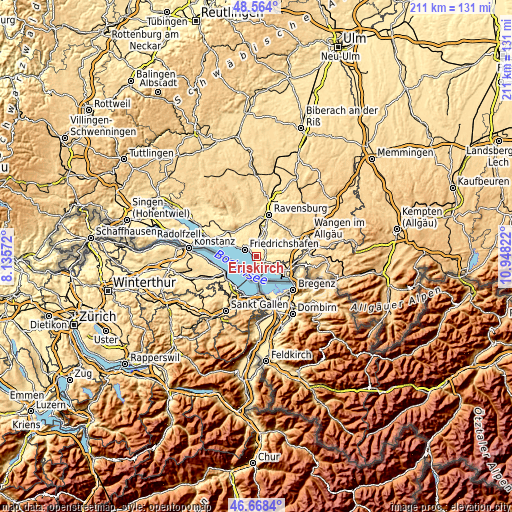
| Width | 6.59 km = 4.1 mi | 13.17 km = 8.2 mi | 210.8 km = 131 mi |
| Height | 6.59 km = 4.1 mi | 13.17 km = 8.2 mi | 210.8 km = 131 mi |
| ↑Max Latitude | 47.6544° | 47.683993° | 48.564° |
| Latitude at center | 47.62479° | 47.62479° | 47.62479° |
| ↓Min Latitude | 47.595163° | 47.56552° | 46.6684° |
| ← Min Longitude | 9.498025° | 9.454079° | 8.13572° |
| Longitude center | 9.54197° | 9.54197° | 9.54197° |
| →Max Longitude | 9.585915° | 9.629861° | 10.94822° |
Nearby cities:
Cities around Eriskirch sort by population:
• Friedrichshafen elevation 405 m
6.1 km,  305°
305°
• Lindau 406 m
13.8 km,  129°
129°
• Tettnang 467 m
6.1 km,  37°
37°
• Meckenbeuren 415 m
8.6 km,  12°
12°
• Kressbronn am Bodensee 413 m
5.1 km, 126°
• Langenargen 402 m
2.9 km,  180°
180°
• Immenstaad am Bodensee 408 m
13.9 km,  289°
289°
• Oberteuringen 448 m
12.3 km,  333°
333°
• Bodnegg 601 m
14.5 km,  49°
49°
• Bodolz 423 m
11.4 km,  124°
124°
• Neukirch 560 m
12.6 km,  73°
73°
• Nonnenhorn 404 m
7.6 km,  137°
137°
Multilingual:
 En español:
Eriskirch elevación 411 m.
 En France:
Eriskirch élévation 411 m.
 Auf Deutsch:
Eriskirch höhe über dem Meeresspiegel ist 411 m.

Sources and notes:
- [note 1] Map square and city borders are not equal. Map elevation data is calculated only from area inside that square.
- [src 1] Elevation data from geonames database provided with same terms of usage.
- [src 2] The elevation map of Eriskirch is generated using elevation data from NASA's 3 arcsec (90m) resolution SRTM data.
- [src 3] Base (background) map © OpenStreetMap contributors tiles are generated by Geofabrik and OpenTopoMap.
Copyright & License:
This Eriskirch Elevation Map is licensed under CC BY-SA. You may reuse any part from this page, if you give a proper credit by linking to this URL:
 More info on terms of use page.