Flintbek elevation
Flintbek (Schleswig-Holstein), Germany elevation is 10 meters and Flintbek elevation in feet is 33 ft above sea level [src 1]. Flintbek is a seat of a fourth-order administrative division (feature code) with elevation that is 248 meters (814 ft) smaller than average city elevation in Germany.
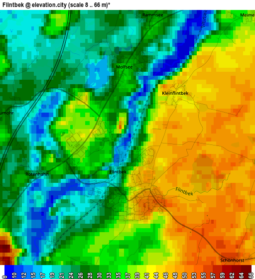
Below is the Elevation map of Flintbek, which displays elevation range with different colors. Scale of the first map is from 8 to 66 m (26 to 217 ft) with average elevation of 33.3 meters (=109 ft) [note 1]
These maps also provides idea of topography and contour of this city, they are displayed at different zoom levels. More info about maps, scale and edge coordinates you can find below images.
| \ | Map #1 | Map #2 | Topo.Map |
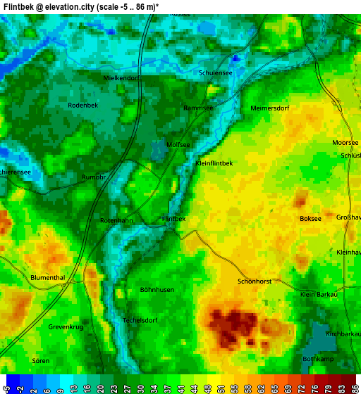
| Scale [m] | 8..66 m | -5..86 m | × |
| Scale [ft] | 26..217 ft | -16..282 ft | × |
| Average | 33.3 m = 109 ft | 33.4 m = 110 ft | × |
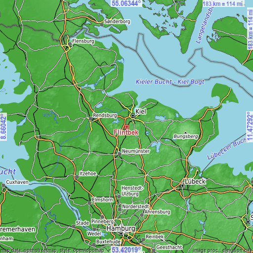
| Width | 5.71 km = 3.5 mi | 11.42 km = 7.1 mi | 182.7 km = 113.5 mi |
| Height | 5.71 km = 3.5 mi | 11.42 km = 7.1 mi | 182.7 km = 113.5 mi |
| ↑Max Latitude | 54.275667° | 54.301318° | 55.06344° |
| Latitude at center | 54.25° | 54.25° | 54.25° |
| ↓Min Latitude | 54.224317° | 54.198618° | 53.42019° |
| ← Min Longitude | 10.022725° | 9.978779° | 8.66042° |
| Longitude center | 10.06667° | 10.06667° | 10.06667° |
| →Max Longitude | 10.110615° | 10.154561° | 11.47292° |
Nearby cities:
Cities around Flintbek sort by population:
• Kiel elevation 7 m
9.1 km,  29°
29°
• Kronshagen 23 m
9.3 km,  6°
6°
• Bordesholm 28 m
8.5 km,  195°
195°
• Molfsee 26 m
1.9 km,  0°
0°
• Wattenbek 23 m
9.3 km,  186°
186°
• Felde 16 m
10.3 km,  302°
302°
• Quarnbek 13 m
10.7 km,  329°
329°
• Melsdorf 16 m
7.7 km,  343°
343°
• Westensee 16 m
11.4 km,  283°
283°
• Mielkendorf 25 m
3.9 km, 343°
• Langwedel 28 m
10.1 km,  243°
243°
• Brügge 22 m
8.3 km,  178°
178°
Multilingual:
 En español:
Flintbek elevación 10 m.
 En France:
Flintbek élévation 10 m.


Sources and notes:
- [note 1] Map square and city borders are not equal. Map elevation data is calculated only from area inside that square.
- [src 1] Elevation data from geonames database provided with same terms of usage.
- [src 2] The elevation map of Flintbek is generated using elevation data from NASA's 3 arcsec (90m) resolution SRTM data.
- [src 3] Base (background) map © OpenStreetMap contributors tiles are generated by Geofabrik and OpenTopoMap.
Copyright & License:
This Flintbek Elevation Map is licensed under CC BY-SA. You may reuse any part from this page, if you give a proper credit by linking to this URL:
 More info on terms of use page.