Forst elevation
Forst (Brandenburg), Germany elevation is 80 meters and Forst elevation in feet is 262 ft above sea level [src 1]. Forst is a seat of a third-order administrative division (feature code) with elevation that is 178 meters (584 ft) smaller than average city elevation in Germany.
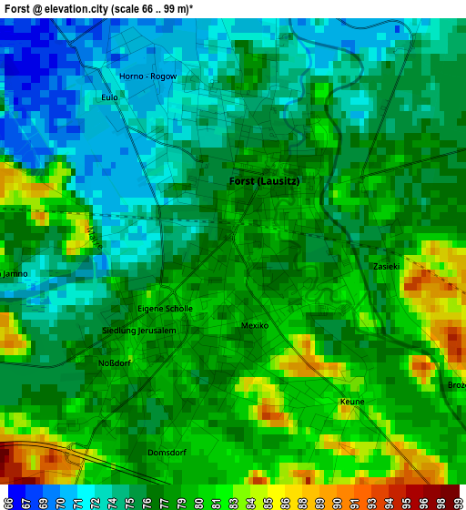
Below is the Elevation map of Forst, which displays elevation range with different colors. Scale of the first map is from 66 to 99 m (217 to 325 ft) with average elevation of 77.2 meters (=253 ft) [note 1]
These maps also provides idea of topography and contour of this city, they are displayed at different zoom levels. More info about maps, scale and edge coordinates you can find below images.
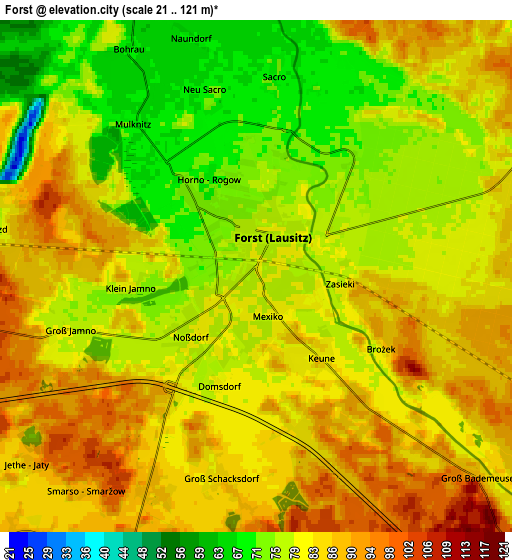
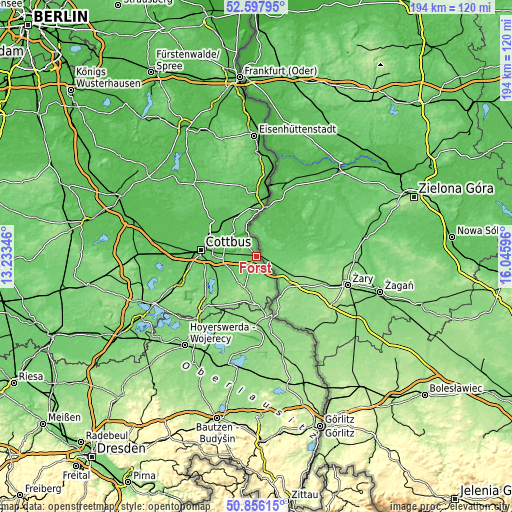
| \ | Map #1 | Map #2 | Topo.Map |
| Scale [m] | 66..99 m | 21..121 m | × |
| Scale [ft] | 217..325 ft | 69..397 ft | × |
| Average | 77.2 m = 253 ft | 81.5 m = 267 ft | × |
| Width | 6.05 km = 3.8 mi | 12.1 km = 7.5 mi | 193.7 km = 120.4 mi |
| Height | 6.05 km = 3.8 mi | 12.1 km = 7.5 mi | 193.7 km = 120.4 mi |
| ↑Max Latitude | 51.762647° | 51.789837° | 52.59795° |
| Latitude at center | 51.73544° | 51.73544° | 51.73544° |
| ↓Min Latitude | 51.708217° | 51.680977° | 50.85615° |
| ← Min Longitude | 14.595765° | 14.551819° | 13.23346° |
| Longitude center | 14.63971° | 14.63971° | 14.63971° |
| →Max Longitude | 14.683655° | 14.727601° | 16.04596° |
Nearby cities:
Cities around Forst sort by population:
• Cottbus elevation 80 m
21.5 km,  276°
276°
• Guben 47 m
24.4 km,  12°
12°
• Peitz 64 m
20.8 km,  311°
311°
• Schenkendöbern 52 m
24.7 km,  359°
359°
• Bad Muskau 126 m
21.2 km,  166°
166°
• Krauschwitz 134 m
24.3 km, 168°
• Schleife 131 m
23.6 km,  198°
198°
• Jänschwalde 64 m
17 km,  325°
325°
• Gablenz 142 m
22.5 km,  175°
175°
• Tschernitz 135 m
17 km,  185°
185°
• Groß Düben 133 m
19.4 km, 195°
• Trebendorf 133 m
23 km, 192°
Multilingual:
 En español:
Forst elevación 80 m.
 En France:
Forst élévation 80 m.


Sources and notes:
- [note 1] Map square and city borders are not equal. Map elevation data is calculated only from area inside that square.
- [src 1] Elevation data from geonames database provided with same terms of usage.
- [src 2] The elevation map of Forst is generated using elevation data from NASA's 3 arcsec (90m) resolution SRTM data.
- [src 3] Base (background) map © OpenStreetMap contributors tiles are generated by Geofabrik and OpenTopoMap.
Copyright & License:
This Forst Elevation Map is licensed under CC BY-SA. You may reuse any part from this page, if you give a proper credit by linking to this URL:
 More info on terms of use page.