Friedrichsdorf elevation
Friedrichsdorf (Hesse, Regierungsbezirk Darmstadt), Germany elevation is 202 meters and Friedrichsdorf elevation in feet is 663 ft above sea level [src 1]. Friedrichsdorf is a populated place (feature code) with elevation that is 56 meters (184 ft) smaller than average city elevation in Germany.
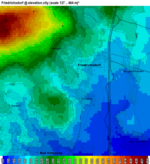
Below is the Elevation map of Friedrichsdorf, which displays elevation range with different colors. Scale of the first map is from 137 to 464 m (449 to 1522 ft) with average elevation of 211.4 meters (=694 ft) [note 1]
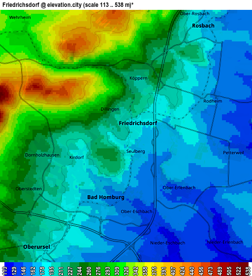
These maps also provides idea of topography and contour of this city, they are displayed at different zoom levels. More info about maps, scale and edge coordinates you can find below images.
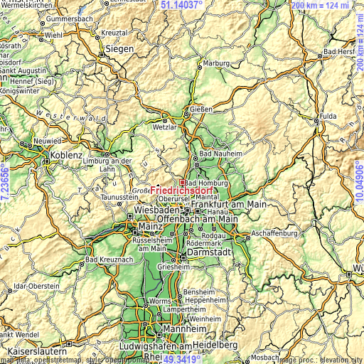
| \ | Map #1 | Map #2 | Topo.Map |
| Scale [m] | 137..464 m | 113..538 m | × |
| Scale [ft] | 449..1522 ft | 371..1765 ft | × |
| Average | 211.4 m = 694 ft | 224.2 m = 736 ft | × |
| Width | 6.25 km = 3.9 mi | 12.5 km = 7.8 mi | 200 km = 124.3 mi |
| Height | 6.25 km = 3.9 mi | 12.5 km = 7.8 mi | 200 km = 124.3 mi |
| ↑Max Latitude | 50.277712° | 50.305788° | 51.14037° |
| Latitude at center | 50.24962° | 50.24962° | 50.24962° |
| ↓Min Latitude | 50.221511° | 50.193386° | 49.3419° |
| ← Min Longitude | 8.598865° | 8.554919° | 7.23656° |
| Longitude center | 8.64281° | 8.64281° | 8.64281° |
| →Max Longitude | 8.686755° | 8.730701° | 10.04906° |
Nearby cities:
Cities around Friedrichsdorf sort by population:
• Bad Homburg vor der Höhe elevation 186 m
3.1 km,  214°
214°
• Oberursel 216 m
6.6 km,  224°
224°
• Bad Vilbel 117 m
10.4 km,  139°
139°
• Friedberg 159 m
12.6 km,  39°
39°
• Karben 118 m
9.4 km,  103°
103°
• Kronberg 251 m
11.2 km,  229°
229°
• Kronberg Tal 232 m
12.6 km, 231°
• Neu-Anspach 320 m
12.6 km,  306°
306°
• Usingen 299 m
12.2 km,  321°
321°
• Rosbach vor der Höhe 184 m
6.8 km,  29°
29°
• Steinbach am Taunus 170 m
10.4 km, 208°
• Wehrheim 314 m
7.8 km, 315°
Multilingual:
 En español:
Friedrichsdorf elevación 202 m.
 En France:
Friedrichsdorf élévation 202 m.
 Auf Deutsch:
Friedrichsdorf höhe über dem Meeresspiegel ist 202 m.

Sources and notes:
- [note 1] Map square and city borders are not equal. Map elevation data is calculated only from area inside that square.
- [src 1] Elevation data from geonames database provided with same terms of usage.
- [src 2] The elevation map of Friedrichsdorf is generated using elevation data from NASA's 3 arcsec (90m) resolution SRTM data.
- [src 3] Base (background) map © OpenStreetMap contributors tiles are generated by Geofabrik and OpenTopoMap.
Copyright & License:
This Friedrichsdorf Elevation Map is licensed under CC BY-SA. You may reuse any part from this page, if you give a proper credit by linking to this URL:
 More info on terms of use page.