Fürstenstein elevation
Fürstenstein (Bavaria, Lower Bavaria), Germany elevation is 499 meters and Fürstenstein elevation in feet is 1637 ft above sea level [src 1]. Fürstenstein is a seat of a fourth-order administrative division (feature code) with elevation that is 241 meters (791 ft) bigger than average city elevation in Germany.
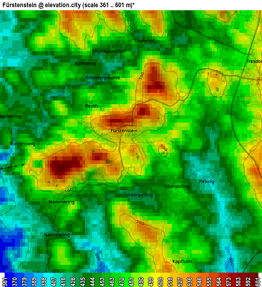
Below is the Elevation map of Fürstenstein, which displays elevation range with different colors. Scale of the first map is from 361 to 601 m (1184 to 1972 ft) with average elevation of 464.4 meters (=1524 ft) [note 1]
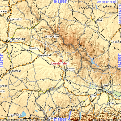
These maps also provides idea of topography and contour of this city, they are displayed at different zoom levels. More info about maps, scale and edge coordinates you can find below images.
| \ | Map #1 | Topo.Map |
| Scale [m] | 361..601 m | × |
| Scale [ft] | 1184..1972 ft | × |
| Average | 464.4 m = 1524 ft | × |
| Width | 6.45 km = 4 mi | 206.3 km = 128.2 mi |
| Height | 6.45 km = 4 mi | 206.3 km = 128.2 mi |
| ↑Max Latitude | 48.745656° | 49.63595° |
| Latitude at center | 48.71667° | 48.71667° |
| ↓Min Latitude | 48.687667° | 47.78028° |
| ← Min Longitude | 13.289385° | 11.92708° |
| Longitude center | 13.33333° | 13.33333° |
| →Max Longitude | 13.377275° | 14.73958° |
Nearby cities:
Cities around Fürstenstein sort by population:
• Hutthurm elevation 460 m
11.3 km,  115°
115°
• Schöllnach 381 m
12.1 km,  290°
290°
• Röhrnbach 432 m
14.1 km,  80°
80°
• Tittling 512 m
3.7 km,  73°
73°
• Ruderting 448 m
9.6 km,  140°
140°
• Perlesreut 562 m
10.6 km,  46°
46°
• Thurmansbang 499 m
5.7 km,  346°
346°
• Saldenburg 536 m
6.5 km,  14°
14°
• Haselbach 348 m
8.9 km,  152°
152°
• Außernzell 374 m
9.6 km,  274°
274°
• Zenting 447 m
9.9 km,  326°
326°
• Fürsteneck 354 m
9.8 km,  90°
90°
Multilingual:
 En español:
Fürstenstein elevación 499 m.
 En France:
Fürstenstein élévation 499 m.
 Auf Deutsch:
Fürstenstein höhe über dem Meeresspiegel ist 499 m.

Sources and notes:
- [note 1] Map square and city borders are not equal. Map elevation data is calculated only from area inside that square.
- [src 1] Elevation data from geonames database provided with same terms of usage.
- [src 2] The elevation map of Fürstenstein is generated using elevation data from NASA's 3 arcsec (90m) resolution SRTM data.
- [src 3] Base (background) map © OpenStreetMap contributors tiles are generated by Geofabrik and OpenTopoMap.
Copyright & License:
This Fürstenstein Elevation Map is licensed under CC BY-SA. You may reuse any part from this page, if you give a proper credit by linking to this URL:
 More info on terms of use page.