Gablingen elevation
Gablingen (Bavaria, Swabia), Germany elevation is 466 meters and Gablingen elevation in feet is 1529 ft above sea level [src 1]. Gablingen is a seat of a fourth-order administrative division (feature code) with elevation that is 208 meters (682 ft) bigger than average city elevation in Germany.
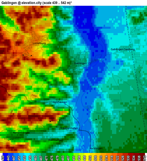
Below is the Elevation map of Gablingen, which displays elevation range with different colors. Scale of the first map is from 439 to 542 m (1440 to 1778 ft) with average elevation of 477.3 meters (=1566 ft) [note 1]
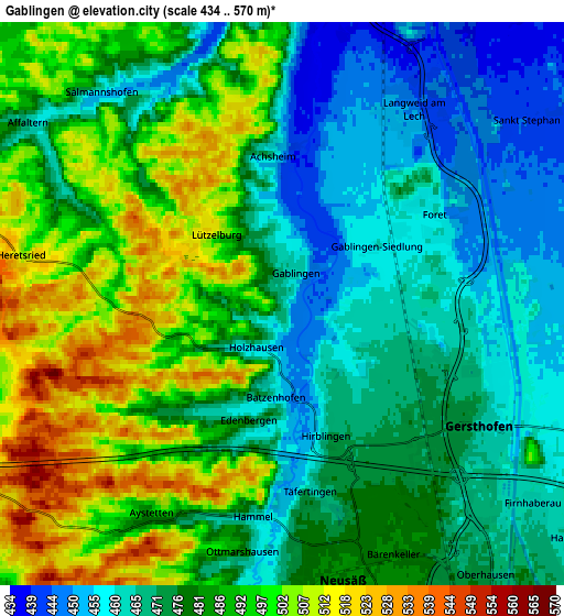
These maps also provides idea of topography and contour of this city, they are displayed at different zoom levels. More info about maps, scale and edge coordinates you can find below images.
| \ | Map #1 | Map #2 | Topo.Map |
| Scale [m] | 439..542 m | 434..570 m | × |
| Scale [ft] | 1440..1778 ft | 1424..1870 ft | × |
| Average | 477.3 m = 1566 ft | 480.7 m = 1577 ft | × |
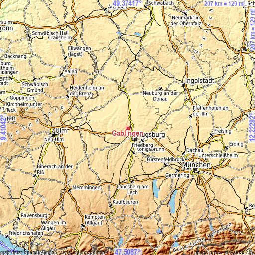
| Width | 6.48 km = 4 mi | 12.96 km = 8.1 mi | 207.4 km = 128.9 mi |
| Height | 6.48 km = 4 mi | 12.96 km = 8.1 mi | 207.4 km = 128.9 mi |
| ↑Max Latitude | 48.479139° | 48.508262° | 49.37417° |
| Latitude at center | 48.45° | 48.45° | 48.45° |
| ↓Min Latitude | 48.420844° | 48.391671° | 47.5087° |
| ← Min Longitude | 10.772725° | 10.728779° | 9.41042° |
| Longitude center | 10.81667° | 10.81667° | 10.81667° |
| →Max Longitude | 10.860615° | 10.904561° | 12.22292° |
Nearby cities:
Cities around Gablingen sort by population:
• Augsburg elevation 489 m
10.6 km,  145°
145°
• Gersthofen 473 m
5 km,  124°
124°
• Stadtbergen 488 m
9.5 km,  166°
166°
• Meitingen 432 m
11 km,  13°
13°
• Langweid 449 m
5.3 km,  30°
30°
• Biberbach 438 m
7.5 km,  357°
357°
• Aystetten 489 m
5.7 km,  210°
210°
• Rehling 502 m
9.4 km,  66°
66°
• Adelsried 488 m
7.8 km,  248°
248°
• Todtenweis 448 m
11.1 km,  47°
47°
• Bonstetten 508 m
8.3 km,  262°
262°
• Heretsried 505 m
6 km,  280°
280°
Multilingual:
 En español:
Gablingen elevación 466 m.
 En France:
Gablingen élévation 466 m.
 Auf Deutsch:
Gablingen höhe über dem Meeresspiegel ist 466 m.

Sources and notes:
- [note 1] Map square and city borders are not equal. Map elevation data is calculated only from area inside that square.
- [src 1] Elevation data from geonames database provided with same terms of usage.
- [src 2] The elevation map of Gablingen is generated using elevation data from NASA's 3 arcsec (90m) resolution SRTM data.
- [src 3] Base (background) map © OpenStreetMap contributors tiles are generated by Geofabrik and OpenTopoMap.
Copyright & License:
This Gablingen Elevation Map is licensed under CC BY-SA. You may reuse any part from this page, if you give a proper credit by linking to this URL:
 More info on terms of use page.