Gelnhausen elevation
Gelnhausen (Hesse, Regierungsbezirk Darmstadt), Germany elevation is 139 meters and Gelnhausen elevation in feet is 456 ft above sea level [src 1]. Gelnhausen is a seat of a third-order administrative division (feature code) with elevation that is 119 meters (390 ft) smaller than average city elevation in Germany.
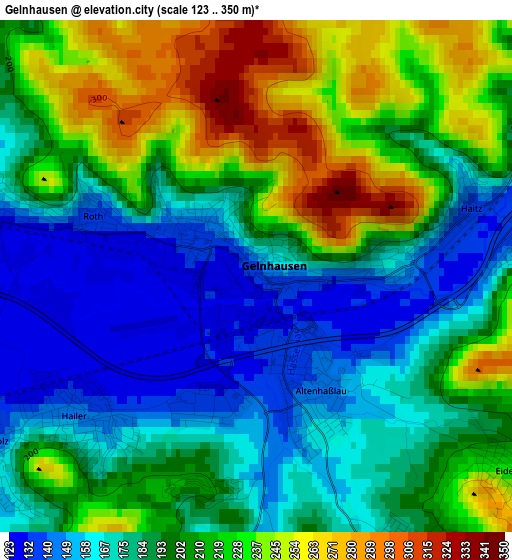
Below is the Elevation map of Gelnhausen, which displays elevation range with different colors. Scale of the first map is from 123 to 350 m (404 to 1148 ft) with average elevation of 198.2 meters (=650 ft) [note 1]
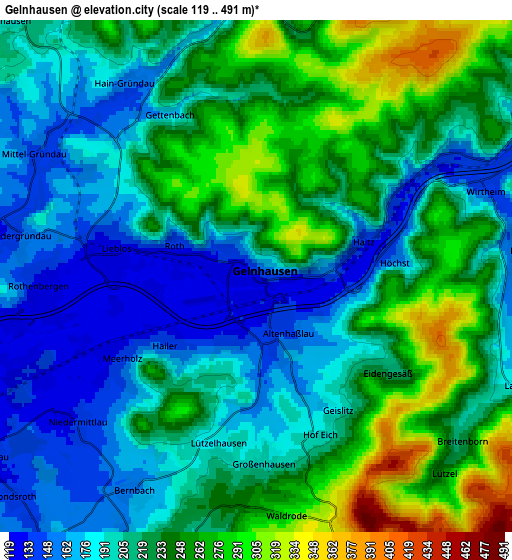
These maps also provides idea of topography and contour of this city, they are displayed at different zoom levels. More info about maps, scale and edge coordinates you can find below images.
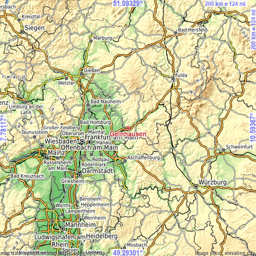
| \ | Map #1 | Map #2 | Topo.Map |
| Scale [m] | 123..350 m | 119..491 m | × |
| Scale [ft] | 404..1148 ft | 390..1611 ft | × |
| Average | 198.2 m = 650 ft | 219.3 m = 719 ft | × |
| Width | 6.26 km = 3.9 mi | 12.51 km = 7.8 mi | 200.2 km = 124.4 mi |
| Height | 6.26 km = 3.9 mi | 12.51 km = 7.8 mi | 200.2 km = 124.4 mi |
| ↑Max Latitude | 50.229761° | 50.257865° | 51.09329° |
| Latitude at center | 50.20164° | 50.20164° | 50.20164° |
| ↓Min Latitude | 50.173503° | 50.145349° | 49.29301° |
| ← Min Longitude | 9.143475° | 9.099529° | 7.78117° |
| Longitude center | 9.18742° | 9.18742° | 9.18742° |
| →Max Longitude | 9.231365° | 9.275311° | 10.59367° |
Nearby cities:
Cities around Gelnhausen sort by population:
• Büdingen elevation 136 m
11.2 km,  331°
331°
• Hain-Gründau 149 m
5.6 km, 325°
• Langenselbold 124 m
10.9 km,  255°
255°
• Wächtersbach 148 m
9.7 km,  52°
52°
• Rodenbach 127 m
12.4 km,  242°
242°
• Bad Orb 171 m
11.8 km,  75°
75°
• Hammersbach 135 m
14.6 km,  276°
276°
• Schöllkrippen 209 m
13.6 km,  161°
161°
• Krombach 249 m
13.2 km,  174°
174°
• Geiselbach 283 m
8.7 km,  175°
175°
• Kleinkahl 345 m
11 km,  149°
149°
• Nieder-Gründau 153 m
5.7 km, 280°
Multilingual:
 En español:
Gelnhausen elevación 139 m.
 En France:
Gelnhausen élévation 139 m.
 Auf Deutsch:
Gelnhausen höhe über dem Meeresspiegel ist 139 m.

Sources and notes:
- [note 1] Map square and city borders are not equal. Map elevation data is calculated only from area inside that square.
- [src 1] Elevation data from geonames database provided with same terms of usage.
- [src 2] The elevation map of Gelnhausen is generated using elevation data from NASA's 3 arcsec (90m) resolution SRTM data.
- [src 3] Base (background) map © OpenStreetMap contributors tiles are generated by Geofabrik and OpenTopoMap.
Copyright & License:
This Gelnhausen Elevation Map is licensed under CC BY-SA. You may reuse any part from this page, if you give a proper credit by linking to this URL:
 More info on terms of use page.