Gerlingen elevation
Gerlingen (Baden-Württemberg, Regierungsbezirk Stuttgart), Germany elevation is 341 meters and Gerlingen elevation in feet is 1119 ft above sea level [src 1]. Gerlingen is a populated place (feature code) with elevation that is 83 meters (272 ft) bigger than average city elevation in Germany.
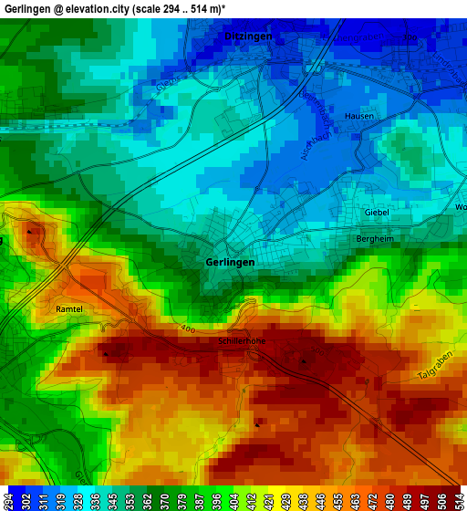
Below is the Elevation map of Gerlingen, which displays elevation range with different colors. Scale of the first map is from 294 to 514 m (965 to 1686 ft) with average elevation of 388.2 meters (=1274 ft) [note 1]
These maps also provides idea of topography and contour of this city, they are displayed at different zoom levels. More info about maps, scale and edge coordinates you can find below images.
| \ | Map #1 | Map #2 | Topo.Map |
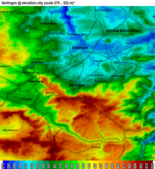
| Scale [m] | 294..514 m | 275..522 m | × |
| Scale [ft] | 965..1686 ft | 902..1713 ft | × |
| Average | 388.2 m = 1274 ft | 388.8 m = 1276 ft | × |
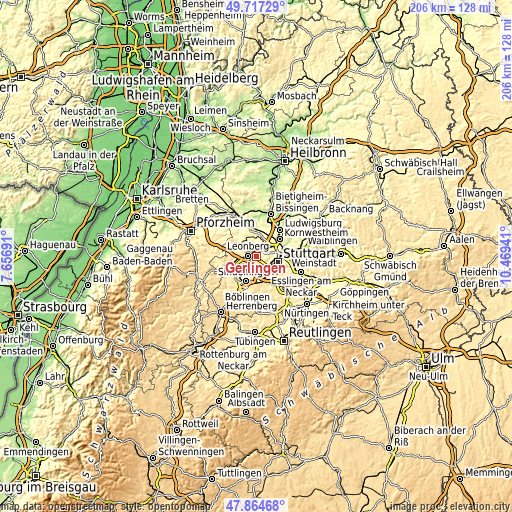
| Width | 6.44 km = 4 mi | 12.87 km = 8 mi | 206 km = 128 mi |
| Height | 6.44 km = 4 mi | 12.87 km = 8 mi | 206 km = 128 mi |
| ↑Max Latitude | 48.828478° | 48.8574° | 49.71729° |
| Latitude at center | 48.79954° | 48.79954° | 48.79954° |
| ↓Min Latitude | 48.770585° | 48.741613° | 47.86468° |
| ← Min Longitude | 9.019215° | 8.975269° | 7.65691° |
| Longitude center | 9.06316° | 9.06316° | 9.06316° |
| →Max Longitude | 9.107105° | 9.151051° | 10.46941° |
Nearby cities:
Cities around Gerlingen sort by population:
• Stuttgart elevation 252 m
8.6 km,  102°
102°
• Stuttgart-Ost 259 m
10.9 km, 99°
• Leonberg 382 m
3.4 km,  270°
270°
• Stuttgart Feuerbach 286 m
7 km,  81°
81°
• Ditzingen 300 m
3 km,  5°
5°
• Korntal 310 m
5.6 km,  49°
49°
• Renningen 408 m
9.7 km,  250°
250°
• Schwieberdingen 256 m
8.6 km, 5°
• Möglingen 291 m
10.8 km,  25°
25°
• Rutesheim 440 m
8.7 km,  276°
276°
• Magstadt 427 m
9.3 km,  229°
229°
• Hemmingen 323 m
7.8 km,  343°
343°
Multilingual:
 En español:
Gerlingen elevación 341 m.
 En France:
Gerlingen élévation 341 m.
 Auf Deutsch:
Gerlingen höhe über dem Meeresspiegel ist 341 m.

Sources and notes:
- [note 1] Map square and city borders are not equal. Map elevation data is calculated only from area inside that square.
- [src 1] Elevation data from geonames database provided with same terms of usage.
- [src 2] The elevation map of Gerlingen is generated using elevation data from NASA's 3 arcsec (90m) resolution SRTM data.
- [src 3] Base (background) map © OpenStreetMap contributors tiles are generated by Geofabrik and OpenTopoMap.
Copyright & License:
This Gerlingen Elevation Map is licensed under CC BY-SA. You may reuse any part from this page, if you give a proper credit by linking to this URL:
 More info on terms of use page.