Gernsheim elevation
Gernsheim (Hesse, Regierungsbezirk Darmstadt), Germany elevation is 93 meters and Gernsheim elevation in feet is 305 ft above sea level [src 1]. Gernsheim is a populated place (feature code) with elevation that is 165 meters (541 ft) smaller than average city elevation in Germany.
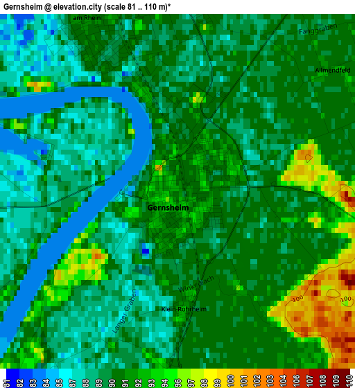
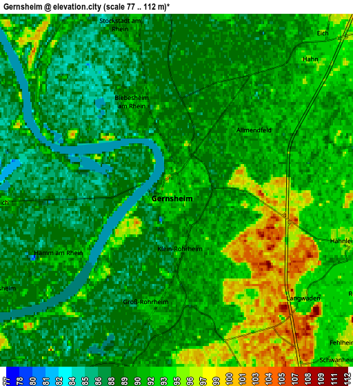
Below is the Elevation map of Gernsheim, which displays elevation range with different colors. Scale of the first map is from 81 to 110 m (266 to 361 ft) with average elevation of 90.2 meters (=296 ft) [note 1]
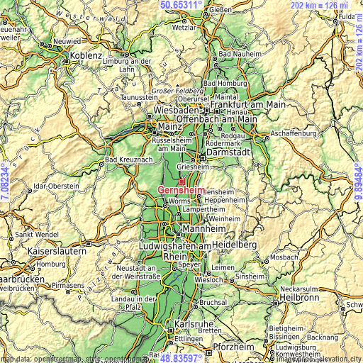
These maps also provides idea of topography and contour of this city, they are displayed at different zoom levels. More info about maps, scale and edge coordinates you can find below images.
| \ | Map #1 | Map #2 | Topo.Map |
| Scale [m] | 81..110 m | 77..112 m | × |
| Scale [ft] | 266..361 ft | 253..367 ft | × |
| Average | 90.2 m = 296 ft | 90.7 m = 298 ft | × |
| Width | 6.31 km = 3.9 mi | 12.63 km = 7.8 mi | 202 km = 125.5 mi |
| Height | 6.31 km = 3.9 mi | 12.63 km = 7.8 mi | 202 km = 125.5 mi |
| ↑Max Latitude | 49.781434° | 49.809801° | 50.65311° |
| Latitude at center | 49.75305° | 49.75305° | 49.75305° |
| ↓Min Latitude | 49.724649° | 49.696232° | 48.83597° |
| ← Min Longitude | 8.444645° | 8.400699° | 7.08234° |
| Longitude center | 8.48859° | 8.48859° | 8.48859° |
| →Max Longitude | 8.532535° | 8.576481° | 9.89484° |
Nearby cities:
Cities around Gernsheim sort by population:
• Pfungstadt elevation 109 m
10.1 km,  54°
54°
• Riedstadt 93 m
9 km,  3°
3°
• Alsbach-Hähnlein 98 m
7.9 km,  101°
101°
• Biblis 91 m
7.2 km,  197°
197°
• Zwingenberg 99 m
9.4 km,  110°
110°
• Biebesheim 92 m
3.5 km,  333°
333°
• Einhausen 93 m
9.5 km,  153°
153°
• Stockstadt am Rhein 89 m
6.4 km,  349°
349°
• Bickenbach 124 m
9.3 km,  85°
85°
• Groß-Rohrheim 91 m
3.6 km,  186°
186°
• Gimbsheim 89 m
8.6 km,  288°
288°
• Alsheim 92 m
10.8 km,  278°
278°
Multilingual:
 En español:
Gernsheim elevación 93 m.
 En France:
Gernsheim élévation 93 m.
 Auf Deutsch:
Gernsheim höhe über dem Meeresspiegel ist 93 m.

Sources and notes:
- [note 1] Map square and city borders are not equal. Map elevation data is calculated only from area inside that square.
- [src 1] Elevation data from geonames database provided with same terms of usage.
- [src 2] The elevation map of Gernsheim is generated using elevation data from NASA's 3 arcsec (90m) resolution SRTM data.
- [src 3] Base (background) map © OpenStreetMap contributors tiles are generated by Geofabrik and OpenTopoMap.
Copyright & License:
This Gernsheim Elevation Map is licensed under CC BY-SA. You may reuse any part from this page, if you give a proper credit by linking to this URL:
 More info on terms of use page.