Gestratz elevation
Gestratz (Bavaria, Swabia), Germany elevation is 662 meters and Gestratz elevation in feet is 2172 ft above sea level [src 1]. Gestratz is a seat of a fourth-order administrative division (feature code) with elevation that is 404 meters (1325 ft) bigger than average city elevation in Germany.
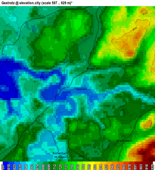
Below is the Elevation map of Gestratz, which displays elevation range with different colors. Scale of the first map is from 597 to 929 m (1959 to 3048 ft) with average elevation of 702 meters (=2303 ft) [note 1]
These maps also provides idea of topography and contour of this city, they are displayed at different zoom levels. More info about maps, scale and edge coordinates you can find below images.
| \ | Map #1 | Topo.Map |
| Scale [m] | 597..929 m | × |
| Scale [ft] | 1959..3048 ft | × |
| Average | 702 m = 2303 ft | × |
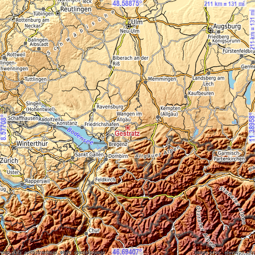
| Width | 6.58 km = 4.1 mi | 210.7 km = 130.9 mi |
| Height | 6.58 km = 4.1 mi | 210.7 km = 130.9 mi |
| ↑Max Latitude | 47.679596° | 48.58875° |
| Latitude at center | 47.65° | 47.65° |
| ↓Min Latitude | 47.620388° | 46.69407° |
| ← Min Longitude | 9.939385° | 8.57708° |
| Longitude center | 9.98333° | 9.98333° |
| →Max Longitude | 10.027275° | 11.38958° |
Nearby cities:
Cities around Gestratz sort by population:
• Isny elevation 707 m
6.3 km,  41°
41°
• Oberstaufen 790 m
10.9 km,  164°
164°
• Weiler-Simmerberg 624 m
9.1 km,  214°
214°
• Weitnau 791 m
10.8 km,  94°
94°
• Heimenkirch 658 m
6.4 km,  249°
249°
• Opfenbach 566 m
11.4 km,  260°
260°
• Röthenbach 658 m
3.1 km,  193°
193°
• Stiefenhofen 816 m
6.5 km,  166°
166°
• Maierhöfen 750 m
5 km, 90°
• Oberreute 856 m
10.1 km,  196°
196°
• Missen-Wilhams 839 m
11.4 km,  119°
119°
• Grünenbach 716 m
3 km,  141°
141°
Multilingual:
 En español:
Gestratz elevación 662 m.
 En France:
Gestratz élévation 662 m.
 Auf Deutsch:
Gestratz höhe über dem Meeresspiegel ist 662 m.

Sources and notes:
- [note 1] Map square and city borders are not equal. Map elevation data is calculated only from area inside that square.
- [src 1] Elevation data from geonames database provided with same terms of usage.
- [src 2] The elevation map of Gestratz is generated using elevation data from NASA's 3 arcsec (90m) resolution SRTM data.
- [src 3] Base (background) map © OpenStreetMap contributors tiles are generated by Geofabrik and OpenTopoMap.
Copyright & License:
This Gestratz Elevation Map is licensed under CC BY-SA. You may reuse any part from this page, if you give a proper credit by linking to this URL:
 More info on terms of use page.